Rescue map updated in real time

The rescue information map system developed by the group of engineers Tu Tat Huan, Dang Long and Nguyen Thi Mai Anh has expanded the scope of data collection to Da Nang, Hue and Quang Nam (old). This map applies artificial intelligence (AI) to synthesize posts and comments on social networks, determine the location, level of flooding and emergency status of each area.
The information was classified as a "hot spot" - where there were many calls for help and a "cold spot" - an area that had not responded, helping rescue forces prioritize the deployment of human resources.
The tool has been used in many floods in the North and Central regions before, recording thousands of visits per day, and is now continuing to be updated to serve the new flood.
Drone - a solution that can promote effectiveness again
In previous floods, drones have proven effective in surveying isolated areas and supporting the transport of relief goods to areas that cannot be reached by normal vehicles.
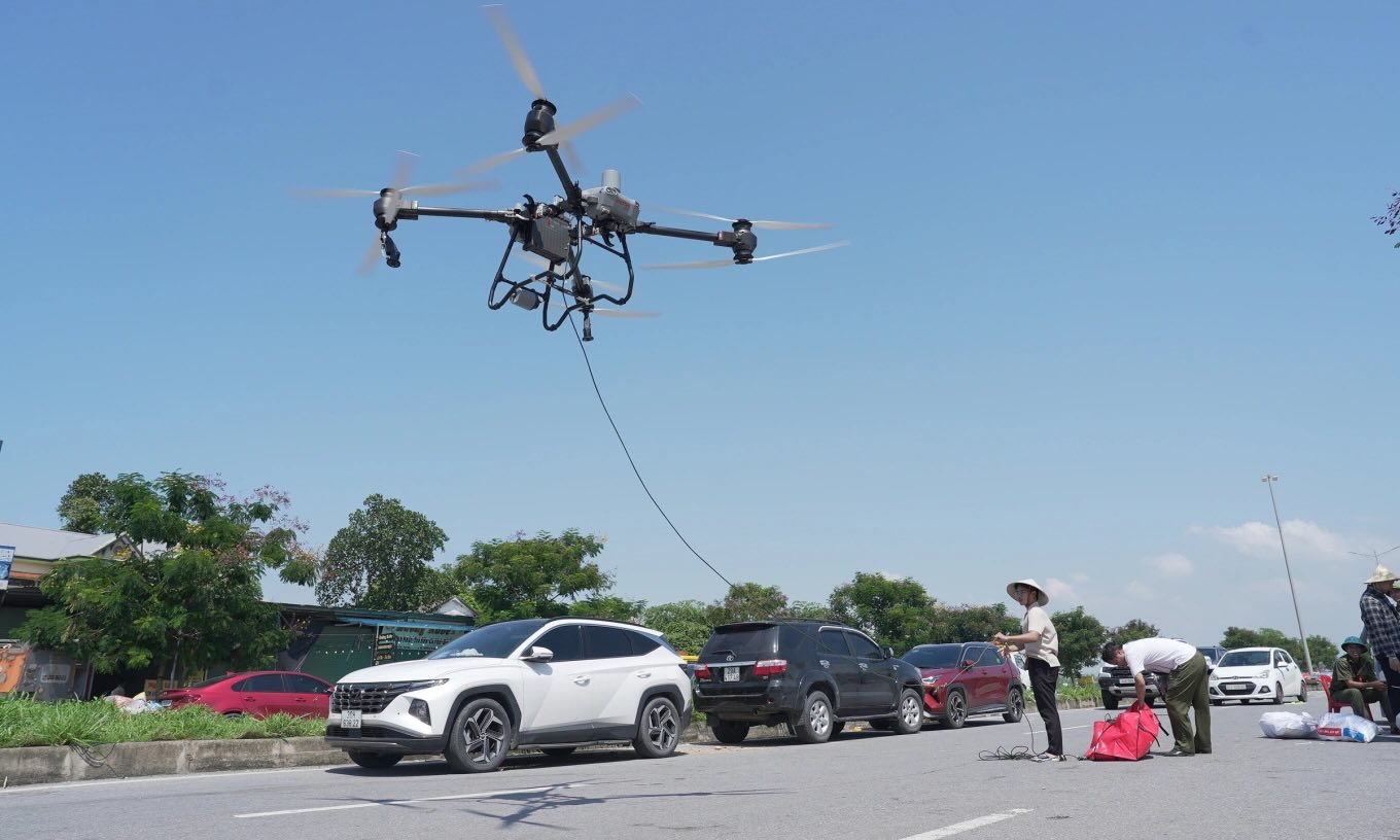
With the current flood situation in Da Nang and Hue, this is considered one of the technologies that can be mobilized again soon, helping rescue forces access faster; while minimizing risks for those directly involved.
At the same time, volunteer groups and social organizations continue to take advantage of social networks, digital maps and communication applications to share relief information, locate people in need of help, and coordinate resources. Each data and image sent by people helps the AI system update faster and reflect more realistically.
Once again, technology is proving its role not only in socio-economic development, but also in times of emergency, where every minute, every second can decide human life.