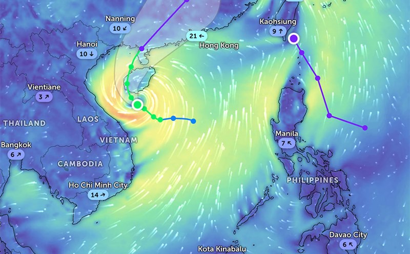
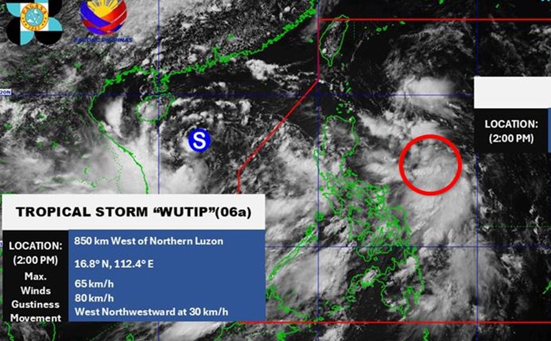
According to the latest weather forecast from the Philippine Atmospheric, Geophysical and Astronomical Services Administration ( pagasa), as of 3:00 p.m. on June 16, a low pressure area formed inside the Philippine Area of Responsibility (PAR).
The center of the low pressure is located at about 11.2 degrees North latitude, 123.3 degrees East longitude, in the coastal waters of Concepcion and Iloilo. However, this low pressure area is unlikely to develop into a tropical depression in the next 24 hours.
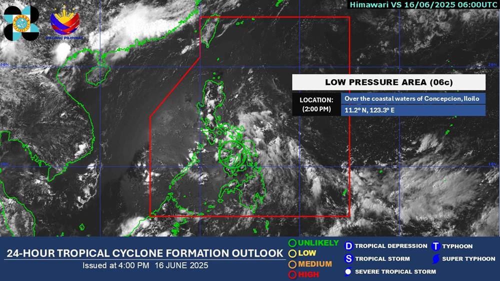
The low pressure affects the eastern part of Luzon. Cloudy skies with scattered thunderstorms and thunderstorms in the Visayas region, Bicol Region, Romblon, Quezon and Marinduque. Floods or landslides may occur due to the impact of heavy rains.
The low pressure has not affected the weather in the sea and inland areas of Vietnam.
According to the National Center for Hydro-Meteorological Forecasting, on the night of June 16 and June 17, the Northern region will have scattered showers and thunderstorms, locally heavy rain with common rainfall of 15-30mm, locally over 60mm (concentrated in the late afternoon and night).
The mountainous areas of the North will have rain, moderate rain at night, locally heavy rain to very heavy rain, with rainfall of 20-50mm, some places over 100mm.
In addition, in the late afternoon and evening of June 16, in Thanh Hoa, Nghe An; the area from Khanh Hoa to Binh Thuan, the Central Highlands and the South, there will be local heavy rain with rainfall of over 50mm.
In the next 6 hours, there is a risk of flash floods, landslides, and land subsidence on steep slopes and small streams in Hoa Binh (Cao Phong, Da Bac, Kim Boi, Lac Son, Luong Son, Mai Chau, Tan Lac, Hoa Binh City) and Dak Nong (Dak Glong, Dak Mil, Dak R'Lap, Dak Song, Krong No, Gia Nghia City, Tuy Duc).
People and tourists in the North need to proactively monitor weather forecasts, bring umbrellas and raincoats to prevent sudden thunderstorms.
Regularly update local information and recommendations on flash floods, landslides, and land subsidence on steep slopes and small streams in Hoa Binh and Dak Nong.