Risk of storm overlapping storm No. 1 Wutip, new low pressure near the East Sea is strengthening

Ninh Phương |

As Typhoon No. 1 Wutip intensifies in the East Sea, a low pressure is forecast to strengthen into a storm in the next 24 hours. Many areas will have heavy rain in the next few days.

A low pressure area being monitored in the Philippine Area of Responsibility (PAR) has a high probability of developing into a tropical storm within the next 24 hours, according to information from the Philippine Atmospheric, Geophysical and Astronomical Services Administration ( pagasa).

In the June 12 bulletin, Pagasa weather expert Grace Castañeda said that at 3 a.m., the low pressure was determined to be located about 235 km east of Calayan, Cagayan Province.

This low pressure area is likely to strengthen into a storm in the next 24 hours and is currently moving north and northwest. We also see its speed accelerating, said Castañeda.

The low pressure is forecast to become a storm and will approach Taiwan (China), and is likely to last for a short time or dissipate within less than 48 hours.

The low pressure area is expected to bring rain to some areas in the northernmost Luzon region of the Philippines on June 12.

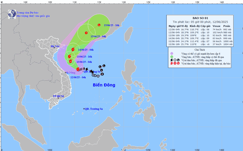
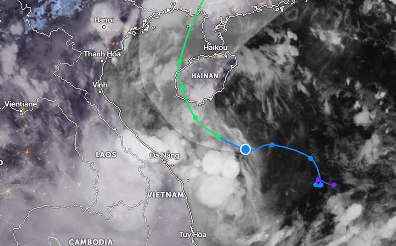
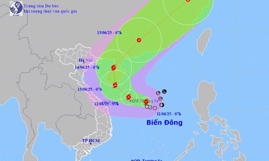
Meanwhile, this morning, storm No. 1 Wutip was at about 17.0 degrees North latitude, 110.4 degrees East longitude, just west of Hoang Sa archipelago.

Strong wind level 8-9, gust level 11. The storm is moving in a West-Northwest direction at a speed of 10-15km/h.

It is forecasted that by the morning of June 13, storm No. 1 Wutip will approach the south of Hainan Island (China), strengthening to level 10, gusting to level 13.

On the morning of June 14, the storm moved to Zhejiang, China with winds reduced to level 9, gusting to level 11.

By the morning of June 15, the storm moved northeast, gradually weakening into a low pressure area over mainland southern China.

Dangerous areas in the next 2 days include: the northwest of the East Sea (including Hoang Sa archipelago), the offshore waters from Quang Tri to Quang Ngai, and the Gulf of Tonkin. The natural disaster risk level is level 3.

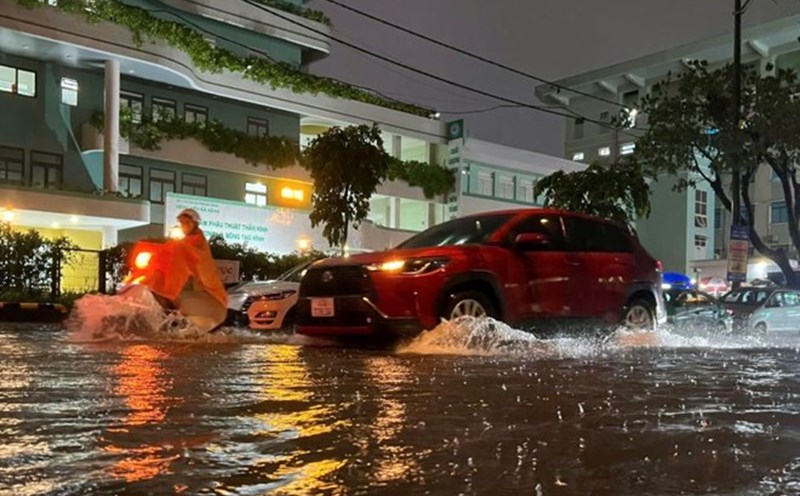
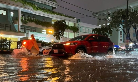
It is forecasted that from June 12 to 13, the Central Central region will have very heavy rain, with common rainfall of 100-200mm, some places over 350mm. Ha Tinh and the Northern Central Highlands will have moderate rain, heavy rain, some places over 150mm. Warning of flash floods, landslides and flooding in low-lying areas.

People and tourists in areas affected by extreme weather should bring rain protective gear and always be cautious of the risk of flooding and landslides.

Ninh Phương
TIN LIÊN QUAN

Update new forecast on when storm No. 1 will make landfall and reach its strongest intensity

|

Storm No. 1 WUTIP is forecast to increase to level 10, gusting to level 13 in the next 24 hours. The storm is most likely to strengthen when it makes landfall on Hainan Island (China).

Forecast of places with very heavy rain exceeding 350mm as storm No. 1 WUTIP intensifies

|

Storm No. 1 WUTIP is forecast to continue to strengthen in the East Sea. Some areas in the Central region and the Central Highlands will have very heavy rain.

Weather forecast for today, September 12: Storm No. 1 causes heavy thunderstorms in many places

|

Weather forecast for today, June 12, storm No. 1 WUTIP continues to strengthen in the East Sea, causing heavy rain in many places on the mainland of Vietnam.

Storm No. 1 WUTIP accelerates, causing very heavy rain in the Central region and the Central Highlands

|

Storm No. 1 WUTIP is forecast to continue to strengthen as it moves in the East Sea.

Storm No. 1 travels around the East Sea, forecast to continue to strengthen

|

The tropical depression in the East Sea has strengthened into storm No. 1 and is forecast to continue to strengthen.

Update new forecast on when storm No. 1 will make landfall and reach its strongest intensity

Ninh Phương |

Storm No. 1 WUTIP is forecast to increase to level 10, gusting to level 13 in the next 24 hours. The storm is most likely to strengthen when it makes landfall on Hainan Island (China).

Forecast of places with very heavy rain exceeding 350mm as storm No. 1 WUTIP intensifies

Ninh Phương |

Storm No. 1 WUTIP is forecast to continue to strengthen in the East Sea. Some areas in the Central region and the Central Highlands will have very heavy rain.

Weather forecast for today, September 12: Storm No. 1 causes heavy thunderstorms in many places

Chí Long |

Weather forecast for today, June 12, storm No. 1 WUTIP continues to strengthen in the East Sea, causing heavy rain in many places on the mainland of Vietnam.

Storm No. 1 WUTIP accelerates, causing very heavy rain in the Central region and the Central Highlands

Chí Long |

Storm No. 1 WUTIP is forecast to continue to strengthen as it moves in the East Sea.

Storm No. 1 travels around the East Sea, forecast to continue to strengthen

Chí Long |

The tropical depression in the East Sea has strengthened into storm No. 1 and is forecast to continue to strengthen.