According to storm news, the latest low pressure from the Joint Typhoon Warning Center (JTWC), a new low pressure has just formed in the Indian Ocean.
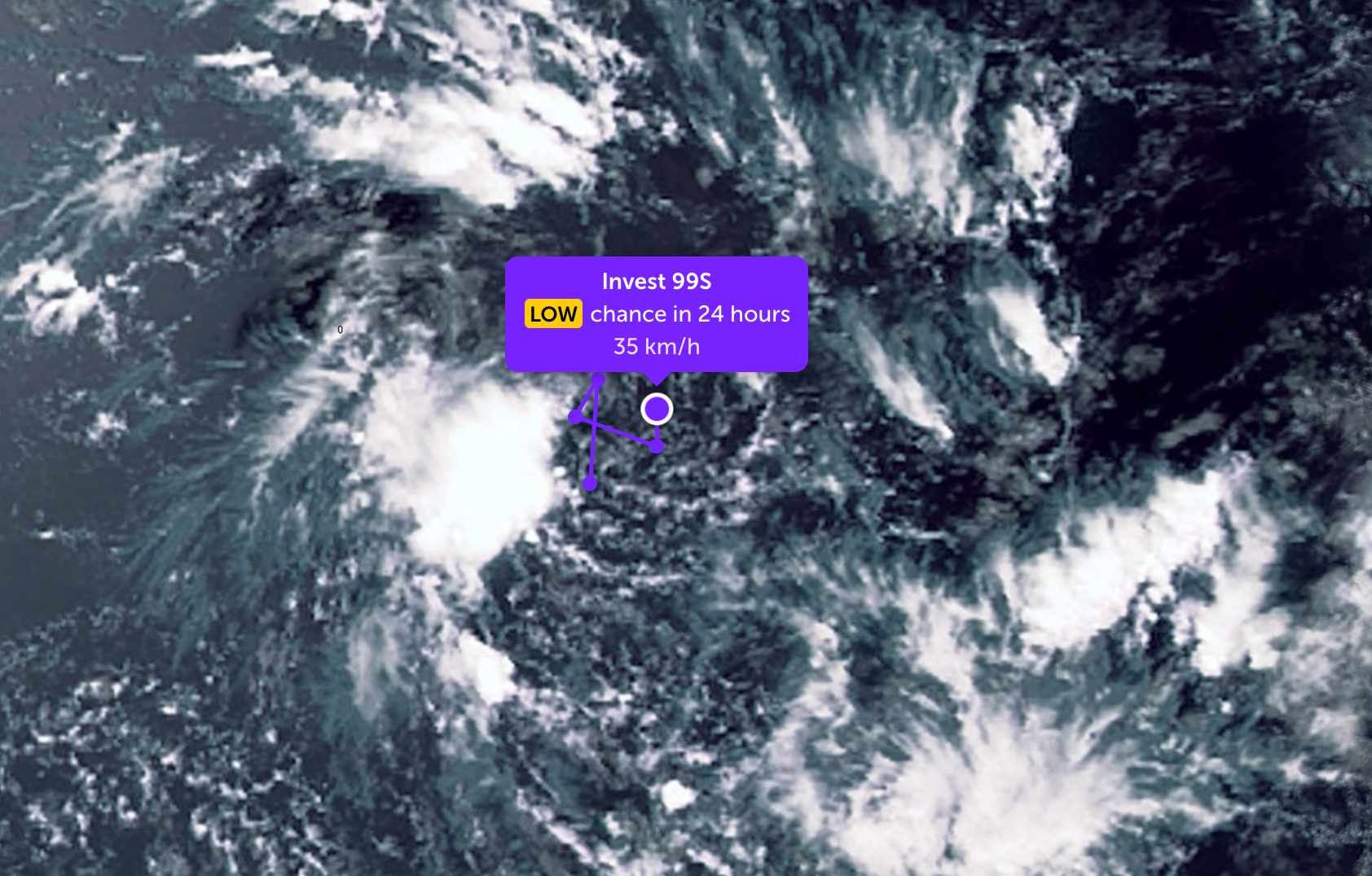
As of noon on March 31, the location of the low pressure center with the symbol Invest 99S is currently located in the Southwest Indian Ocean. This system moves in an X-shaped line, tending to swirl around an area.
The strongest wind near the center of the low pressure remains at about 35-45 km/h. JTWC forecasts that the low pressure is unlikely to strengthen into a tropical depression or storm in the next 24 hours.
Because it is still quite far from the mainland, the low pressure has not caused much impact on the mainland area around the area.
In the East Sea, according to the National Center for Hydro-Meteorological Forecasting, the Gulf of Tonkin area has light rain in some places, good visibility over 10km; South to Southeast wind level 4-5; waves 2.0-3.0m high (slight to moderate rough seas).
Sea area from Quang Tri - Khanh Hoa) no rain, good visibility; Southeast to South wind level 4-5; waves 1.0-2.0m.
The South Central Coast - Southern region (Lam Dong - Ca Mau - An Giang) has no rain; light wind; low waves 0.5-1.5m (stable sea).
No rain in the Northern East Sea and Hoang Sa Archipelago areas; south to southwest wind level 4-5; waves 1.0-2.5m.
No rain in the Central and Southern East Sea areas; light winds up to level 3-4; low waves 0.5-1.5m.
The sea weather is generally favorable, with good visibility; the Gulf of Tonkin area has the highest waves, and the remaining areas have relatively calm seas.
People and tourists can arrange plans to go to sea during this time. Pay attention to weather forecasts and local instructions to avoid unexpected rain, wind, and big waves.


