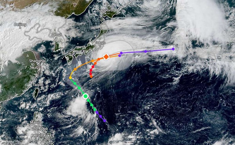
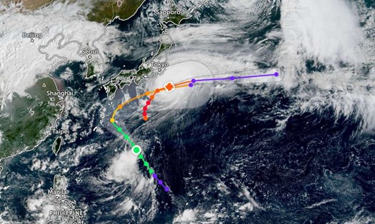
According to the latest weather forecast from the Philippine Atmospheric, Geophysical and Astronomical Services Administration (PAGASA), on the morning of October 8, a tropical depression was active outside the Philippine Area of Responsibility (PAR).
The tropical depression is at about 17.8 degrees North latitude - 137.8 degrees East longitude in the Philippine Sea.
The Joint Typhoon Warning Center (JTWC) forecasts that this tropical depression has a high probability of strengthening in the next 24 hours, because it is in a favorable environment when the wind is weak, the sea surface temperature is warm (30-31 degrees Celsius).
However, trajectory models agree that the tropical depression will continue to move northwest, with maximum current winds of about 45-55 km/h.
Tourists in the Philippines or planning to travel to the sea east of the Philippines in the next few days should closely monitor weather reports. When this system develops into a tropical depression or storm, there may be heavy rain, rough seas and gusts of wind, affecting aviation and maritime activities.
It is recommended to adjust your schedule or choose safer destinations when there is newly updated official information.
Meanwhile, according to the weather report of the National Center for Hydro-Meteorological Forecasting, today the South China Sea (including Truong Sa special zone) and the Gulf of Thailand will have showers and thunderstorms.
Forecast for the day and night of October 18, the Central and South East Sea (including Truong Sa special zone), the sea area from Lam Dong to Ca Mau, Ca Mau to An Giang and the Gulf of Thailand will have scattered showers and thunderstorms.
During thunderstorms, there is a possibility of tornadoes, strong gusts of wind of level 6-7, and waves over 2.0m high.
In October, there is a possibility of 2-3 storms or tropical depressions appearing in the East Sea, of which 1-2 are likely to affect the mainland of Vietnam.