According to storm news, the latest low pressure from the Joint Typhoon Warning Center (JTWC), a low pressure is about to strengthen into a storm in the Northern Pacific region.
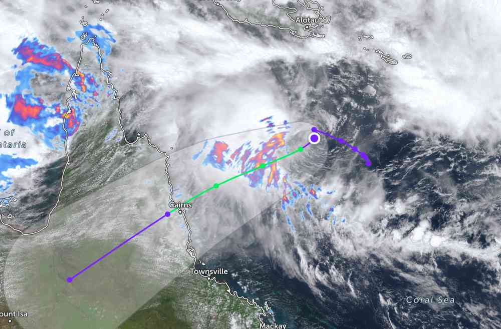
As of this morning, the center of the tropical depression, coded 24P (strengthened from low pressure 29U), is located 613 km east - northeast of Cairns, Australia. In the past 6 hours, the low pressure has moved south - southeast at a speed of 4 km/h.
The strongest wind near the center of the tropical depression reached 65 km/h. JTWC forecasts that the tropical depression will strengthen into a storm in the afternoon of March 4, with winds increasing to 85 km/h.
This tropical storm will continue to move southeast, towards mainland Cairns, Australia in the next few days.
The tropical depression has not directly affected the weather on the mainland of this country.
While previously, 2 low pressure areas with symbols 92P and 93P continuously made landfall in northern Australia, causing widespread thunderstorms.
People and tourists planning to travel to Northern Australia during this time should pay attention to weather forecasts. Check your flight schedule and follow local instructions to avoid storms affecting your journey.
In the East Sea, according to the National Center for Hydro-Meteorological Forecasting (Department of Hydro-Meteorological Forecasting), this morning March 4, at Bach Long Vy station, strong Northeast wind at level 6, gusting at level 8 was recorded.
During the day and night of March 4, the Gulf of Tonkin area will have strong Northeast winds of level 5, sometimes level 6, gusts of level 7-8, rough seas; from night the wind will gradually decrease. Sea waves are 2.0-3.0 m high.
In the northern sea area of the Northern East Sea, Northeast wind is strong at level 6, gusting at level 7-8; especially in the northeast sea area, at times level 7, gusting at level 8-9, strong sea waves. Sea waves are 2.0-4.0 m high.
In addition, during the day and night of March 4, in the Gulf of Tonkin, the sea area from South Quang Tri to Gia Lai and the sea area north of the Northern East Sea area will have scattered showers, with thunderstorms in some places.
In thunderstorms, there is a possibility of tornadoes and strong gusts of wind, affecting the operation of fishing and tourism boats at sea.


