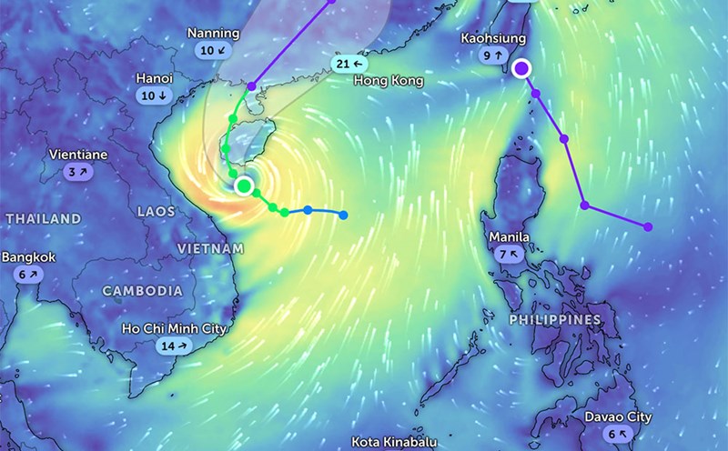
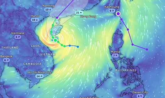
According to the latest weather forecast from the Philippine Atmospheric, Geophysical and Astronomical Services Administration (PAGASA), as of 8:00 a.m. on June 17, the low pressure area has moved into the mainland of the Philippines.
The center of the low pressure is located at about 13.2 degrees North latitude, 121.8 degrees East longitude, 70km East Southeast of Calapan city, Oriental Mindoro. This low pressure area is unlikely to develop into a tropical depression in the next 24 hours.
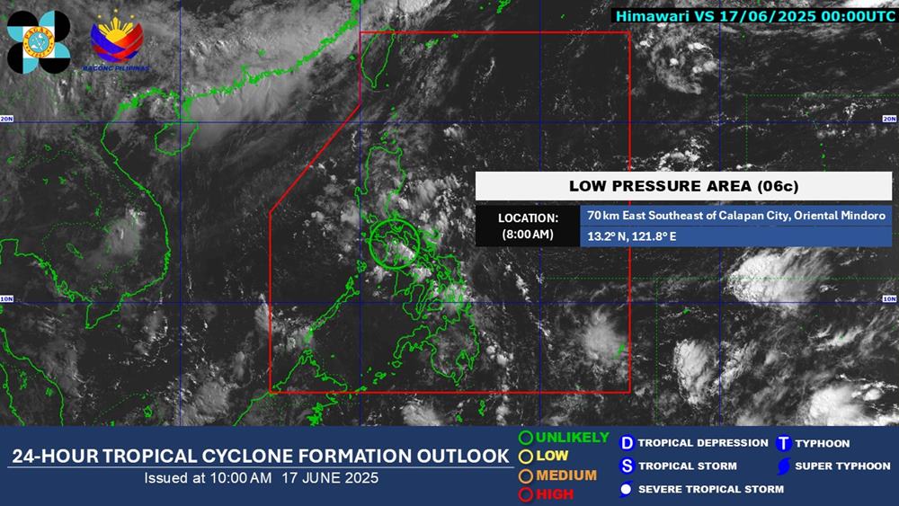
However, this low pressure is significantly affecting the weather in many areas of the Central and Southern Philippines.
Accordingly, Metro Manila, Calabarzon, Mimaropa, Bicol Region, Zambales, Bataan, Pampanga, Bulacan, Isabela, Quirino and Aurora will experience cloudy skies with scattered heavy rain and thunderstorms.
The rest of Luzon, Visayas and Mindanao will have cloudy skies with scattered thunderstorms.
moderate to heavy rain can cause flash floods and landslides in the above areas.
People and tourists in these areas should pay attention to weather forecasts and check flight schedules regularly. Bring umbrellas and raincoats outside to prevent sudden changes in weather.
Although it is getting closer to the East Sea, the low pressure has not affected the weather at sea and on land in Vietnam.
According to the National Center for Hydro-Meteorological Forecasting, on the day and night of June 17, the Northern region will have scattered showers and thunderstorms, locally heavy rain with rainfall from 15-30mm, locally over 70mm. The rain will mainly be concentrated in the afternoon and night.
In the late afternoon and evening of June 17, the Central Highlands and the South will have scattered showers and thunderstorms, locally heavy rain with rainfall from 10-30mm, locally over 50mm.
During thunderstorms, there is a possibility of tornadoes, lightning, hail and strong gusts of wind. Localized heavy rains pose a risk of flash floods in small rivers and streams, landslides in steep mountainous areas and flooding in low-lying areas.
In the afternoon and evening of June 17, in Lang Son, Bac Son, Cao Loc, Chi Lang, Huu Lung, Van Quan areas, there is a risk of flash floods, landslides, and subsidence on steep slopes and small streams.
It is forecasted that in the next 3 days (17/19), wind surge will mainly appear in the Gulf of Tonkin, fluctuating 0.2m.