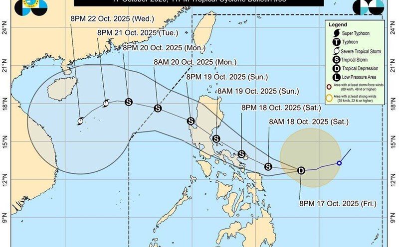
According to the latest storm information from the Philippine Atmospheric and Astronomical Services Administration (PAGASA), in the early morning of October 18, tropical depression Ramil strengthened into a tropical storm, with the international name Fengshen (Phong Than).
The storm has maximum sustained winds of 65 km/h, gusts of 80 km/h, moving west at a speed of 20 km/h.
The storm is expected to make landfall or approach Catanduanes in the afternoon or evening of October 18, then continue towards the coast of Aurora or Isabela provinces (Luzon Island, Philippines) on October 19.
After passing through the mountainous areas of Northern and Central Luzon, the storm is likely to enter the East Sea on the morning of October 20.
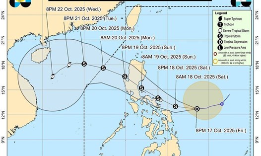
Storm Fengshen forms and moves north of the East Sea to become storm No. 12
According to the Vietnam National Center for Hydro-Meteorological Forecasting, on the morning of October 18, the tropical depression in the East of the Central Philippines strengthened into a storm, with the international name Fengshen.
At 7:00 a.m. on October 18, the center of the storm was at about 13.1 degrees North latitude - 126.5 degrees East longitude, in the sea east of the central Philippines. The strongest wind near the storm center is level 8 (62-74 km/h), gusting to level 10. The storm is moving west at a speed of about 20 km/h.
Forecast of the path and intensity of storm Fengshen that could become storm No. 12 in the East Sea
Morning of October 19: The storm is moving west-northwest at a speed of about 20 km/h, entering the eastern coastal area of Luzon Island (Philippines), likely to strengthen to level 9, gusting to level 11.
Morning of October 20: The center of the storm is in the eastern sea of the North East Sea, level 9, gusting to level 11.
Morning of October 21: The storm continues to move deep into the North East Sea, likely to strengthen to level 10, gusting to level 12.
From the next 72 to 120 hours, the storm will tend to move southwest, at a speed of about 10 km/h and is likely to continue to strengthen.
From October 19, the eastern sea area of the North East Sea will have winds gradually increasing to level 6-7; the area near the storm center will have strong winds of level 8-9, gusting to level 11. Waves are 2.5-5m high, very rough seas.
In about 20-22.10, the North East Sea area (including Hoang Sa archipelago) is likely to be affected by strong winds of level 10-11, gusting to level 13.
Ship operating in the danger zone may encounter thunderstorms, strong winds and large waves.

Previously, the National Steering Committee for Civil Defense sent an official dispatch to the People's Committees of 15 coastal provinces and cities from Quang Ninh to Lam Dong, requesting proactive implementation of response measures to the tropical depression currently operating near the East Sea and likely to strengthen into a storm.
According to the Department of Meteorology and Hydrology (Ministry of Agriculture and Environment), there is a possibility of natural disasters causing heavy rain in the Central region (focusing on provinces from Ha Tinh to Quang Ngai). The common rainfall is 70-150mm, locally very heavy rain over 350mm, locally over 500mm in Hue City.
After October 19, moderate rain, locally heavy rain will continue. In particular, from October 23 to 26, the Central region will be affected by the combination of cold air formedation and high-altitude easterly wind disturbances. This is a typical weather pattern combined with terrain characteristics that can cause heavy rain and floods in the basins of the Ha Tinh - Quang Ngai river basin.
Recommendations for visitors during the active period of typhoon Fengshen
Closely monitor storm forecasts in the coming days, especially if you plan to travel by sea or travel to coastal provinces of Central - Northern Vietnam, or the Philippine sea area.
Limit sea trips, boat activities and island tours from October 19 onwards.
Domestic and international flights to/from the Northern Philippines may be affected, so they should proactively check their schedules with airlines.