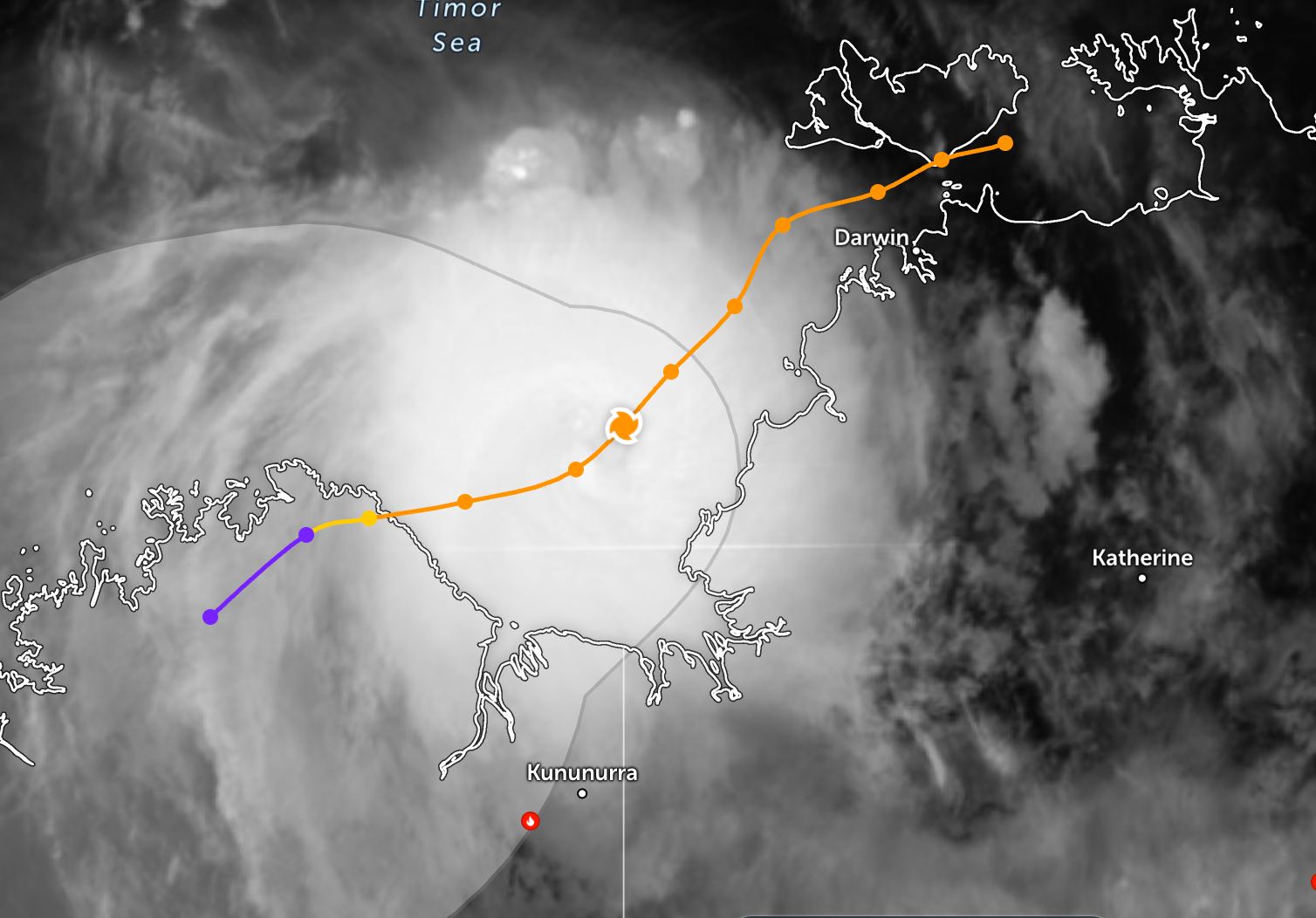
On the night of November 22 and early morning of November 23 (local time), fina made landfall in the Darwin area and the Tiwi archipelago with gusts of up to 110 km/h. The Australian Bureau of Meteorology assessed it as a severe tropical storm.
On November 23, fina moved away from Darwin as wind gusts reached 205 km/h.
During the sweep through Darwin, fina devastated the crowded city of more than 140,000 residents, causing property damage and submerging roads. Fortunately, there were no casualties.
At the time of the storm, about 19,000 people in the city were without power.
The government is making efforts to restore power sources. People are coordinating with authorities to clean up streets and houses after the storm.
Australian media reported that part of the roof of the city's largest Darwin Royal Hospital collapsed during the storm. Meanwhile, Darwin International Airport reopened today after being forced to close operations from 22 November before the storm made landfall.
Darwin was the site of one of Australia's worst natural disasters after Typhoon Tracy swept through much of the city on Christmas Day in 1974, killing 66 people.
After sweeping through Darwin, fina is continuing to move to western Australia. The strongest wind near the center of the storm reached 165 km/h.
fina is currently about 191 km west-southwest of Darwin City (Australia), and is moving southwest at a speed of about 11 km/h. The sea area around the center of the storm will see waves up to 9.8 meters high, showing strong winds and rough seas.
It is forecasted that in the next 12 hours, fina will continue to move along the northwest edge of the subtropical high pressure range and keep the direction southwest. During this period, the storm may increase slightly before the dry air mass enters, hindering the development of the system.
After that, the storm is forecast to change direction, moving in the Southwest - West axis for about the next two days, affected by the weak prolongation of the subtropical high pressure. The fina meteorological agency forecasts that fina will continue to make landfall in Australia for about the next 36 hours.
Immediately after reaching land, the storm will quickly weaken due to strong wind shear, dry air overflowing and increased soil friction. fina is forecast to completely dissipate within the next three days, continuing to move slowly to the Southwest and South as it is located deep inland.
People and tourists coming to areas where the storm has passed should pay attention to weather forecasts. Check flight schedules and follow local instructions to ensure safety.


