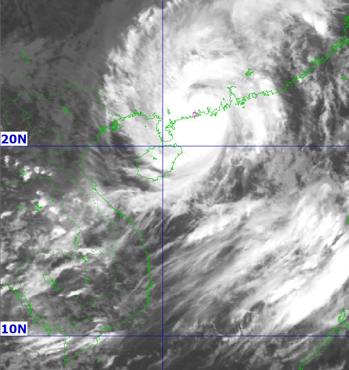
According to the latest storm information from the JTWC Joint Typhoon Warning Center, Typhoon No. 9 Ragasa (called Nando in the Philippines, Typhoon No. 18) continues to move west-northwest at a speed of 22 km/h, with strong winds of 195 km/h. At sea, the highest waves were recorded at 11.6 m.
The storm is forecast to continue moving west-northwest. When entering the Lusian Peninsula (China), Ragasa will gradually weaken due to the impact of the terrain.
The National Meteorological Center of China said that Typhoon Ragasa made landfall in the Hailing Island area, Duong Giang city, Guangdong province at around 5:00 p.m. on September 24 (local time), with the strongest winds near the center reaching about 145 km/h.
At the Chuandao town meteorological station (in Giang Mon city), maximum gusts of wind were recorded at 241 km/h - the highest level since the locality began collecting data.
The strong wind knocked down trees, swept away signs, and damaged fences. For many hours, the pouring rain caused the city of more than 2 million people to shake in the storm.
The Hong Kong Meteorological Station (China) recorded that when sweeping across the area about 100 km south of Hong Kong, Typhoon Ragasa had sustained winds of about 195 km/h near the center.
Hong Kong classified typhoons with winds of 185 km/h or more as "super typhoons" to warn of special danger.
Meanwhile, in Taiwan (China), the consequences of the broken long-standing flood barrier in Mataian stream (Hoa Lien) increased the death toll to 17. The number of missing people has dropped from 152 to 17 after most have been found.
According to the forecast, in the next 36-48 hours, the storm will gradually dissipate in the area near the border between Laos and Northern Vietnam. The likelihood of the storm returning to sea is very low, with most models predicting that Ragasa will move entirely on land.
The National Center for Hydro-Meteorological Forecasting said that from the night of September 24 to September 26, in the Northern region, Thanh Hoa and Nghe An, there will be heavy to very heavy rain, with common rainfall of 100-250mm, locally over 350mm.
Heavy rain in the above areas is likely to last until the end of the night of September 26 with total rainfall of 150-300mm, locally over 450mm.
Ragasa is the strongest storm in the Northwest Pacific and South China Sea since the beginning of the year, and one of two strongest storms ever recorded in the South China Sea since 1950, along with Saola (2023) and Yagi (2024).
For tourists, it is important to note: due to the impact of the storm, the southern coastal areas of China, Hong Kong and northern Vietnam may have heavy rain, high waves and strong winds in the next 1-2 days. Tourists should closely monitor weather reports, adjust travel plans and limit outdoor activities, especially at sea.


