Early on June 13, the Philippine Atmospheric, Geophysical and Astronomical Services Administration ( pagasa) said that Auring had weakened into a low pressure area and had now left the Philippine Area of Responsibility (PAR).
Meteorologist Benison Estareja said that Auring - the first tropical storm to form in 2025 in the Philippines - became a tropical depression at 8:00 p.m. on June 12 (local time), and swept across much of Taiwan (China).
The Taiwan Meteorological Station (China) determined that the storm made landfall at a speed of about 30 km/h, bringing widespread heavy rain.
From June 13 to early morning of June 14, the entire island will have short-term but strong showers or thunderstorms. Tourists planning to visit or are in Taiwan (China) should pay attention to weather forecasts and prepare backup plans when there are changes due to bad weather.
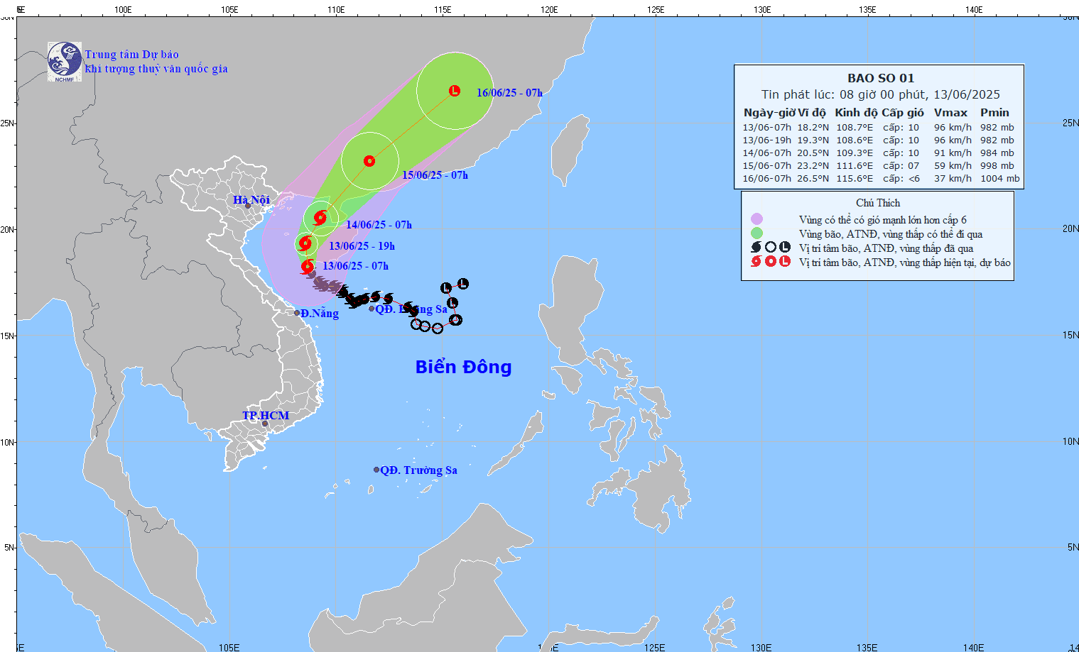
Meanwhile, at 7:00 a.m. this morning, June 13, storm No. 1 Wutip was in the sea southwest of Hainan Island (China), reaching level 10 intensity, gusting to level 13. The storm is moving north-northwest at a speed of about 10km/h.
Forecast of the development of storm No. 1 (in the next 24 to 72 hours) going around, changing direction from North-Northwest, to North Northeast and Northeast after sweeping across Hainan Island towards the southern mainland of China.
Typhoon No. 1 Wutip is forecast to weaken into a tropical depression on land, in the southwestern area of Guangdong province (China) on June 15.
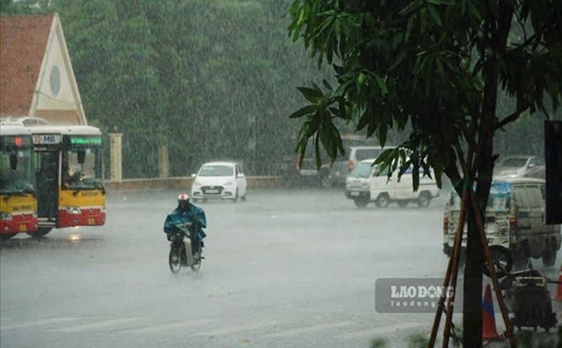
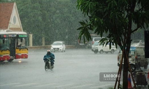
Storm No. 1 continues to affect the weather at sea and on land in Vietnam.
The Gulf of Tonkin has strong winds of level 6-7, near the center of the storm level 8-10, gusting to level 13. Waves are 2-4m high, with the East alone being 3.0-5.0m. The sea is very rough.
The Northwest of the East Sea and off the coast of Quang Tri - Da Nang will have winds of level 6-8, near the storm center level 9-10, gusting to level 13. Waves are 3-5m high, near the center of the storm 4-6m. The sea is very rough.
From Hai Phong to Nghe An, the sea level will rise abnormally ( Hon Dau: 3.9m, Hon Ngu: 2.8m). Risk of flooding in coastal low-lying areas, river mouths from 5pm to 7pm on June 13 and 14.
On June 13, the area from Quang Binh to Hue will have heavy to very heavy rain with common rainfall of 50-120mm, some places over 250mm; the South Nghe An, Ha Tinh, from Da Nang to Quang Nam and Kon Tum will have moderate rain, heavy rain, locally very heavy rain and thunderstorms with common rainfall of 20-40mm, some places over 120mm.
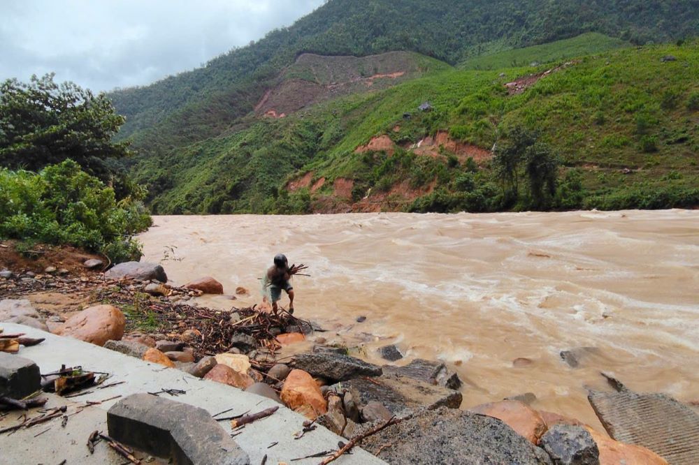
People and tourists in areas affected by storm No. 1 Wutip need to be on guard against flash floods, landslides in mountainous areas, and urban flooding in low-lying areas.