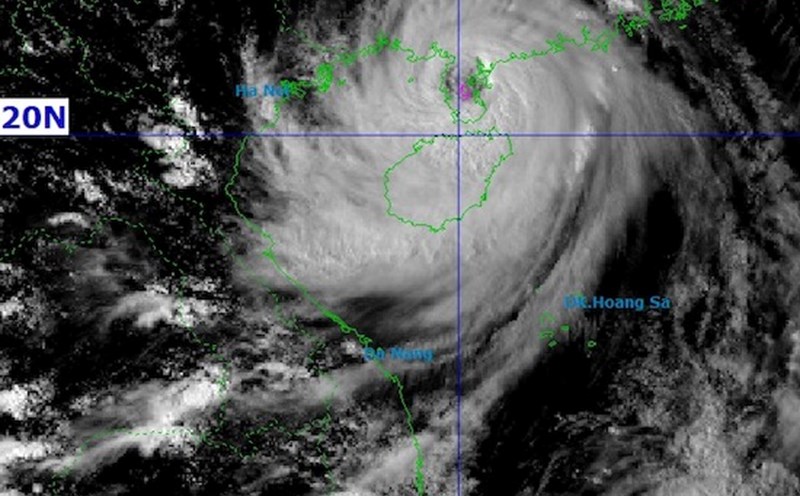
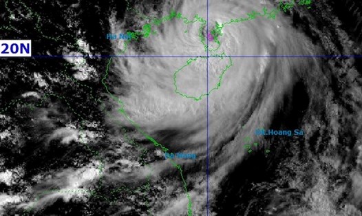
According to the latest storm information from the National Center for Hydro-Meteorological Forecasting (NCHMF), storm No. 11 of 2025 (international name Matmo, Philippine name is Paolo) is located in the Northeast of the East Sea, with the strongest wind near the center reaching level 10, gusting to level 13.
The storm is moving west-northwest at a speed of about 25 km/h. This is a new storm in the East Sea, formed after a tropical depression rapidly strengthened right after storm No. 10 Bualoi.
The Joint Typhoon Warning Center (JTWC) said that over the past 6 hours, the storm has been moving west-northwest at a speed of about 28 km/h. The highest waves in the storm's area will reach about 8.5 m.
Storm No. 11 Matmo is forecast to continue moving northwest.
In the next 36 hours, the storm is likely to strengthen, reaching a maximum intensity of about 155 km/h (equivalent to level 14 - gust above level 15).
The storm is then forecast to move towards the southern coastal region of China.
Typhoon No. 11 Matmo is forecast to make its first landfall in the northern area of Hainan Island and Zhuizhou Peninsula (China) in about 2 more days.
Next, the storm will continue to move westward and is likely to affect the China - Vietnam border area in the next 2-3 days.
According to the National Center for Hydro-Meteorological Forecasting, in the next 24 to 72 hours, the storm will continue to move west-northwest at a speed of 20-25 km/h.
At 10:00 p.m. on October 5, the storm's eye was at about 21.1° North and 109.0° East, in the northern sea area of the Gulf of Tonkin, about 140 km East Southeast of Mong Cai (Quang Ninh), the wind in the storm's eye was fluctuating at level 10-11, gusting to level 14.
By October 6, the storm is likely to move deep into the mainland of the Northeast region of the North and gradually weaken, becoming a tropical depression when entering the Northern mountainous region.
The eastern sea area of the North East Sea will be affected by strong winds of level 8-10, the area near the storm's eye may be affected by level 11-13, gusts of level 16, waves 4.0-6.0 m high, some places 6.0 8.0 m, and the sea will be very rough.
From the morning of October 5, the sea area northeast of the Gulf of Tonkin will have winds gradually increasing to level 8-9.
On the evening of October 5, coastal areas from Quang Ninh to Ninh Binh provinces, especially the sea area near the storm's eye, will have winds of level 10-11, gusts of level 14, waves 3.0-5.0 m, and rough seas.
Ships operating in these dangerous areas are at high risk of being affected by large waves, strong winds, and thunderstorms.
For tourists, storm No. 11 may cause rough seas in the East Sea in the next few days, affecting shipping routes and coastal tourism activities in Central and Northern Vietnam.
Tourists planning to travel or relax at destinations such as Quang Ninh, Hai Phong, Thanh Hoa, Nghe An and the northern border area should regularly update weather reports and proactively adjust their schedules when there are warnings from authorities to ensure safety.