According to the National Center for Hydro-Meteorological Forecasting (NCHMF), the localities expected to be most affected by storm No. 3 Wipha are Quang Ninh, Hai Phong, coastal areas of Hung Yen, Ninh Binh and Thanh Hoa.
NCHMF experts predict that Typhoon Wipha is likely to reach strong intensity of level 12-13, gusting to level 14-15 in the east of the Lusi Peninsula (China) before weakening and moving into the Gulf of Tonkin with winds of about level 810.
From the night of July 20 to July 22, the storm will directly affect coastal waters from Quang Ninh to Thanh Hoa with strong winds of level 7-9, gusts of level 11, waves 3-5m high. The islands of Bach Long Vi, Co To, and Cat Hai may experience strong winds sooner.
From July 21 to 24, the storm will cause widespread heavy rain in the North and North Central regions, especially in the midlands and deltas of the North, Thanh Hoa and Nghe An. There are places with very heavy rain with an amount of over 150mm/3 hours, high risk of flooding in low-lying areas, flash floods and landslides in the mountainous provinces of the North and North Central regions.
This widespread heavy rain has a common rainfall of 100-200mm, locally over 300mm; in the Northeast region, the Northern Delta, Thanh Hoa and Nghe An, there will be heavy to very heavy rain with common rainfall of 200-350mm, locally over 600mm.
Meanwhile, according to the Joint Typhoon Warning Center (JTWC)'s typhoon forecast, in the next 24 hours, Typhoon Wipha will change direction to the west-southwest, moving along the Chinese coast and approaching the Zhejiang area.
The highest wave height recorded near the center of the storm was 8.8 meters.
Wipha then accelerates westward. Forecast models show the possibility of Typhoon No. 3 Wipha maintaining winds of up to 110km/h when entering the Gulf of Tonkin, after reaching maximum winds of 130km/h when sweeping across the southern mainland of Guangdong province, China.
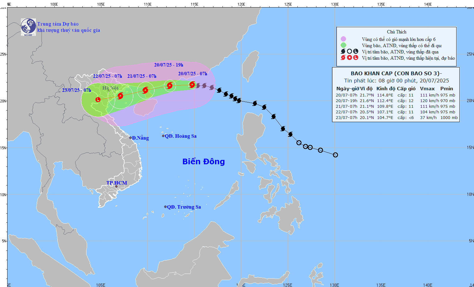
Storm No. 3 Wipha is forecast to make a second landfall in about the next 60 hours, near the Red River Delta, southeast of Hanoi. After making landfall, the storm continues to move deep inland for the remainder of the forecast period
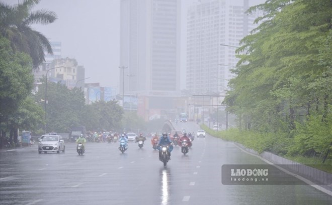
People and tourists should be on guard against thunderstorms that can cause tornadoes, lightning, and strong gusts of wind. Limit outdoor activities, going out to sea, and taking island tours in areas that are about to be affected by storm No. 3 Wipha.


