According to the latest storm news from the National Center for Hydro-Meteorological Forecasting, at 1:00 p.m. on July 21, storm No. 3 Wipha is forecast to be at about 20.8°N; 108.9°E, in the eastern sea area of the Northern Gulf of Tonkin. Intensity level 11-12, gust level 15.
The northern sea area of the North East Sea will have strong winds of level 8-10, near the storm center level 11-12, gusting to level 15. Waves are 5.0-4.0m high, with rough seas.
Northern Gulf of Tonkin (Bach Long Vi, Co To, Cat Hai, Hon Dau): Strong winds of level 6-7, increasing to level 8-9, near the storm center level 10-11, gusting to level 14. Waves are 3.0-5.0m high.
Southern Gulf of Tonkin ( Hon Ngu): Strong winds of level 6-7, near the storm center level 8-9, gusting to level 11. Waves are 2.0-4.0m high.
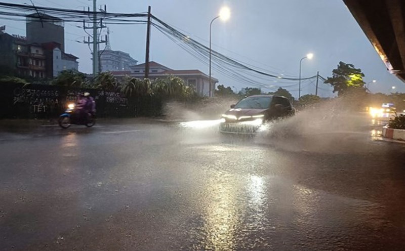
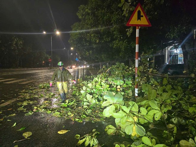
From the evening and night of July 21, the coast from Quang Ninh to Nghe An will have strong winds of level 7-9, near the storm center level 10-11, gusting to level 14. On land, the wind is level 6-7, gusting to level 8-9.
From 21-23.7, the Northeast region, the Northern Delta, Thanh Hoa, Nghe An will have heavy to very heavy rain (200-350mm, some places over 600mm). The North and Ha Tinh will have moderate to heavy rain (100-200mm, some places >300mm).
Meanwhile, the Central and Southern highlands will have scattered showers and thunderstorms, locally heavy rain (10-30mm, some places over 70mm).
People and tourists in Quang Ninh, Hai Phong, Nam Dinh and the northern and north central mountainous areas should temporarily stop outdoor activities, stay away from areas with rivers, streams, and hills prone to landslides.
Weather forecast for tonight, July 20, and tomorrow, July 21:
Hanoi City
Lowest temperature: 25-27 degrees Celsius
Highest temperature: 27-29 degrees Celsius
Cloudy, rain at night, moderate rain and thunderstorms, locally heavy to very heavy rain; day with heavy to very heavy rain and thunderstorms. Northwest wind level 2-3, then increase to level 4-5. During thunderstorms, there is a possibility of tornadoes, lightning, hail and strong gusts of wind.
Northwest
Lowest temperature: 24-27 degrees Celsius, some places below 24 degrees Celsius
Highest temperature: 28-31 degrees Celsius, some places above 31 degrees Celsius
Cloudy, scattered showers and thunderstorms at night, locally heavy rain; heavy rain and thunderstorms during the day. Light wind, tomorrow the west to northwest wind will be level 2-3. During thunderstorms, there is a possibility of tornadoes, lightning, hail and strong gusts of wind.
Northeast
Lowest temperature: 24-27 degrees Celsius
Highest temperature: 26-29 degrees Celsius, some places above 29 degrees Celsius
Cloudy, scattered showers and thunderstorms at night, locally heavy rain, especially in the Northeast and Delta, there will be rain, moderate rain and thunderstorms, locally heavy to very heavy rain; during the day, there will be heavy to very heavy rain and thunderstorms. Northwest wind level 2-3, then increase to level 4-5, especially in coastal areas from late afternoon the wind gradually strengthens to level 6-8, gusting to level 9-10. During thunderstorms, there is a possibility of tornadoes, lightning, hail and strong gusts of wind.
Thanh Hoa to Hue
Lowest temperature: 26-29 degrees Celsius
Highest temperature: 29-32 degrees Celsius
North: cloudy, rain at night, moderate rain and thunderstorms, locally heavy to very heavy rain, day with heavy to very heavy rain and thunderstorms.
South: cloudy, scattered showers and thunderstorms at night, scattered showers and thunderstorms during the day.
Northwest wind level 2-4. During thunderstorms, there is a possibility of tornadoes, lightning, hail and strong gusts of wind.
South Central Coast
Lowest temperature: 26-29 degrees Celsius
Highest temperature: 32-35 degrees Celsius, some places above 35 degrees Celsius
Cloudy, showers and thunderstorms in some places in the evening and at night; sunny during the day, some places are hot. Southwest wind level 2-4. During thunderstorms, there is a possibility of tornadoes, lightning, hail and strong gusts of wind.
Central Highlands
Lowest temperature: 20-23 degrees Celsius
Highest temperature: 25-28 degrees Celsius, some places above 28 degrees Celsius
Cloudy, with showers and thunderstorms in some places, with showers and scattered thunderstorms in the afternoon and evening, with some places having heavy rain. Southwest wind level 3. During thunderstorms, there is a possibility of tornadoes, lightning and strong gusts of wind.
Southern region
Lowest temperature: 24-27 degrees Celsius
Highest temperature: 29-32 degrees Celsius, some places above 32 degrees Celsius
Cloudy, with showers and thunderstorms in some places, with showers and scattered thunderstorms in the afternoon and evening, with some places having heavy rain. Southwest wind level 3. During thunderstorms, there is a possibility of tornadoes, lightning and strong gusts of wind.
Ho Chi Minh City
Lowest temperature: 24-26 degrees Celsius
Highest temperature: 29-31 degrees Celsius
Cloudy, with showers and thunderstorms in some places, with showers and scattered thunderstorms in the afternoon and evening, with some places having heavy rain. Southwest wind level 3. During thunderstorms, there is a possibility of tornadoes, lightning and strong gusts of wind.