According to the latest storm news from the National Center for Hydro-Meteorological Forecasting, at 1:00 p.m. on September 19, the center of storm No. 8 was at about 22.6 degrees North latitude - 115.2 degrees East longitude, in the coastal area of Guangdong province (China), about 120km east of Hong Kong (China).
The strongest wind near the storm center is level 9 (75-88 km/h), gusting to level 11. The storm is moving northwest at a speed of 10-15 km/h.
According to data from the Joint Typhoon Warning Center (JTWC), at around 2:50 p.m., Typhoon No. 8 Mitag officially made landfall in Guangdong Province, China.
The Quang Dong Provincial Meteorological Station recorded that at the time of landfall in Son Vi city (Shanwei), the strongest wind near the storm's center reached 25 meters/s.
The meteorological agency forecasts that Mitag will continue to move northwest at a speed of 10-15 km/h and gradually weaken as it moves further inland.
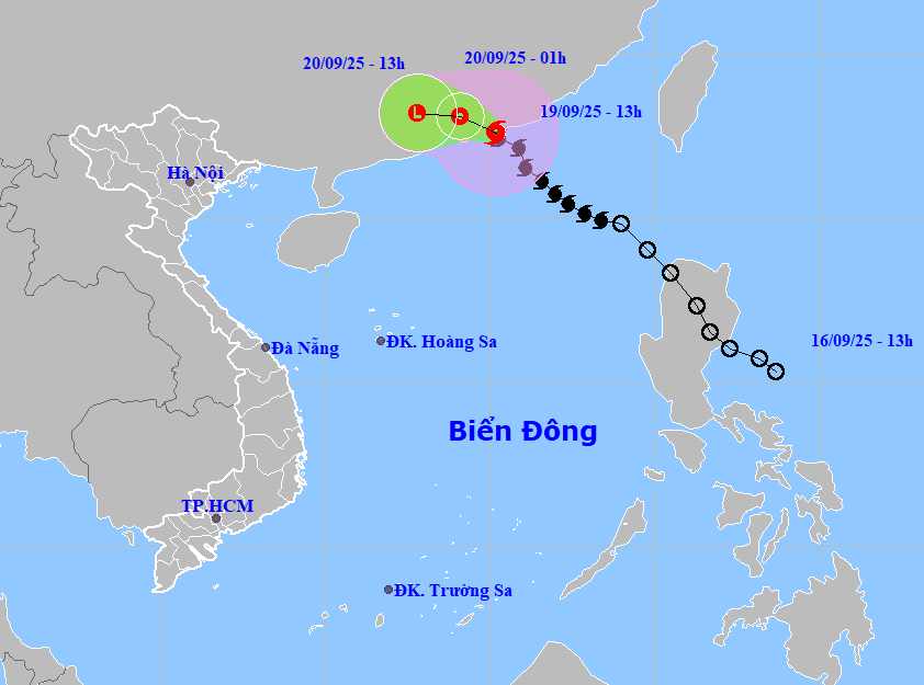
The National Center for Hydro-Meteorological Forecasting predicts that by 1:00 a.m. on September 20, the storm will move west-northwest at a speed of about 10-15 km/h, weakening into a tropical depression in the mainland south of Quang Dong province. The center of the tropical depression is located at about 23.1 degrees North latitude -114.1 degrees East longitude. The strongest wind near the storm center is level 6-7, gusting to level 9.
At 1:00 p.m. on September 20, the storm continued to move westward at a speed of about 10-15 km/h, moving deep into the mainland of Guangdong province (China) and weakening into a low pressure area. The center of the low pressure is located at about 23.2 degrees North latitude - 112.8 degrees East longitude. The strongest wind is below level 6.
Due to the impact of storm No. 8, the northern sea area of the East Sea will have strong winds of level 6-7, gusting to level 9. The area near the storm center is strong at level 8-9, gusting to level 11. Waves are 3.0-5.0m high, the sea is very rough.
Ship in the danger zone is at risk of being affected by thunderstorms, whirlwinds, strong winds and large waves.
People and tourists planning to visit these coastal areas or areas where storms pass through should pay attention to weather forecasts. Check flight schedules and follow local instructions to avoid dangerous storms.


