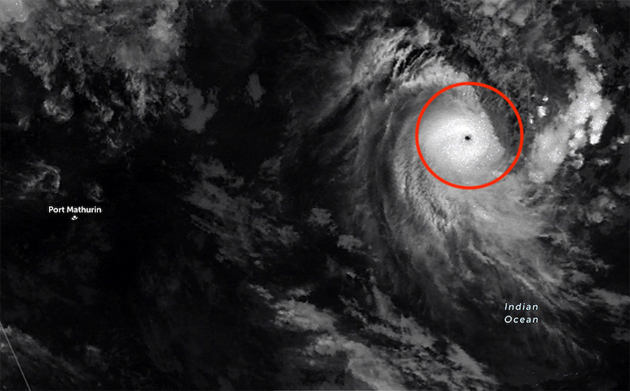
According to the latest storm news from the US Joint Typhoon Warning Center (JTWC), Typhoon Dudzai is currently located about 1,200 km from Diego Garcia Island.
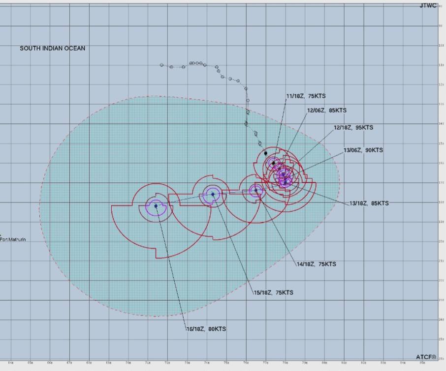
In the next 24 hours, the storm is forecast to continue to move slowly southward, before suddenly changing direction to the West due to the impact of a subtropical high pressure area forming in the Southwest.
Dudzai models are forecast to continue to strengthen in the next 12 hours, thanks to very favorable environmental conditions. The current maximum intensity is forecast to be about 205 km/h, however some assessments suggest that this number may be even lower than reality.
Wind gusts near the center of the storm are currently estimated to exceed 250 km/h, storm Dudzai became the second most powerful tropical storm in the 2025-2026 storm season in the southwestern Indian Ocean region, after storm Grant. This is the first storm in the world to reach super typhoon level in 2026.
After a period of rapid intensification, the storm may temporarily weaken for 1-2 days due to slow movement in cooler seawater. However, from about 4-5 days, the storm is forecast to be likely to strengthen again when encountering more favorable atmospheric conditions.
Typhoon Dudzai is currently very far from the mainland, not directly threatening population islands such as Rodrigues; Mauritius; Reunion (La Reunion) belonging to France.
Different forecast models show that the uncertainty about the storm's trajectory will gradually increase from mid-week to the end of the week. The storm may change intensity quickly and develop complicatedly, although it has not yet directly affected tourist destinations.
Tourists need to closely monitor the developments of Typhoon Dudzai, especially if they have plans for sea tourism or yachts in the southwestern Indian Ocean.


