According to the new weather forecast from the Joint Typhoon Warning Center (JTWC), the tropical disturbance Invest 92W is currently active in the Philippine Sea, with a high possibility of becoming a tropical depression in the next 24 hours.
The wind near the center will reach 35-45 km/h, with some places reaching 56 km/h.
The Philippine Atmospheric, Geophysical and Astronomical Services Administration (PAGASA) is also monitoring the low pressure.
Forecast models all show that the depression will move north and tend to strengthen gradually in the coming day.
People and vessels operating at sea need to closely monitor the developments of these low pressure areas and regularly update information from local authorities.
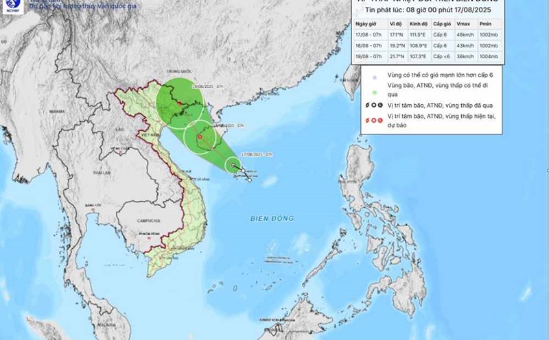
Meanwhile, the tropical depression in the East Sea is tending to move northwest at a speed of 15-20km/h, approaching the Hainan Island (China).
According to the National Center for Hydro-Meteorological Forecasting, the strongest wind near the center of the low pressure reaches level 6 (39-49 km/h), gusting to level 8.
It is forecasted that by 7:00 p.m. on August 18, the tropical depression will be at about 19.8°N - 107.8°E, in the Northern Gulf of Tonkin. The intensity is maintained at level 6, gusting to level 8. The danger zone is identified from 16.5°N to 21.0°N and from 106.5°E to 110.5°E.
The affected area includes the northwest sea of the East Sea, the eastern sea from Quang Tri to Hue and the Gulf of Tonkin, including Bach Long Vi and Co To. The natural disaster risk level is level 3.
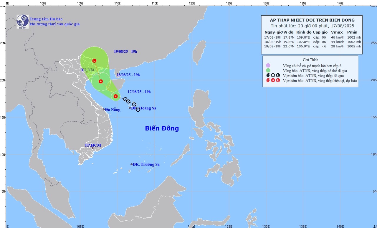
At 7:00 p.m. on August 19, the tropical depression continued to move in the North-Northwest direction at a speed of about 15 km/h and gradually weakened into a low pressure area. The center was then located at about 22.6°N - 106.9°E, in the south of Guangxi Province (China).
The intensity decreases to below level 6. The danger zone is identified in the north of latitude 18.5°N and west of longitude 109.5°E. The affected area is still the Gulf of Tonkin, including Bach Long Vi and Co To. The natural disaster risk level continues to be maintained at level 3.
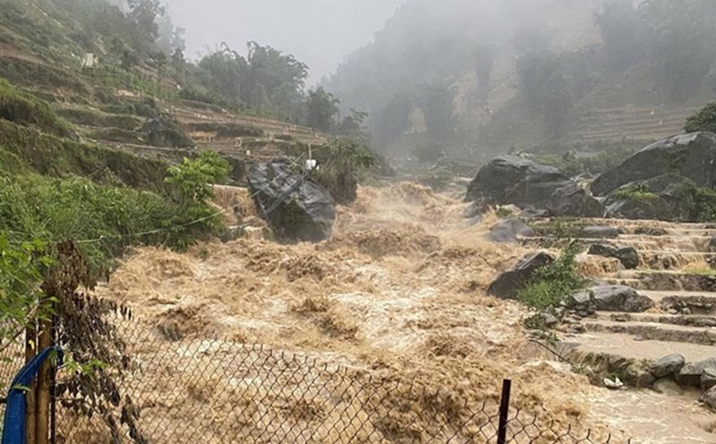
In the coming days, the Northwest sea of the East Sea, the eastern sea from Quang Tri to Hue and the Gulf of Tonkin (including Bach Long Vi, Co To) will have thunderstorms with strong winds of level 6, gusting to level 8. Waves are 2.0-3.0 m high, rough seas. Ship operating in the dangerous area are likely to experience thunderstorms, tornadoes, strong winds and big waves, and should be very careful to avoid them.
Tourists planning to visit and travel by sea in the provinces from Quang Tri to Quang Ninh during this time should closely monitor weather forecasts and follow the instructions of local authorities.
Limit travel by boat, boat or recreational activities at sea during the period of tropical depression. Tourists staying on islands and coastal resorts need to prepare safety plans, ensure communication and regularly update weather information.