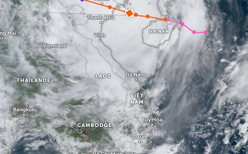
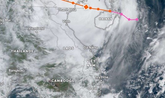
According to the National Center for Hydro-Meteorological Forecasting, Typhoon Yagi is approaching the mainland provinces and cities of Quang Ninh and Hai Phong. At 10:00 a.m. today (September 7), the eye of the storm was located at about 20.6 degrees North latitude, 107.6 degrees East longitude, in the Gulf of Tonkin, Vietnam.
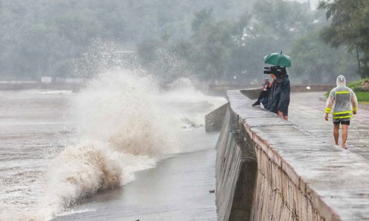
The strongest wind in the area where storm Yagi passes is level 13 (134-149km/h), gusting to level 16. It is forecasted that in the next 3 hours, the storm will move in a West Northwest direction, increasing its speed to 20km/h.
Due to the influence of storm No. 3's circulation, Bach Long Vi Island has strong winds of level 13, gusts of level 14; Co To Island has strong winds of level 13, gusts of level 16; Tien Yen (Quang Ninh) strong winds of level 9, gusts of level 11; Dam Ha (Quang Ninh) strong winds of level 8, gusts of level 12; Cua Ong (Quang Ninh) strong winds of level 12, gusts of level 14; Dong Xuyen (Hai Phong) strong winds of level 7, gusts of level 8; Ba Lat (Thai Binh) strong winds of level 8, gusts of level 10...
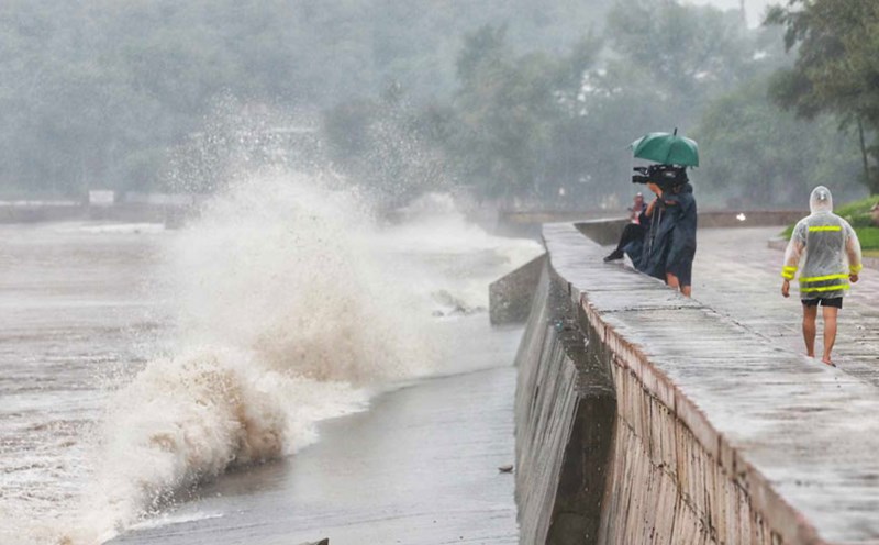
The terrible winds of storm No. 3 are devastating Co To Island, blowing away many roofs, signs, knocking down trees and causing power outages across the district.
Based on images from the Vietnam Natural Disaster Monitoring System (Vndms), the eye of storm Yagi is hovering over Bai Tu Long Bay, Van Don Bay and Co To District.
However, Vndms' forecast shows that the path of storm No. 3 will head straight towards the area between Hai Phong and Quang Ninh, through Hai Duong, Bac Ninh...
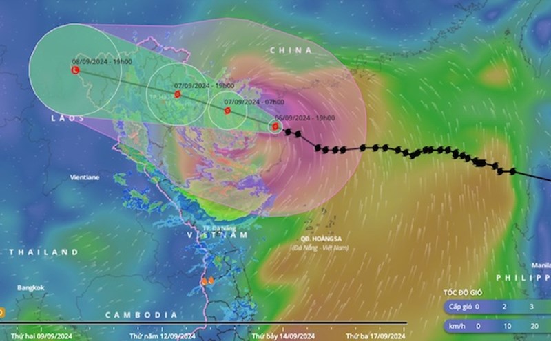
It is forecasted that at 7:00 p.m. on September 7, the storm will make landfall.
By 7am on September 8, the storm will directly affect Yen Bai and Son La and weaken into a tropical depression.