Go towards the sun
Border tripoint", "The place where the sun sets last on Vietnamese territory"... These are familiar names for A Pa Chai - the westernmost point on the mainland of the Fatherland. But to reach the milestone where the 3 borders meet, what people remember most is not only that special location, but also the journey to overcome the routes that were once considered the most difficult in the Northwest.
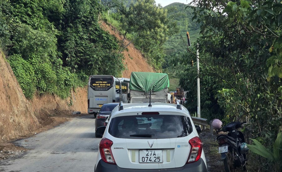
National Highway 4H winds like a thin thread embracing the mountainside. Each curve opens up another layer of clouds, another valley and then closes with vertical cliffs. The further we move towards Sin Thau, the fewer houses become, the phone signal sometimes disappears, only the sound of engines echoing in the great forest.
That road takes people towards the sunset.
And also takes people back to a region of memories of the westernmost point of the Fatherland - a place once considered the farthest land not only because of geographical distance, but also because of the high mountains and old forests dividing it.
The people of Sin Thau still pass on the saying: "The sun sets here last, the day is longer, the rooster crows for 3 countries to hear and the road to it is also more difficult".
The saying sounds like a metaphor, but it encapsulates both the geographical and historical location of the land where 3 borders meet.
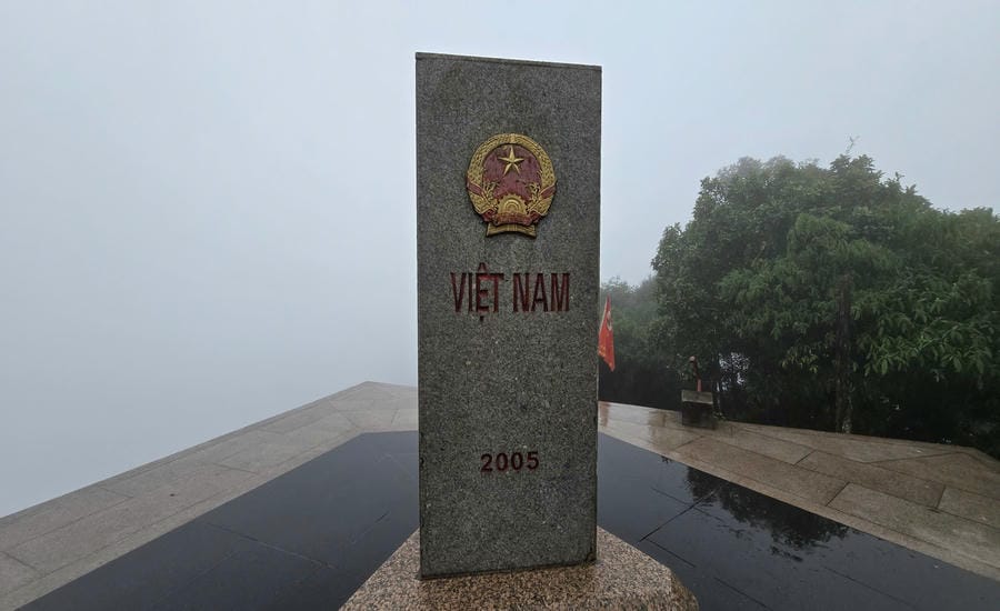
A Pa Chai is the intersection of the Vietnam - Laos - China border, and also the westernmost point on the mainland of Vietnam. On the top of Khoang La San, nearly 1,900m high, a granite marker stands silently between 3 countries, marking the sacred sovereignty of the Fatherland.
Standing in front of that milestone, what impresses is not only the special location on the map. Below are mountain ranges connecting each other to the horizon, villages nestled under the valley and the only road following the mountainside bringing people closer to the plains.
Perhaps because of this, at the westernmost point, each road has more meaning than a simple traffic route.
Through the region of obstacles
Few people remember that less than a quarter of a century ago, the journey to Sin Thau was still a story of footsteps.
In the early 2000s, from the center of Dien Bien province to Muong Nhe, it took almost a whole day on bumpy dirt and rock roads. But that was just the beginning.
To enter Sin Thau, there is no other choice but to walk.
The trails weaving through the old forest are the only traffic route. People carry goods on their backs. Officials bring rice, salt and necessities for many working days. Each trip depends on the weather. When it rains, the road is slippery like grease. When the sun rises, dust covers hair and clothes.
Before the 2000s, Sin Thau belonged to Muong Te district, former Lai Chau province. This place was once likened to the "mountainous and waterless" region of the Northwest.
Going back 60 years, Xinh Phinh commune - the old name of Sin Thau - is more than 300km from Lai Chau provincial capital. To go down to the province, you have to walk for nearly 1 month. One trip means many weeks leaving the village. News arrives late. Goods arrive late. Life is almost isolated from the outside.
That memory is still intact in the story of Mr. Po Dan Xinh, who has been attached to the westernmost land for 70 years of his life.
He said that in the past, from Sin Thau to the district center, there was only a road cutting through the old forest. Each person brought rice, dried fish and a few bamboo tubes. "If you are tired of walking, stop. When it's dark, light a fire, cook rice in a bamboo tube and sleep in the middle of the forest. The next morning, we continue to go. It takes about ten days to get to the center," he recounted.
Walking trips lasting dozens of days are now only in the memories of the elderly. The national highway has been opened to the village. Motorbikes and cars can bring goods, supplies, and necessities to the place.
Having a big road to get there, the villagers are very happy," Mr. Po Dan Xinh smiled.
That joy is also the reason why his family voluntarily donated thousands of square meters of land for the State to expand the road. For him, losing a part of the fields but in return is a wider road for children and grandchildren to go to school, people to go to the market, ambulances can enter the village when needed.
In Sin Thau, many people also think like him.
Because for border areas, the road has never been just a traffic story. It brings opportunities to escape poverty, brings goods, knowledge and even a new rhythm of life to villages that were once isolated in the great forest.
The road connects near the westernmost point
Arriving at Sin Thau, the 7-seater car had to continue along National Highway 4H. The road is still winding, clinging to the mountainside like a silk strip across the great forest. There are sections where the road surface is just enough for two cars to avoid each other.
The way to the westernmost point today has been much more favorable, but it is still not an easy journey.
Vehicles carrying construction materials, goods, and agricultural products have now become familiar on the road that used to only have human footprints. People's travel and trade are more convenient. Villages nestled at the foot of the mountain are no longer as far away as before.
In the border area, transport infrastructure always has special meaning. Each road opened not only serves socio-economic development but also contributes to consolidating national defense and security, creating conditions for functional forces to perform the task of managing and protecting border lines and landmarks.
Standing on the top of Khoang La San, the milestone where 3 borders meet appears firmly in the blue sky. From here, you can take a look through the rolling mountains of Vietnam, Laos and China. Invisible borders established by sovereignty markers, quietly present in the great forest through many seasons of rain and sunshine.
Many people come to A Pa Chai to touch the westernmost milestone, to mark a journey of conquest. But what remains after the trip is the story of the roads.
That is the road that once forced people to carry rice, dried fish, sleep in the forest for many days to get to the district center.
It is the road that Mr. Po Dan Xinh and many households are willing to donate land to expand, because they understand that each meter of road opened will bring more opportunities for their children and grandchildren.
It is the road to bring the first buses to the village, bringing children to school more conveniently, bringing patients to the hospital faster, and bringing goods from the lowlands to the border region.
There are changes that are very difficult to measure by numbers. That is when people no longer have to calculate their travel time in weeks or months. That is when the villages in the far West are no longer divided every time it rains.
From the forest-crossing trails of yesteryear to National Highway 4H today is a journey across the division of high mountains, deep abysses and months of separation. Each wheel rolling through not only brings people closer to the westernmost milestone, but also carries the pace of development to the land where 3 borders meet.
That road is therefore not only leading to A Pa Chai. It is also a road connecting the westernmost point with all regions of the Fatherland.