According to the National Center for Hydro-Meteorological Forecasting, at 7:00 a.m. on September 29, storm No. 10 Bualoi had dropped to level 9 (75-88km/h), gusting to level 12. Although the storm's intensity has decreased, the impact of the storm is still continuing.
Mr. Mai Van Khiem - Director of the National Center for Hydro-Meteorological Forecasting, Department of Hydro-Meteorology provided information on the forecast of the next impact of the storm.
Accordingly, currently, storm No. 10 has weakened to level 9, gusting to level 11. It is forecasted that by around 10am this morning, the storm will weaken into a tropical depression. The storm then continued to move deep inland and weakened into a low pressure area.

"Although storm No. 10 has weakened, the impact of the storm is still very strong" - Mr. Khiem warned.
According to Mr. Khiem, the phenomenon of prolonged heavy rain in Nghe An, Thanh Hoa, and Ha Tinh provinces today, September 29.
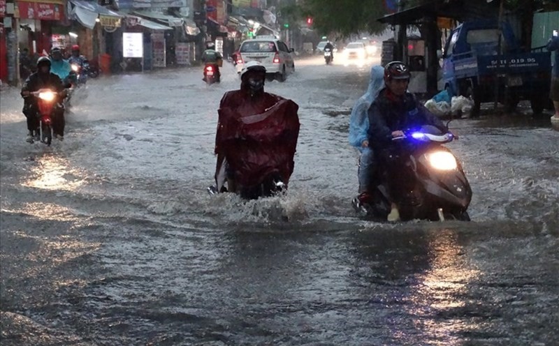
In addition, heavy rain will expand to the Northern Delta and midland provinces, with rainfall forecast to be about 100 - 250mm, some places may locally increase to over 350mm.
Notably, the river system in the Northern regions is at level 2, with some places at level 3. In particular, the Kien Giang river system (Quang Tri) reached its peak last night and was above level 3 alarm level. Although it is currently decreasing, the flooding situation in the riverside area here continues to persist.
The Director of the meteorological agency analyzed that with floods on the Ha Tinh river systems, the rainfall is also rising rapidly, forecast to exceed the level 3 warning this morning. In particular, today and in the coming days, the risk of flooding in low-lying areas and urban areas in Ha Tinh area is very high.
In addition, with heavy rainfall of up to several hundred mm today and tomorrow (September 30), flash floods and landslides may appear in the mountainous areas west of the North Central provinces and the midlands of the Northern mountains.
According to the National Center for Hydro-Meteorological Forecasting, in the past 24 hours (from 7:00 a.m. on September 28 to 7:00 a.m. on September 29), the provinces from Thanh Hoa to Da Nang city had moderate rain, heavy rain, and monitoring stations that measured very heavy rain such as: Van Xuan 257.2mm (Thanh Hoa); Yen Thuong 414mm (Nghe An); Huong Quang 328mm (Ha Tinh); Hoa Thanh 215.2mm (Quang Tri); Hong Trung 199mm (Hue city); Suoi Luong 108.2mm (Da Nang city)...
In the past 9 hours (from 10:00 p.m. on September 28 to 7:00 a.m. on September 29), the areas of Lao Cai, Son La and Phu Tho provinces have had moderate rain, with monitoring stations having heavy rain such as: Nhi Lang 111.8mm (Lao Cai); Muong Do 73.4mm (Son La); Lung Van 133.8mm (Phu Tho)...
Soil moisture models show that some areas in the above provinces are nearly saturated (over 85%) or have reached a saturated state.
Warning in the next 3 - 6 hours (from 7:40 on September 29), the above provinces will continue to have rain with common accumulated rainfall as follows: Lao Cai from 20 - 40mm, some places over 60mm; Son La, Phu Tho from 30 - 70mm, some places over 100mm; from Thanh Hoa to Ha Tinh from 90-130mm, some places over 180mm; from Quang Tri to Da Nang city from 10 - 30mm, some places over 50mm.
Warning in the next 6 hours (from 7:40 on September 29), there is a risk of flash floods on small rivers and streams, landslides on steep slopes in many communes/wards in the above provinces.