Latest update from the National Center for Hydro-Meteorological Forecasting, due to the influence of storm No. 10, at Co To station (Quang Ninh), there are strong winds of level 7, gusting to level 9; Bach Long Vi station (Hai Phong) has strong winds of level 8, gusting to level 9; Hon Ngu station (Nghe An) has strong winds of level 10, gusting to level 14, storm surge water is 1.6 m high; Con Co station (Quang Tri) has strong winds of level 10, gusting to level 11. On the mainland along the coast of the provinces from Quang Ninh to northern Quang Tri, there were strong winds of level 6-9, gusting to level 10-12. Dien Chau Station (Nghe An) strong wind level 11, gust level2; Hoanh Son Station (Ha Tinh) strong wind level 11, gust level4; Ky Anh Station (Ha Tinh) strong wind level 10, gust level 12.
At 7:00 a.m. on September 29, the center of storm No. 9 Bualoi was at about 18.8 degrees north latitude; 105.1 degrees east longitude, on the mainland of the Nghe An - Central Laos border area. The strongest wind near the storm center is level 9 (75-88 km/h), gusting to level 12. The storm is moving west-northwest at a speed of 20-25 km/h.
It is forecasted that in the next 12 hours, the storm will move west-northwest at a speed of 20-25 km/h, moving deep inland and gradually weakening into a tropical depression, then a low pressure area.
At 7:00 p.m. on September 29, the center of the low pressure area was at about 19.9 degrees north latitude; 102.3 degrees east longitude, in the Upper Laos area. The strongest wind is below level 6. The danger zone in the next 12 hours is from latitude 17 degrees north to 20 degrees north, west of longitude 108 degrees east. Level 3 natural disaster risk for the sea area from Thanh Hoa to Quang Tri (including Hon Ngu island, Con Co special zone), northern Gulf of Tonkin (including Bach Long Vi special zone, Van Don, Co To, Cat Hai and Hon Dau island).
At sea, the sea area from Thanh Hoa to north of Quang Tri (including Hon Ngu island, Con Co special area) will have strong winds of level 6-7, near the storm center level 8-9, gusts of level 12, waves 3-5 m high, very rough seas. The northern Gulf of Tonkin (including the special areas of Bach Long Vi, Van Don, Co To, Cat Hai and Hon Dau island) will have strong winds of level 6-7, gusts of level 8-9, waves 2-4 m high, and rough seas.
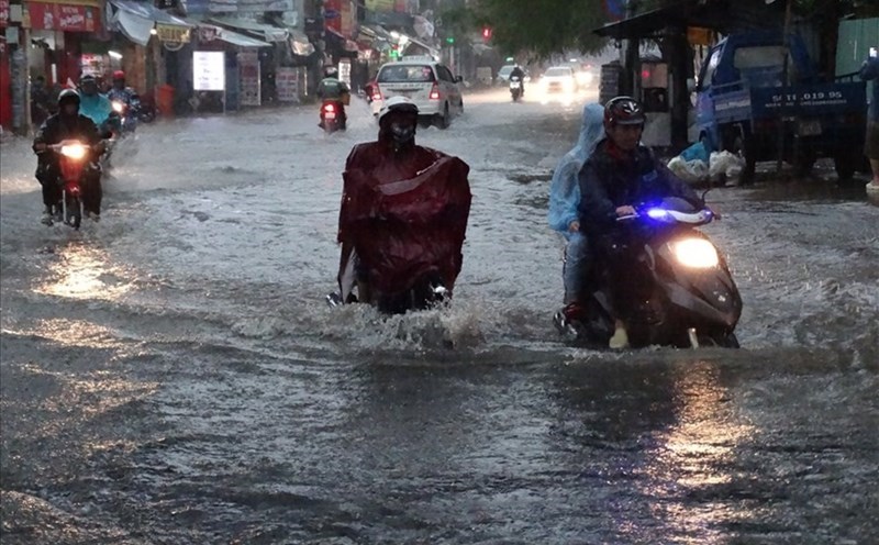
Storm surge and flood warning coastal areas, coastal areas and islands from Quang Ninh to Nghe An have storm surge water from 0.5-1 m high. Warning of high risk of flooding in low-lying areas, coastal roads, riverside roads due to storm surge combined with high tides and big waves in the morning and afternoon of September 29.
On land, the area from Quang Ninh to Ha Tinh will have strong winds of level 6-7, gusting to level 8-9, some places will have level 8, gusting to level 10; the area near the storm center will have level 8-9, gusting to level 12.
Heavy rain, from September 29 to September 30, the Northern Delta, Phu Tho, the southern provinces of Son La, Lao Cai and the provinces from Thanh Hoa to Ha Tinh will have heavy to very heavy rain with total rainfall ranging from 100-200 mm, locally over 350 mm. Warning of the risk of heavy rain with rainfall greater than 200 mm/3 hours. Other places in the North will have moderate rain, heavy rain, some places will have very heavy rain with total rainfall ranging from 70 - 120 mm, locally over 200 mm.