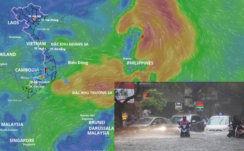
Mr. Mai Van Khiem - Director of the National Center for Hydro-Meteorological Forecasting - said that it is forecasted that around tomorrow morning, July 19, storm Wipha will enter the East Sea, becoming storm No. 3. The prediction is very reliable (about over 90%) that this storm will strengthen when entering the East Sea.
This forecast information makes many tourists worried about the risk of heavy rain in Hanoi and northern sea tourism destinations, especially in coastal areas this weekend (ie July 19 - 20).
However, according to information from the National Center for Hydro-Meteorological Forecasting, people can rest assured because storm Wipha has not affected the mainland, including Hanoi and tourist destinations in the coastal areas of the North during the weekend.
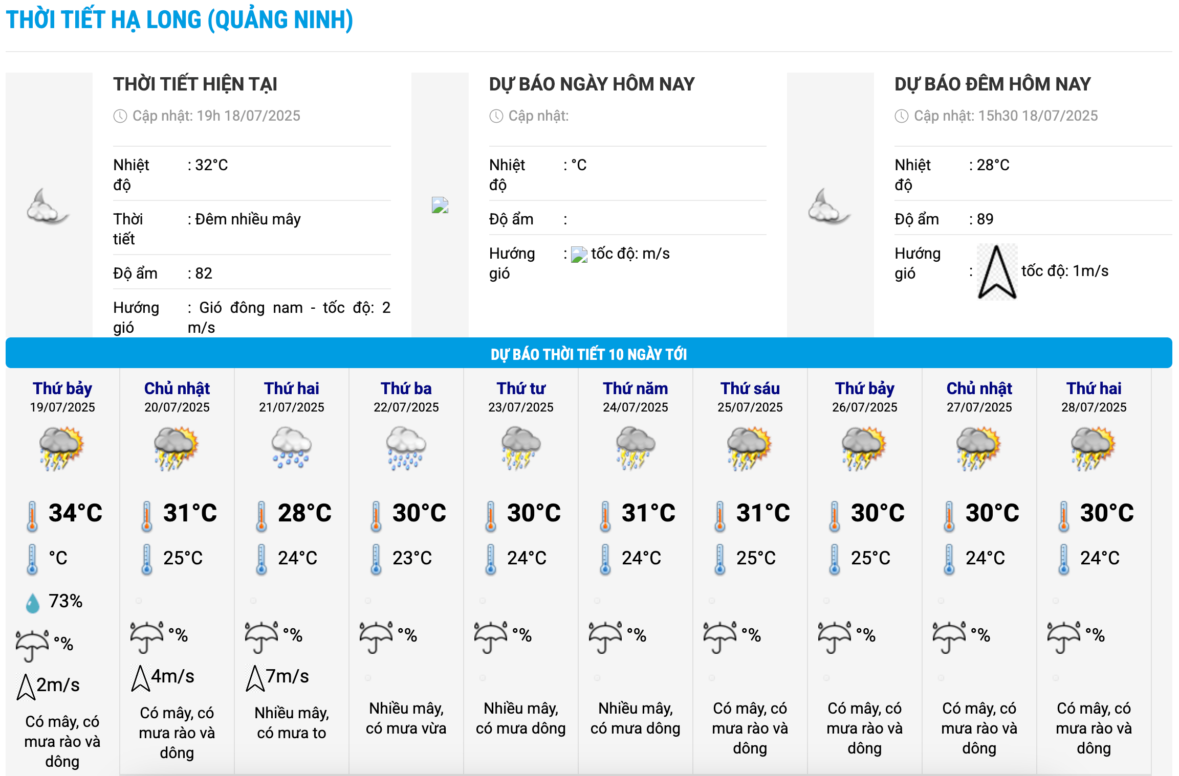
Tourists visiting some tourist destinations such as Ha Long Bay, Bai Chay, Co To Island, Quan Lan Island... (Quang Ninh province); Cat Ba, Do Son (Hai Phong), Ninh Binh... can plan to visit this weekend without being hindered by storms.
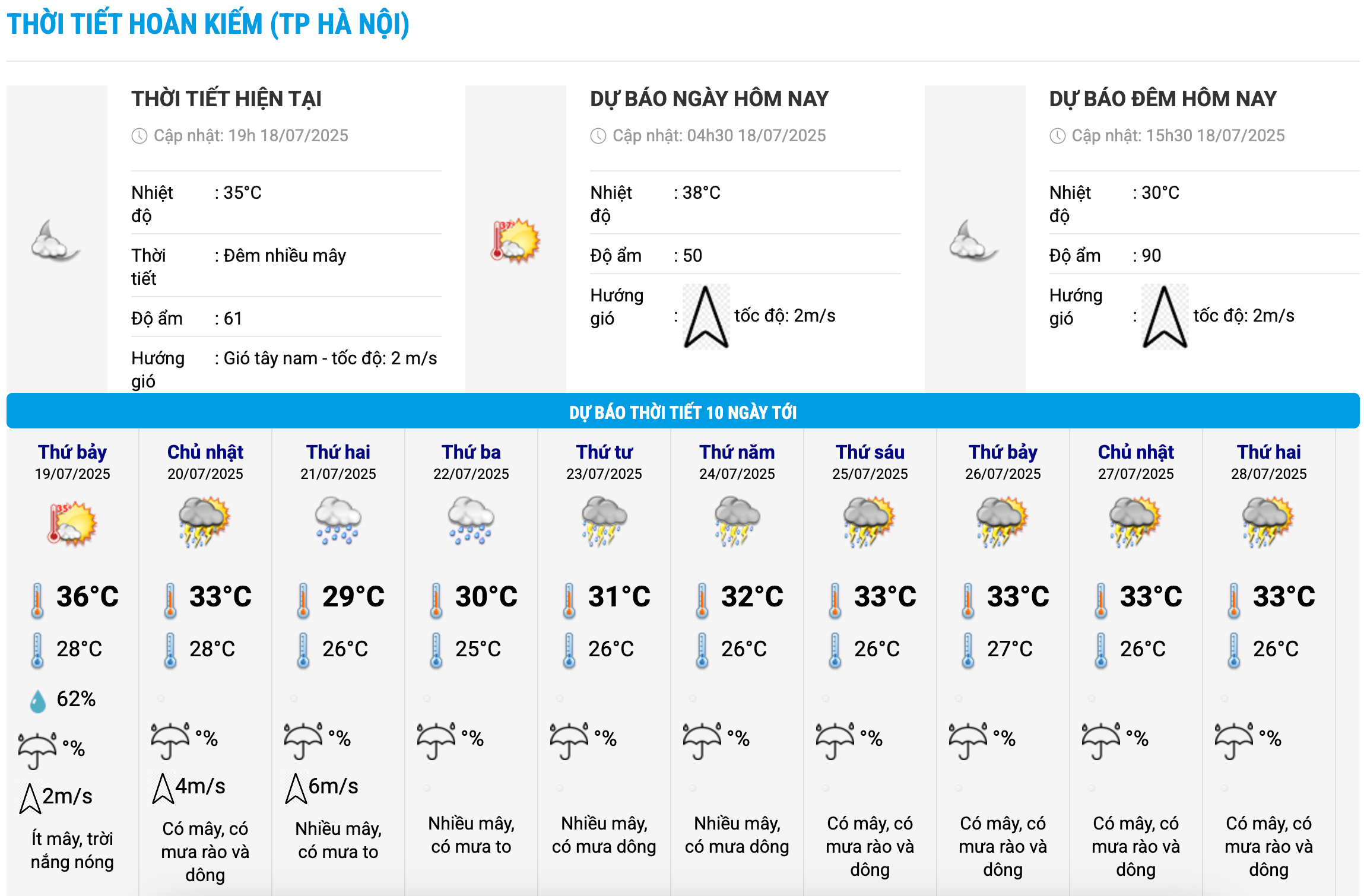
Weather forecast for July 19 in Hanoi is hot weather with the highest temperature commonly 35 - 36 degrees Celsius, some places above 36 degrees Celsius. On July 20, the hot weather tends to decrease, the temperature drops by about 2 - 4 degrees Celsius; the temperature ranges from about 28 - 33 degrees Celsius.
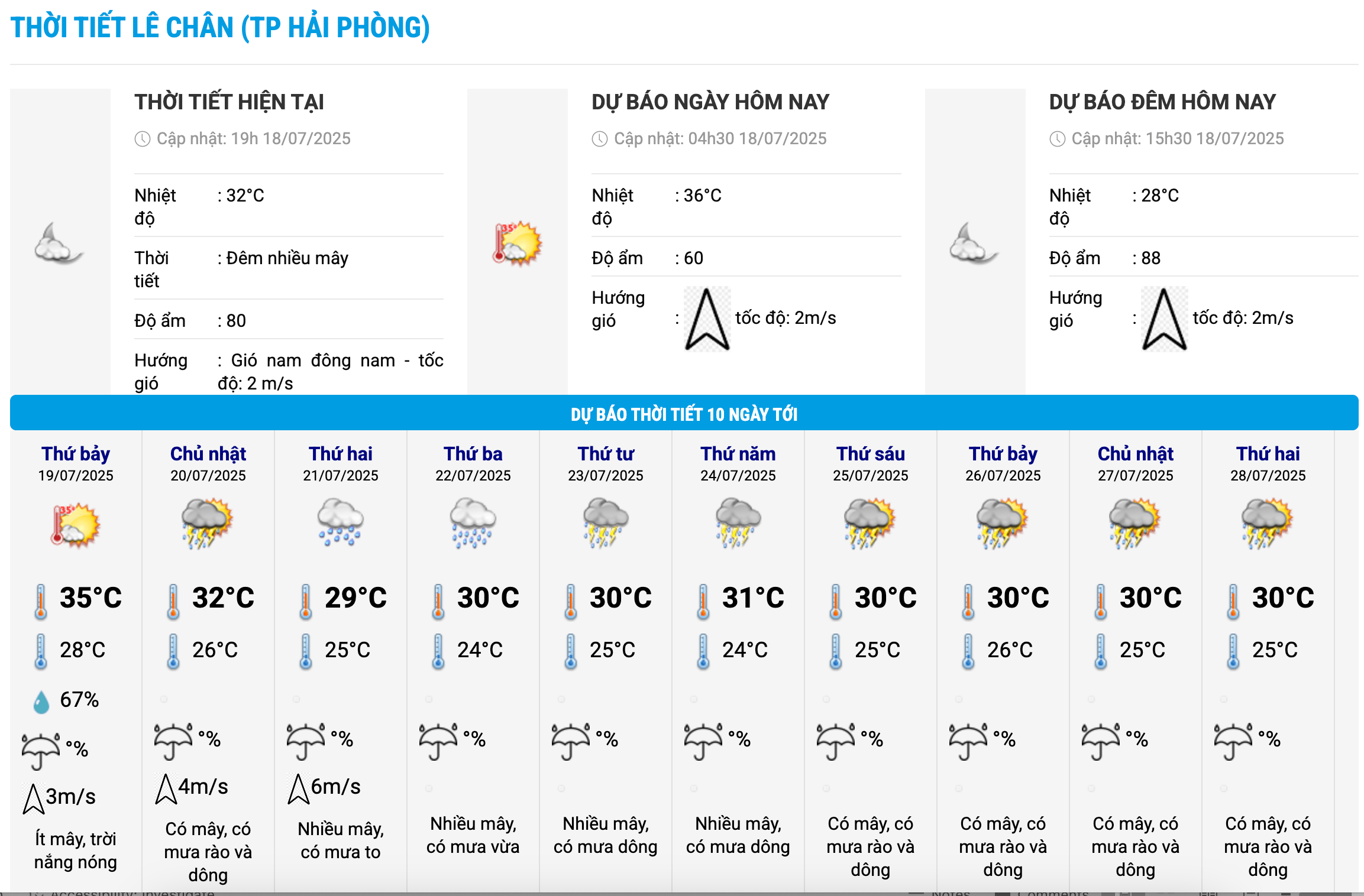
In Hai Phong and Quang Ninh on July 19, it will be sunny, with some places experiencing hot weather. From July 20, the temperature will gradually decrease.
The meteorological agency noted that on the afternoon of July 20, there is a possibility of local thunderstorms in the North, which may affect the operation of ships traveling in Cat Ba and Ha Long Bay areas.
At some tourist destinations in the northern mountainous region such as Lao Cai, Ha Giang, Son La... on July 19, there will be sunshine, some places will be hot, scattered showers and thunderstorms in the evening, some places will have heavy rain.
Regarding the forecast of rain due to the impact of storm Wipha, according to Mr. Mai Van Khiem, from the afternoon of July 20, the storm may affect thunderstorms in the western circulation of the storm. From July 21 to 24, the storm may cause widespread heavy rain in the North and North North Central regions.
"The affected area is forecast to be from Quang Ninh to Nghe An. The total rainfall is estimated at 200 - 350mm, with some places from 500 - 600mm. However, this is a preliminary assessment, the reliability is not high, it needs to be updated further" - Mr. Khiem said.
Thus, from July 21 to July 24, Hanoi and tourist destinations in the north are likely to experience a widespread heavy rain; coastal areas need to be especially wary of strong winds.
However, according to Mr. Khiem, the current forecasts of the storm's trajectory have significant differences between models. The models' forecast landfall points are about 100km apart (real impacts may vary widely). The intensity forecast is not consistent among the forecast centers.
If the storm shifts north, along the coast of Guangxi (China), the impact of rain and wind will decrease. Rainfall depends on the direction of storm No. 3, and will be specifically updated in the emergency storm bulletin on July 20.