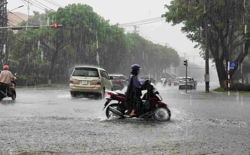
According to the National Center for Hydro-Meteorological Forecasting, in the past 24 hours (from 2:00 p.m. on October 29 to 2:00 p.m. on October 30), the provinces and cities from Quang Tri to Gia Lai have had heavy rain, some places have had very heavy rain. Rainfall measured at some monitoring stations such as: Ta Long 228.8mm (Quang Tri); Binh Dien 291mm (Hue city); Tra Nham 112.8mm (Quang Ngai); An Quang 149.4mm (Gia Lai);...
In the past 10 hours (from 4am to 2pm on October 30), Ha Tinh province has had heavy to very heavy rain, some places have had particularly heavy rain such as: Ho Thuong Tuy 296.2mm, Ky Phong 267mm (Ha Tinh);...
Soil moisture models show that some areas in the above provinces are nearly saturated (over 85%) or have reached a saturated state.
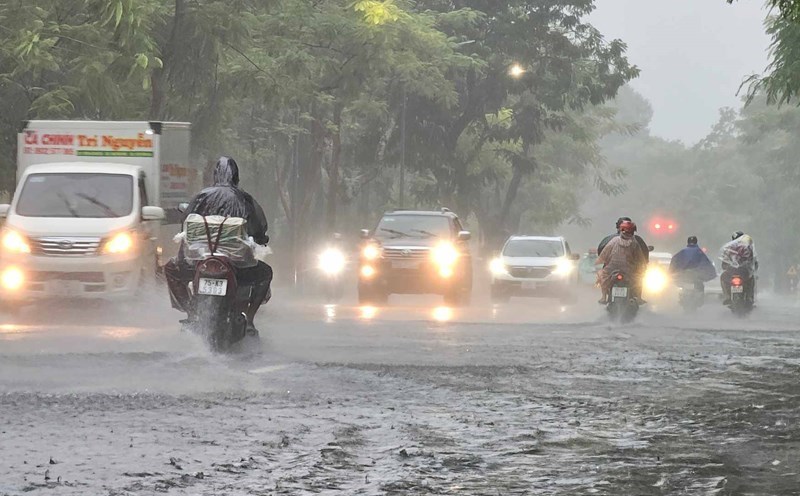
In the next 3 - 6 hours (from 2:30 p.m. on October 30), the above provinces and cities will continue to have rain, with common accumulated rainfall in the provinces from Ha Tinh to Da Nang city from 20 - 50mm, some places over 120mm; Quang Ngai and Gia Lai from 10 - 15mm, some places over 70mm.
In the next 6 hours (from 14:30 on October 30), there is a risk of flash floods on small rivers and streams, landslides on steep slopes in many communes and wards.
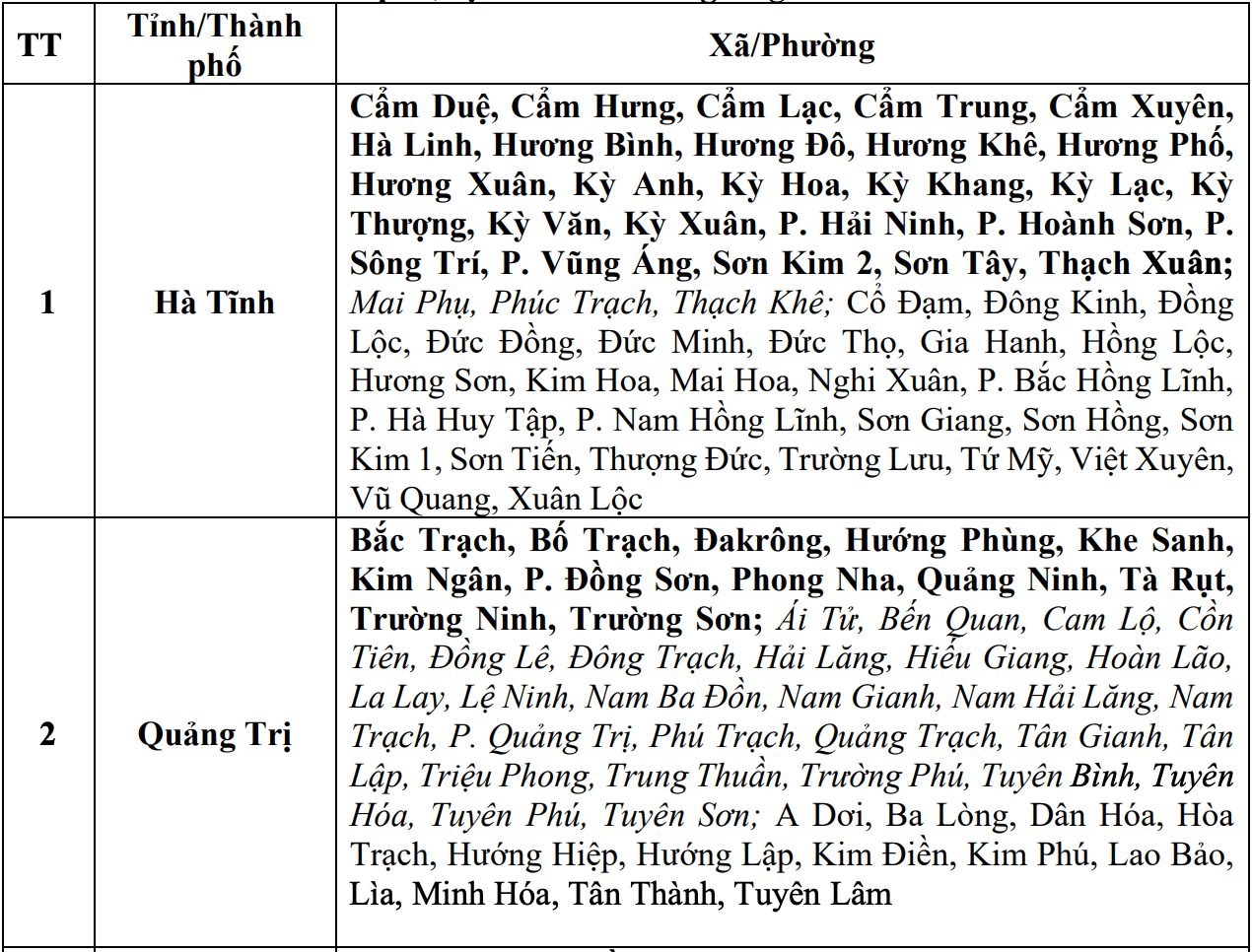
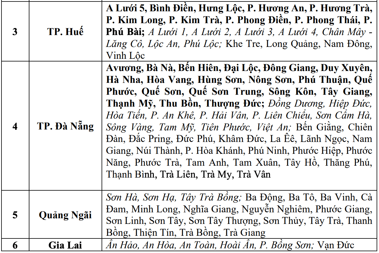
The warning level of natural disaster risk due to flash floods, landslides, and land subsidence due to heavy rain or water flow is level 1; only Hue and Da Nang are level 3.
Flash floods and landslides can have a very negative impact on the environment, threaten people's lives; cause local traffic congestion, affect the movement of vehicles; destroy civil and economic works, causing damage to production and socio-economic activities.
The meteorological agency recommends that local authorities pay attention to reviewing bottlenecks and vulnerable locations in the area to take timely preventive and response measures.