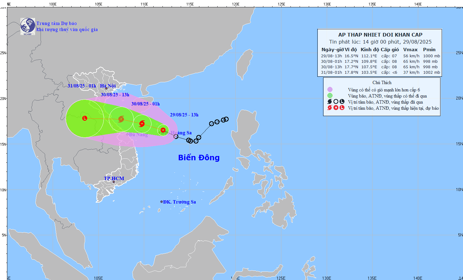
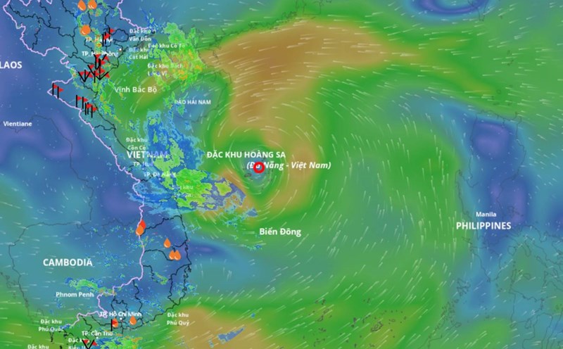
The tropical depression in the East Sea is forecast to strengthen into a storm and continue towards the area of storm No. 5 Kajiki that has just impacted. Mr. Hoang Phuc Lam - Deputy Director of the National Center for Hydro-Meteorological Forecasting has analyzed the developments of this tropical depression.
Sir, what is the forecast for the path and trajectory of the tropical depression?
- The tropical depression currently has an intensity of level 7; in the next 12 hours, it is likely to strengthen into a storm with an intensity of level 8. When approaching the coastal waters of the Central provinces, the storm will likely decrease to a tropical depression, so the coastal areas and mainland areas of our country may be affected by winds of level 5, level 6; later inland level 3 - 4.
The tropical depression is still moving at an average speed of about 15km/h; after strengthening into a storm, it will head towards the provinces from Nghe An to Hue.

So for localities from Nghe An to Hue, what is the biggest risk at present, sir - when this is also an area that has just been affected by storm No. 5?
- Rain due to the tropical depression circulation that may strengthen into a storm will deviate westward. From this evening and tonight (8.29), the coastal provinces of the North and from the coastal areas from Thanh Hoa to Hue may have increased rain.
The areas with the highest chance of rain are Nghe An-Quang Tri provinces. The peak rain period is the day and night of August 30 to August 31.

The total rainfall from this evening to August 31 in the midlands, Northern Delta and Da Nang city will have heavy rain, generally from 100 - 200mm, locally over 400mm.
The area from Thanh Hoa to Hue will have heavy to very heavy rain with common rainfall from 150 - 350mm, locally over 600mm.
This is an area where storm No. 5 has just passed, so the risk of landslides and flash floods in the upcoming rain will still be high.
At sea, what is the impact of the tropical depression, can you warn?
- The western sea area of the North East Sea (including Hoang Sa special zone) has strong winds of level 6-7, the area near the storm's eye has strong winds of level 8, gusts of level 10, waves 2 - 5m high, rough seas.
From the night of August 29, the sea area from Thanh Hoa to Da Nang (including Hon Ngu island and Con Co special area) will have strong thunderstorms; winds will gradually increase to level 6-7, near the storm's eye will be strong at level 8, gusting to level 10; waves 2 - 4m high near the storm's eye will be 3 - 5m high, the sea will be rough.
Sincerely thank you!


