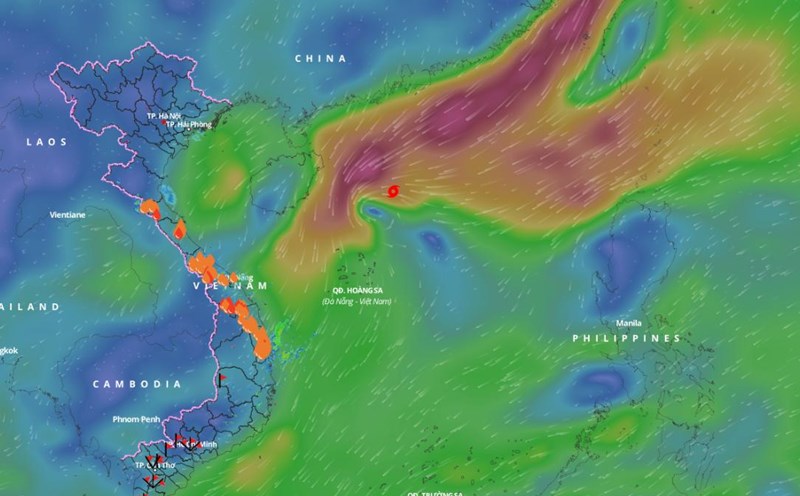
Updated from the National Center for Hydro-Meteorological Forecasting, at 4:00 p.m. on November 19, the center of storm No. 9 Man-yi was located at about 18.6 degrees north latitude; 112.7 degrees east longitude, in the North East Sea, about 220km north of Hoang Sa archipelago.
The strongest wind near the storm center is level 8 (62 - 74km/h), gusting to level 10. Moving west-southwest, speed about 20km/h.
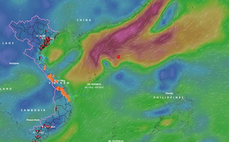
It is forecasted that in the next 12 hours, storm No. 9 Man-yi will move west-southwest at a speed of 15 - 20km/h, gradually weakening into a tropical depression. At 4:00 a.m. on November 20, the center of the tropical depression will be at about 17.8 degrees north latitude - 111 degrees east longitude; west of the North East Sea; about 180km northwest of Hoang Sa archipelago.
The strongest wind near the center of the tropical depression is level 6, gusting to level 8.
It is forecasted that in the next 24 hours, the tropical depression will move southwest at a speed of 10km/h, gradually weakening into a low pressure area. At 4:00 p.m. on November 20, the center of the low pressure area will be at about 17.2 degrees north latitude - 110 degrees east longitude; in the sea off the Central Central Coast.
Regarding the impact of the storm, the western sea area of the North East Sea (including the sea area north of Hoang Sa archipelago) has strong winds of level 6 - 7, the area near the storm's center has winds of level 8, gusts of level 10, waves 3 - 5m high; very rough seas.
Vessels operating in the above mentioned dangerous areas are susceptible to the effects of strong winds and large waves.