Hanoi forecast to continue to have heavy rain, some places over 80mm

AN AN |

According to the meteorological agency, it is forecasted that from July 24 to 26, Hanoi will have moderate rain, locally heavy rain and thunderstorms with rainfall in some places over 80mm.

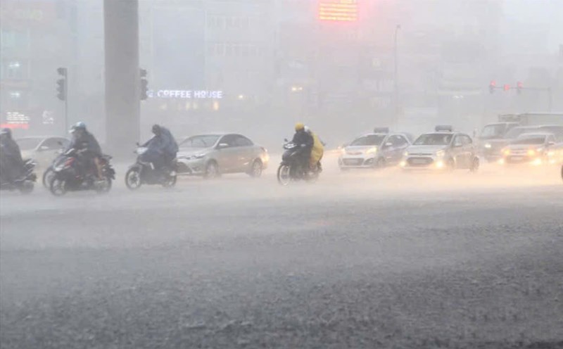
Currently, the inner city of Hanoi is experiencing moderate to very heavy rain.

In the next 3 - 6 hours (from 9:30 a.m. on July 24), the inner city of Hanoi and neighboring areas will continue to have heavy rain with common rainfall ranging from 20 - 40mm, some places over 50mm.

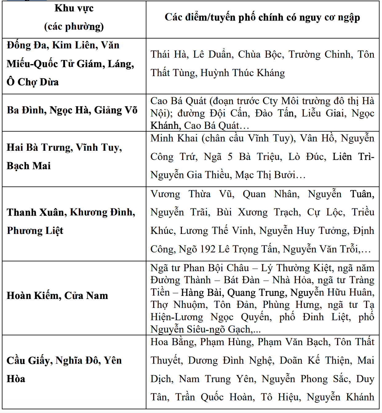
This rain is likely to cause flooding for many streets with common depths of 15 - 20cm; some locations are likely to be flooded deeper with a depth of 20 - 40cm.

Cap nhat canh bao hoi 9 gio 30 phut ngay 24.7 tu co quan khi tuong ve cac diem, tuyen pho co nguy co ngap o Ha Noi trong 3 den 6 gio toi. Nguon: Trung tam Du bao Khi tuong Thuy van Quoc gia
Updated warning at 9:30 a.m. on July 24 from the meteorological agency about points and streets at risk of flooding in Hanoi in the next 3 to 6 hours. Source: National Center for Hydro-Meteorological Forecasting

According to the Northern Hydrometeorological Station, regarding the rainfall in the past 24 hours, Hanoi has had rain, showers and thunderstorms in some places. Rainfall is generally below 10mm, some places are heavier such as: Huong Son 89.6mm; Bat Bat 39.4mm; Cau Ram 37.2mm...

It is forecasted that from today, July 24 to July 25, Hanoi will have rain, moderate rain, locally heavy rain and thunderstorms.

From the night of July 25 to July 26, this area will have scattered showers and thunderstorms. During thunderstorms, there is a possibility of tornadoes, lightning and strong gusts of wind. Rainfall is generally from 30 - 50mm, in some places over 80mm.

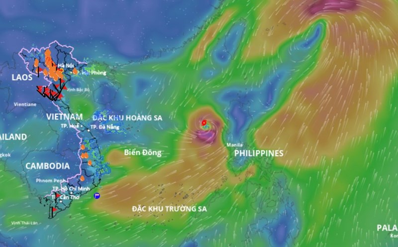
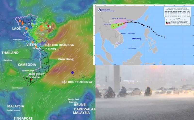
The cause of the rain in Hanoi in the next 2 days is believed to be the influence of the tropical convergence zone with an axis through the North.

The Northern Meteorological Agency forecasts that from July 26 to July 27, Hanoi will have rain in some places.

The warning level of natural disaster risk due to tornadoes, lightning, hail and strong gusts of wind is level 1. Thunderstorms may be accompanied by thunderstorms, tornadoes, lightning and strong gusts of wind that break trees, damage houses, traffic works and infrastructure.

Localized heavy rain can overload urban drainage systems, causing flooding in residential areas, traffic congestion due to flooding and reduced visibility when driving, causing slippery traffic and accidents.

AN AN
TIN LIÊN QUAN

Forecast of areas with heavy rain in the next 2 days, explaining the cause

|

According to the meteorological agency, from now until the night of July 25, the Northern region, Thanh Hoa and Nghe An are forecast to have moderate rain, heavy rain and thunderstorms, locally very heavy rain.

Storm No. 4 Comay is about to strengthen to level 12, forecast affected areas

|

According to the meteorological agency, due to the impact of storm No. 4 Comay, the eastern sea of the northern East Sea will have strong winds of level 7-8, very rough seas.

Changes in storm No. 3 Wipha when making landfall, why is it hot in some places

|

At noon on July 22, the center of storm No. 3 Wipha made landfall in Hung Yen - Ninh Binh provinces with strong winds of level 8, gusting to level 10 - slightly decreasing compared to the previous forecast.

sidewalks in Ho Chi Minh City continue to be encroached, pedestrians have to ask for directions

|

HCMC - Tourists and local people are constantly upset because sidewalks are everywhere occupied, forcing them to " beg for the road", posing a potential risk of traffic accidents.

Forecast of areas with heavy rain in the next 2 days, explaining the cause

AN AN |

According to the meteorological agency, from now until the night of July 25, the Northern region, Thanh Hoa and Nghe An are forecast to have moderate rain, heavy rain and thunderstorms, locally very heavy rain.

Storm No. 4 Comay is about to strengthen to level 12, forecast affected areas

AN AN |

According to the meteorological agency, due to the impact of storm No. 4 Comay, the eastern sea of the northern East Sea will have strong winds of level 7-8, very rough seas.

Changes in storm No. 3 Wipha when making landfall, why is it hot in some places

AN AN |

At noon on July 22, the center of storm No. 3 Wipha made landfall in Hung Yen - Ninh Binh provinces with strong winds of level 8, gusting to level 10 - slightly decreasing compared to the previous forecast.