
According to the National Center for Hydro-Meteorological Forecasting, in the past 24 hours, super typhoon Dolphin continued to move mainly in the West-Northwest direction, but the intensity has gradually decreased. By 7 am this morning (August 2), typhoon Dolphin's intensity decreased to level 15, gusting above level 17.
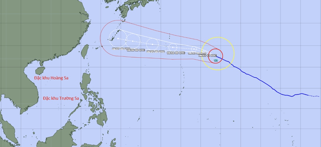
The position at 7 am this morning of the typhoon was at about 22.6 degrees north latitude - 153.7 degrees east longitude. Intensity level 15, gusts above level 17, about more than 2400km east-southeast of Okinawa (Japan).
Forecast in the next 1-2 days, Typhoon Dolphin will move mainly in the West-Northwest direction at a speed of about 25km/h. The intensity tends to gradually weaken, down to level 14-15. Around July 6-7, Typhoon Dolphin will directly affect the Okinawa area (Japan), then continue to move in the West-Northwest direction, towards the mainland of China.
It is predicted that from about August 5th when Typhoon Dolphin approaches the northern area of Taiwan (China), the southwest wind in the southern sea area of the East Sea will increase in intensity. From August 6th - 7th, the southwest wind intensity in most areas of the North, Central and South of the East Sea (including Hoang Sa and Truong Sa special zones) may strengthen to level 6-7, waves are 2 - 4m high, and the sea is very rough.
The National Center for Hydro-Meteorological Forecasting is still closely monitoring the diễn biến of super typhoon Dolphin.


