According to the National Center for Hydro-Meteorological Forecasting, last night and this morning (July 11), the Northern region and Thanh Hoa had moderate rain, heavy rain and thunderstorms, locally very heavy rain.
Rainfall from 7pm on July 10 to 8am on July 11 at some monitoring stations was over 70mm such as: Dao San station (Lai Chau) 150mm, Dong Cuu station (Phu Tho) 88.6mm, Tinh Gia station (Thanh Hoa) 70.6mm,...
In the Northern region, Thanh Hoa from the morning of July 11 to the night of July 12, there is a forecast of moderate rain, heavy rain and thunderstorms, locally very heavy rain with common rainfall of 40 - 110mm, locally over 180mm.
The meteorological agency warns that there is a risk of heavy rain with rainfall greater than 100mm within 3 hours.
From July 13, heavy rain in the North and Thanh Hoa is likely to gradually decrease.
Nghe An and Ha Tinh areas on the day and night of July 11 are forecast to have scattered showers and thunderstorms, locally heavy rain with rainfall in some places over 60mm.
During thunderstorms, there is a possibility of tornadoes, lightning, hail and strong gusts of wind. The National Center for Hydro-Meteorological Forecasting warns that the risk of natural disasters due to heavy rain, tornadoes, lightning, and hail is level 1.
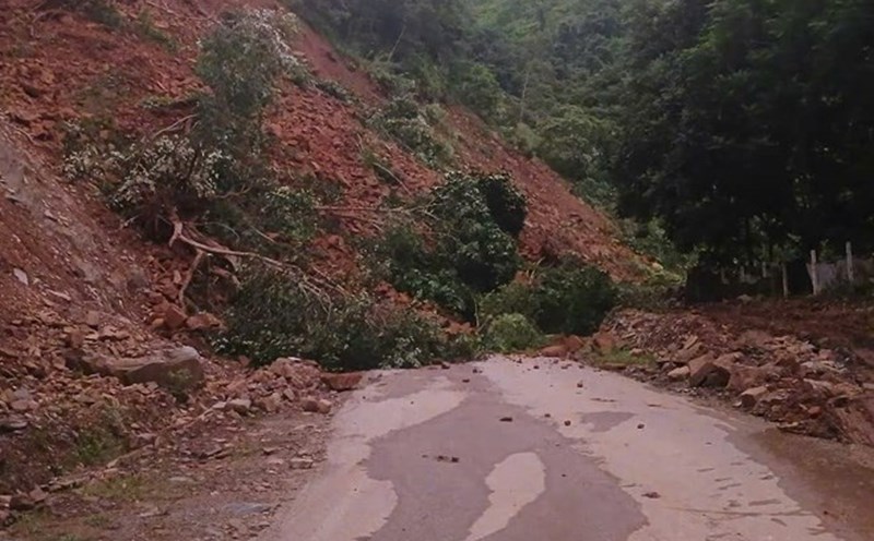
Heavy rain is likely to cause flooding in low-lying areas, urban and industrial areas; flash floods on small rivers and streams, landslides on steep slopes.
Real-time warning information for areas at risk of flash floods and landslides is provided online on the website of the Department of Hydrometeorology at: https://luquetsatlo.nchmf.gov.vn and in a separate bulletin warning of flash floods and landslides.
Regarding the hydrological situation, currently, the upstream water level of the main rivers in the Red - Thai Binh system fluctuates, the downstream water level changes slowly and is below alert level 1.
From tonight (July 11) to July 13, in the upstream of Thao, Lo, Cau, Thuong rivers and small rivers in the Northern region, there is a possibility of a flood with a flood amplitude of 2 - 4m.
During this flood, the peak water level on small rivers, upstream of Thao, Lo, Cau and Thuong rivers is likely to reach alert level 1 to above alert level 1, downstream of rivers in the Red - Thai Binh system is below alert level 1.
The meteorological agency warns that there is a high risk of flooding in low-lying areas along rivers, flash floods and landslides on steep slopes in the mountainous areas of the North. The warning level of natural disaster risk due to floods is level 1.
Floods on rivers and streams can cause flooding in low-lying areas along rivers, affecting activities such as waterway transportation, aquaculture, agricultural production, people's livelihood and socio-economic activities.