The National Center for Hydro-Meteorological Forecasting has issued a weather trend forecast for the next month (from now until August 10).
Regarding temperature trends, the average temperature in most areas across the country is approximately the same as the average of many years, especially in the provinces from Da Nang to Lam Dong and the South, it is 0.5 - 1 degree Celsius higher than the average of many years in the same period.
Hot weather continues to occur in the Northern regions, from Thanh Hoa to Hue and the South Central Coast.
Total rainfall in the Northern regions, Thanh Hoa - Hue is generally 20 - 40% higher than the average of many years in the same period; the remaining areas are generally approximately the same as the average of many years.
In the next month, the Northern region and the northern provinces from Thanh Hoa to Hue are likely to experience some widespread heavy rains. In the Central and Southern highlands, thunderstorms will continue for many days; some days may have moderate to heavy rain, mainly concentrated in the late afternoon.
On a national scale, there is a continued possibility of dangerous weather phenomena such as thunderstorms, tornadoes, lightning, hail and strong gusts of wind.
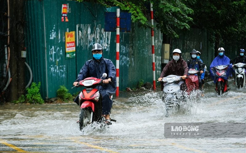
The phenomenon of heavy rain and thunderstorms, whirlwinds, and lightning can negatively affect production activities and public health. In particular, beware of localized heavy rains that can cause floods, inundation in low-lying areas and landslides in mountainous areas.
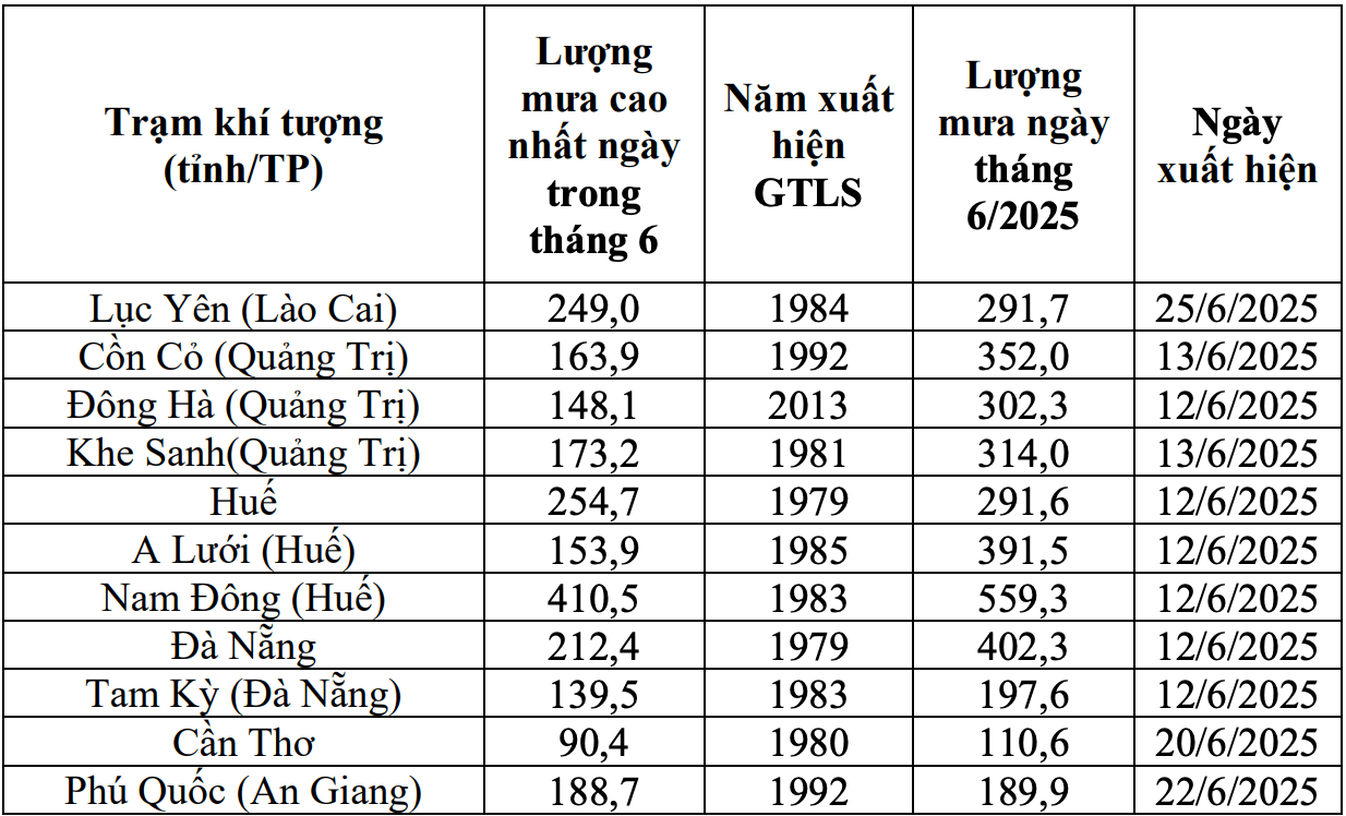
Previously, from June 11 to July 10, the Northern region had 23/30 days of widespread rain, including some days of widespread heavy rain such as June 21 - 22 and July 1.
Thanh Hoa to Da Nang and the coastal areas of Quang Ngai to Gia Lai provinces will have 3 widespread rains on the following days: from June 11 to 14, from June 27 to 29 and from July 1 to 4.
The Central and Southern highlands will experience many days of showers and thunderstorms, including days of moderate to heavy rain. Some stations recorded the highest rainfall of the day exceeding the historical value.
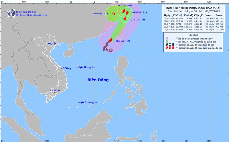
Regarding dangerous phenomena at sea, during the forecast period, the East Sea area is likely to have an equivalent number of storms or tropical depressions compared to the average of many years and may affect our mainland. According to the average data of many years in the above period, in the East Sea, 1.9 storms or tropical depressions in the East Sea made landfall, 0.9 of which made landfall.
Storms, tropical depressions and the southwest monsoon are likely to cause strong winds, large waves at sea and affect the activities of ships.
Previously, from June 11 to July 11, there were 2 storms and 1 tropical depression in the East Sea.