According to the National Center for Hydro-Meteorological Forecasting, last night and today (July 11), the Northern region and Thanh Hoa had moderate rain, heavy rain and thunderstorms, locally very heavy rain.
Rainfall from 7pm on July 10 to 3pm on July 11 at some monitoring stations was over 100mm such as: Dao San station (Lai Chau) 151mm, Nam Ty station (Son La) 126.1mm, Dong Cuu station (Phu Tho) 119.6mm,...
The Northeast region, the West of Phu Tho, Thanh Hoa and Nghe An regions from the evening of July 11 to July 12 are forecast to have moderate rain, heavy rain and thunderstorms, locally very heavy rain. The common rainfall is 30 - 60mm, locally over 120mm. Heavy rain is forecast to be concentrated at night and in the morning.
The meteorological agency warns of the risk of heavy rain with rainfall greater than 100mm within 3 hours.
From the night of July 12, heavy rain in the North, Thanh Hoa and Nghe An is likely to gradually decrease.
Other places in the North, Ha Tinh and the North of Quang Tri from the evening of July 11 to July 12 are forecast to have showers and scattered thunderstorms, locally heavy rain with rainfall in some places over 60mm.
During thunderstorms, there is a possibility of tornadoes, lightning, hail and strong gusts of wind. The National Center for Hydro-Meteorological Forecasting warns that the risk of natural disasters due to heavy rain, tornadoes, lightning, and hail is level 1.
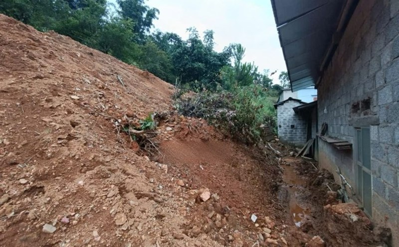
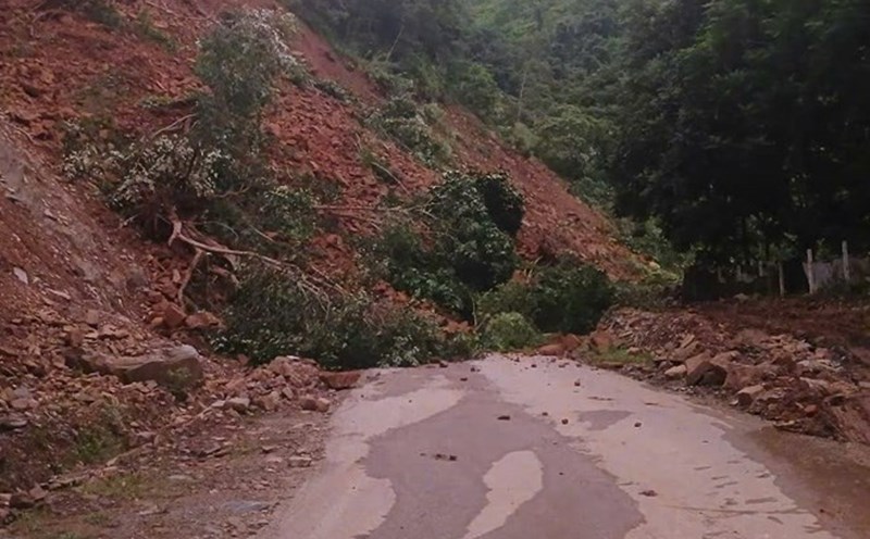
Heavy rain is likely to cause flooding in low-lying areas, urban and industrial areas; flash floods on small rivers and streams, landslides on steep slopes.
Real-time warning information for areas at risk of flash floods and landslides is provided online on the website of the Department of Hydrometeorology at: https://luquetsatlo.nchmf.gov.vn and in a separate bulletin warning of flash floods and landslides.
Regarding the sea weather, currently, the Gulf of Tonkin, the sea area north of the North East Sea, the sea area south of the South East Sea, the sea area from Ca Mau to An Giang and the Gulf of Thailand are having showers and thunderstorms; Phu Quy special area has strong winds of level 5, sometimes level 6.
Forecast for the night of July 11 and July 12, Gulf of Tonkin, the sea area north of the North East Sea, the sea area east of the central East Sea, the South East Sea (including Truong Sa special zone), the sea area from Ca Mau to An Giang and the Gulf of Thailand will have scattered showers and thunderstorms. During thunderstorms, there is a possibility of tornadoes and strong gusts of wind.
In addition, on the night of July 11 and July 12, the sea area from Khanh Hoa to Ho Chi Minh City, the central East Sea area will have strong southwest winds of level 5, sometimes level 6, gusting to level 7 - 8, waves from 2 - 4m high, rough seas. All ships operating in the above areas are at risk of being affected by tornadoes and strong gusts of wind.