The National Center for Hydro-Meteorological Forecasting has issued a forecast of notable weather trends in October.
1 - 2 impacts on the mainland of Vietnam
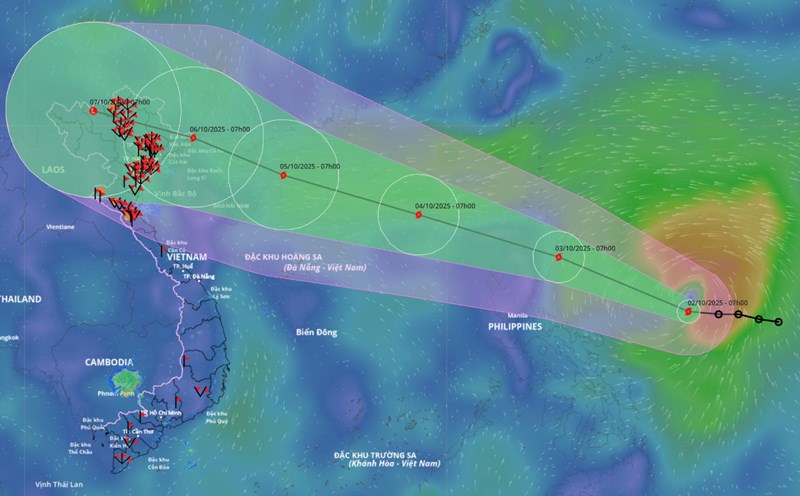
In October, the most notable weather pattern is still storms/tropical depressions.
According to Ms. Tran Thi Chuc - Deputy Head of Climate Forecasting Department, National Center for Hydro-Meteorological Forecasting, according to the average data of many years in the above period, there were 2 storms or tropical depressions in the East Sea, 0.8 of which made landfall in Vietnam.
It is forecasted that in October this year, there will be 2 - 3 storms or tropical depressions in the East Sea and 1 - 2 storms are likely to affect the mainland of Vietnam.
Previously, in September 2025, there were 4 storms in the East Sea, including storm No. 7 Tapah, storm No. 8 Mitag, storm No. 9 Ragasa and storm No. 10 Bualoi. Of which, storm No. 7 and storm No. 8 do not directly affect Vietnam.
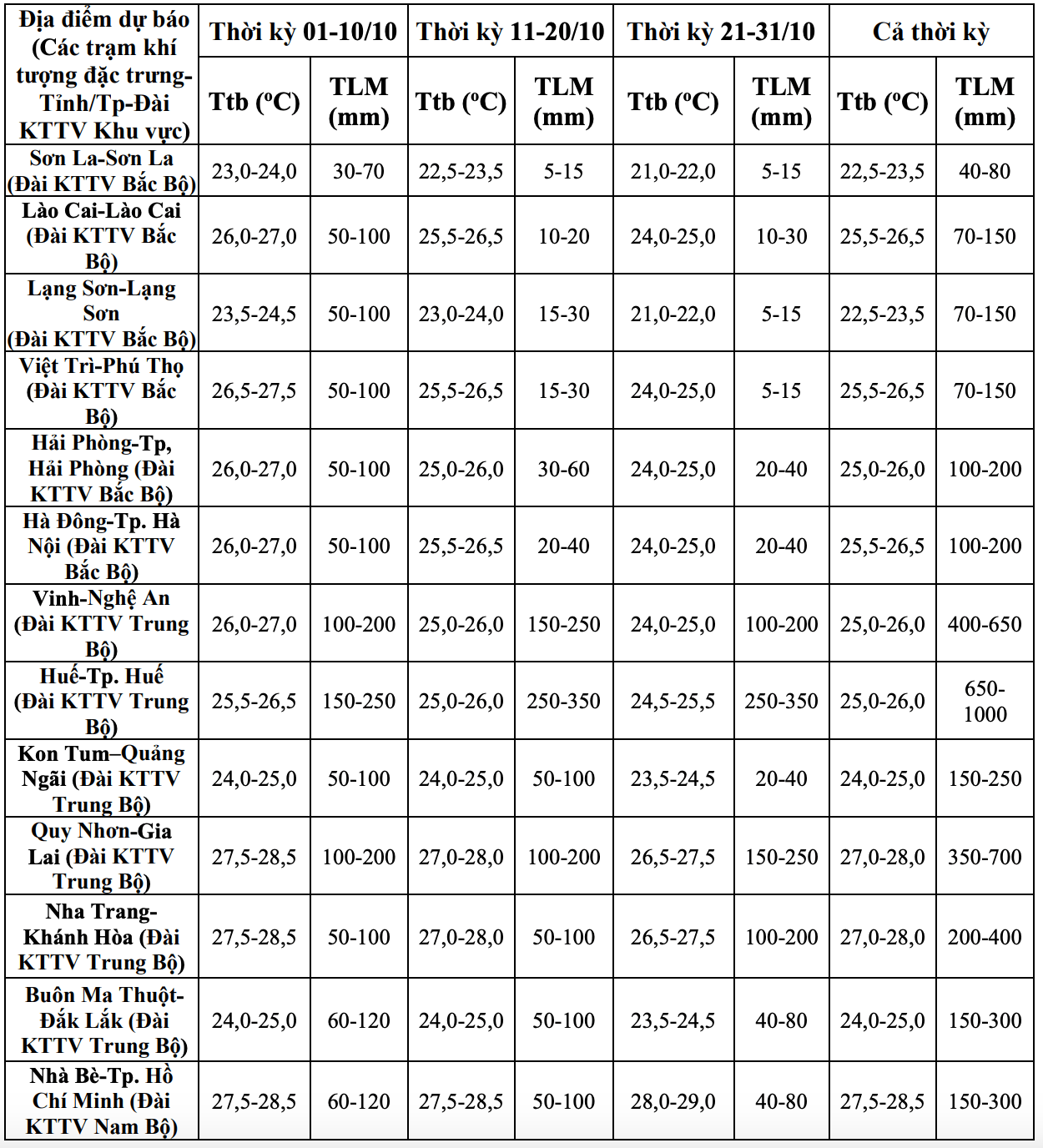
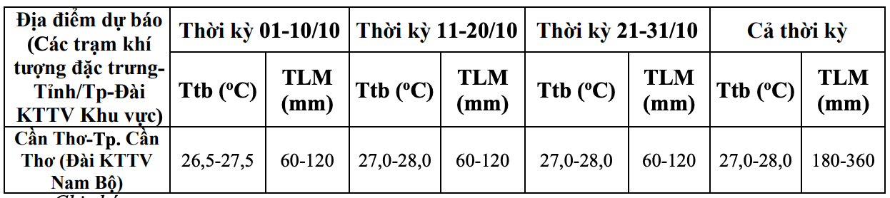
Data analyzed by the meteorological agency also shows that in October, total rainfall in common areas was approximately the same as the average of many years, especially in the provinces from Quang Tri to Quang Ngai, the total rainfall was generally 10 - 30% higher than the average of many years in the same period.
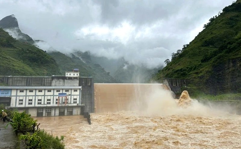
In October, there is a possibility of widespread heavy rain, concentrated in the early stages in the Northern region and Thanh Hoa. The provinces from Nghe An to northern Khanh Hoa are likely to experience some widespread heavy rains. Other areas will have many days of showers and thunderstorms; some days may have moderate to heavy rain.
On a national scale, there is a continued possibility of dangerous weather phenomena such as thunderstorms, whirlwinds, lightning, hail and strong gusts of wind.
Cold air gradually strengthens from mid-October
Regarding temperature trends, during the forecast period, the average temperature nationwide is generally about 0.5 - 1 degree Celsius higher than the average of many years in the same period.
Ms. Tran Thi Chuc added that the cold air is likely to gradually become stronger from mid-October 2025.

According to Dr. Truong Ba Kien, Deputy Director of the Center for Meteorological and Climate Research - Institute of Meteorology, Hydrology and Climate Change, currently, atmospheric and ocean conditions reflect ENSO being in a neutral state, leaning towards the cold phase. ENSO is forecast to transition to La Nina state in 3 months from October to December 2025 with a probability of about 60 - 70%.
The end of the summer monsoon is likely to be close to the average of many years, i.e. around the beginning to mid-October. The winter monsoon is likely to start at approximately the average of many years (ie at the end of October) and increase in intensity from November.