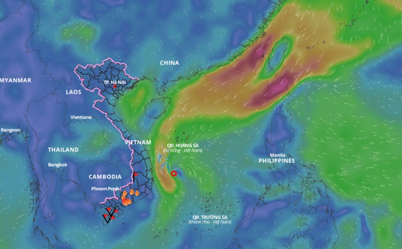
Latest update from the National Center for Hydro-Meteorological Forecasting, at 1:00 p.m. on February 13, the center of the tropical depression was located at about 13.4 degrees north latitude; 111.3 degrees east longitude, in the sea west of the central East Sea. The strongest wind near the center of the tropical depression is level 6 (39 - 49 km/h), gusting to level 8; moving northwest, speed 5 - 10 km/h.
In the next 24 hours, the tropical depression is forecast to move northwest at a speed of about 5 km/h. At 1:00 p.m. on February 14, the center of the depression will be at about 14.1 degrees north latitude - 110.8 degrees east longitude; in the offshore waters from Quang Ngai to Phu Yen. The strongest wind near the center of the depression will decrease to below level 6.
Regarding the impact of the low pressure area, the western sea area of the area between the East Sea and the southwestern sea area of the North East Sea area (including the Hoang Sa archipelago); the offshore sea area from Quang Ngai to Khanh Hoa has strong winds of level 6, gusts of level 8, rough seas.
The western sea area between the East Sea and the southwestern sea area of the North East Sea (including the Hoang Sa archipelago) has waves 2 - 3.5m high. From February 14, the offshore sea area from Hue to Binh Dinh has waves 2 - 3m high.
Ships operating in the above mentioned dangerous areas are likely to be affected by storms, whirlwinds, strong winds and large waves.