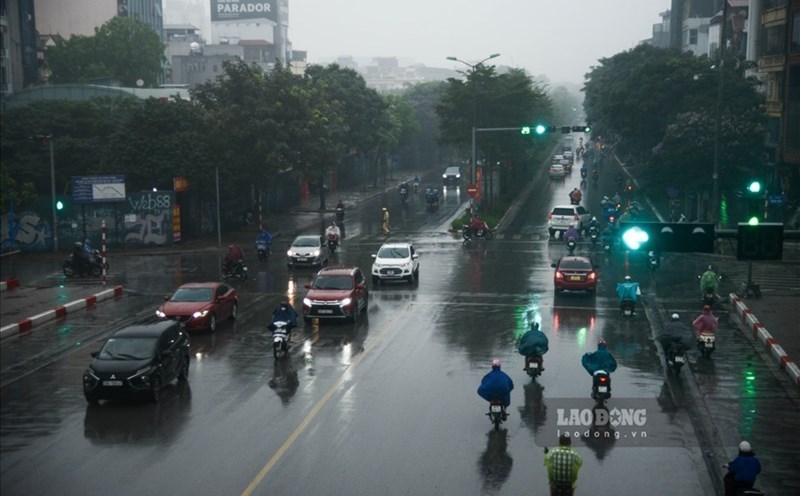
As of 6:30 a.m. on October 7, the Hanoi area has had moderate rain, heavy rain and thunderstorms, with some places experiencing very heavy rain. The rainfall in the past 6 hours was generally from 50 - 100mm, with some monitoring stations measuring higher rainfall such as Soc Son station 157.2mm, Me Tri station 100.2mm,...
It is forecasted that in the next 3 - 6 hours, Hanoi will continue to have moderate rain, heavy rain and thunderstorms, with common rainfall of 50 - 100mm, locally very heavy rain over 150mm. From the evening and night of October 7, the rain in Hanoi is forecast to decrease.
Throughout today, October 7, Hanoi is forecast to have heavy to very heavy rain and thunderstorms with common rainfall of 60 - 120mm, locally over 250mm.
In addition to Hanoi, Thai Nguyen and Bac Ninh are forecast to have heavy to very heavy rain and thunderstorms with common rainfall of 60 - 120mm, locally over 250mm.
The mountainous and midland areas of the North during the day and night of October 7 are forecast to have heavy rain and thunderstorms with common rainfall of 40 - 100mm, locally very heavy rain over 200mm.
The Northern Delta and Thanh Hoa will have moderate rain, heavy rain and thunderstorms with common rainfall of 30 - 60mm, locally very heavy rain over 150mm.
The meteorological agency warns of the risk of heavy rain over 150mm in 3 hours.
The meteorological agency forecasts that from October 8, heavy rain in the North and Thanh Hoa will decrease.
Regarding the hydrological situation, currently, floods on the Cau River, the Thuong River (Thai Nguyen, Bac Ninh) and other rivers in Cao Bang and Lang Son provinces are rising rapidly; other rivers in the Northern region are rising.
The water level at 6:00 a.m. on October 7 on the Cau River at Gia Bay Station (Thai Nguyen) was 26.74 m, above alert level 2 by 0.74 m; at Dap Cau Station (Bac Ninh) was 4.42 m, above alert level 1 by 0.12 m; on the Thuong River (Bac Ninh) at Phu Lang Thuong Station by 4.86 m, above alert level 1 by 0.56 m; on the Luc Nam River (Bac Ninh) at Luc Nam Station by 4.46 m, above alert level 1 by 0.16 m.
From now (October 7) to October 10, floods on the Cau River, Thuong River, Luc Nam River and rivers in Cao Bang, Lang Son Province and other rivers in the Northern region will continue to rise.
During this flood, the flood peak on Cau River, Thuong River, and Luc Nam River exceeded alert level 3 (there is a possibility of particularly large floods on these rivers); the flood peak on rivers in Lang Son, Cao Bang, and Quang Ninh provinces reached alert level 2 - alert level 3 and above alert level 3.
The flood peak on Thao River (Lao Cai), Lo River (Tuyen Quang) will rise to alert level 1 - alert level 2 and above alert level 2; the flood peak will reach Hoa Binh Lake, Hoang Long River (Ninh Binh), the downstream of the Red River in Hanoi will rise above alert level 1.
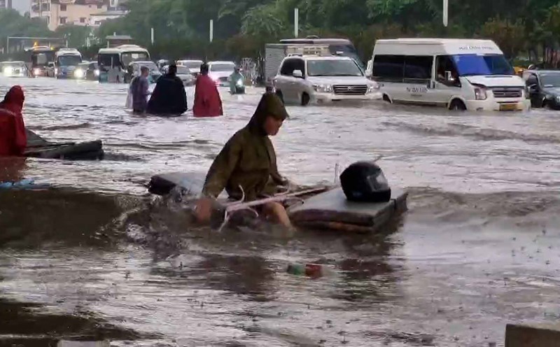
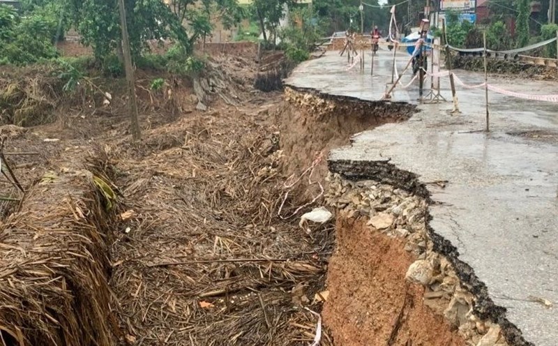
There is a high risk of flooding in low-lying areas along rivers, urban areas in the Northern region; there is a risk of flash floods and landslides on steep slopes in the Northern mountainous areas.
Real-time warning information for areas at risk of flash floods and landslides is provided online on the website of the Department of Hydrometeorology at: https://luquetsatlo.nchmf.gov.vn and in a separate bulletin warning of flash floods and landslides.
The warning level of natural disaster risk due to floods is level 3. Floods on rivers cause flooding in low-lying areas along rivers, affecting activities such as waterway transportation, aquaculture, agricultural production, people's lives and socio-economic activities.
List of points at risk of flooding in Hanoi:
- Tran Vu, Cao Ba Quat, Lieu Giai streets, Doi Can, Ngoc Khanh, Dao Tan, Phung Hung, Bat Dan, Duong Thanh streets, Trang Tien - Hang Bai, Nguyen Huu Huan, Tong Dan, Dinh Liet, Ta Hien - Luong Ngoc Quyen intersections;
Nguyen Sieu - gateway, Phan Boi Chau - Ly Thuong Kiet intersection, Quang Trung, Tho Nhuom, Van Ho, Nguyen Cong Tru, Ba Trieu, Lo Duc, Lien Tri intersection - Nguyen Gia Thieu, Minh Khai, Mac Thi Buoi, Thanh Dam, Thai Ha, Lang Ha, Huynh Thuc Khang, Nguyen Khuyen, Le Duan, Truong Chinh, Ton That Tung, Chua Boc;
Hoa Bang, Cau Giay, Xuan Thuy, Phan Van Truong, Pham Hung, Pham Van Bach, Ton That Thuyet, Duy Tan, Tran Quoc Hoan, Yen Hoa, Nguyen Khang, Duong Dinh Nghe, Le Van Luong, Nam Trung Yen;
To Hieu, Nguyen Phong Sac, Nguyen Khanh Toan, Trich Sai, Au Co, Thuy Khue, Vo Chi Cong, Phu Xa, Xuan Dinh, Pham Van Dong, Tan Xuan, Doan Ke Thien, Mai Dich, Ga Nhon, Tran Binh,
The underpass for people passing through Thang Long, Quan Nhan, Nguyen Tuan, Nguyen Trai, Le Van Luong, To Huu, Cu Loc, Luong The Vinh, Nguyen Huy Tuong, Vuong Thua Vu, Bui Xuong Trach, Trieu Khuc, Giai Phong, Tan Mai, Nguyen Chinh, Linh Nam, Dinh Cong, Nguyen Xien, Linh Dam, Le Trong Tan, Van Phuc,
Nguyen Van Troi, Mo Lao, Phan Dinh Giot, Ngo Thi Nham, To Huu, Chien Thang, Van Phu Urban Area, To Hieu, Yen Nghia, Hoa Lam, Cau Chui ground, Ngoc Lam, Hoang Nhu Tiep, Dam Quang Trung, Co Linh...