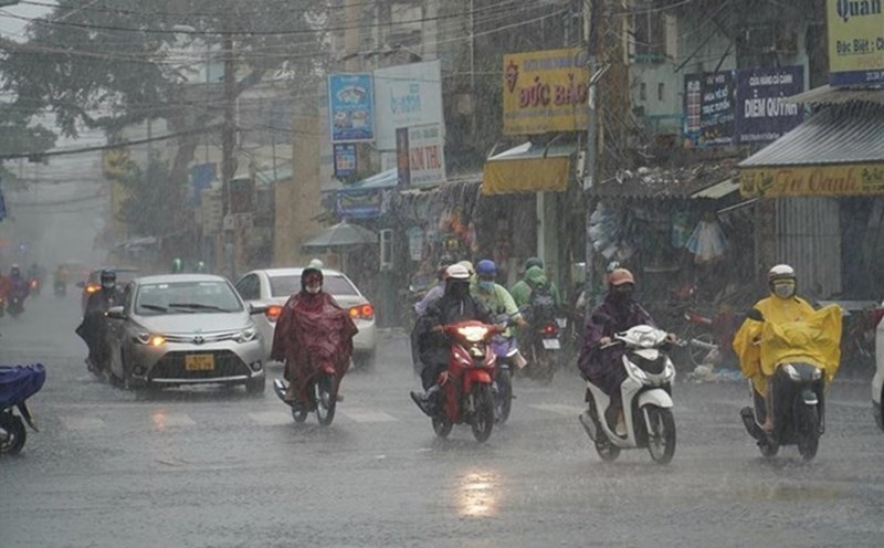
According to the Northern Hydrometeorological Station, in the past 24 hours, Hanoi has been cloudy with rain in some places, with north to northwest winds of level 2. The temperature at 1:00 p.m. on October 25 in Hanoi ranged from 23.6 - 26 degrees Celsius.
Currently, a cold air mass is moving south from the north.
The Hanoi area was affected by a cold air mass from early morning on October 26. Hanoi has rain in some places; northeast wind level 2 - 3. The lowest temperature is generally 19 - 21 degrees Celsius. The night and morning are cold, some places are cold. During the day, it will be sunny with the highest temperature around 24 - 26 degrees Celsius.
The National Center for Hydro-Meteorological Forecasting said that around early morning on October 26, the cold air mass will also affect the Northeast region, then affect the North Central region and some places in the Northwest and Central Central regions. The northeast wind inland is strong at level 2 - 3, coastal areas at level 3 - 4.
The North, Thanh Hoa and Nghe An will continue to have cold nights and mornings, and the mountainous areas will be cold. The lowest temperature in this cold air mass in the Northern region, Thanh Hoa and Nghe An is generally from 19 - 22 degrees Celsius, in mountainous areas it is below 17 degrees Celsius.
The area from South Quang Tri to Da Nang and the East of the provinces from Quang Ngai to Dak Lak will have moderate rain, heavy rain and thunderstorms, locally very heavy rain due to the influence of the strengthening cold air combined with disturbances in the high-altitude East wind zone.
Thunderstorms accompanied by tornadoes, lightning, hail and strong gusts of wind can affect agricultural production, break trees, damage houses, traffic works and infrastructure.
Heavy rain is likely to cause flooding in low-lying areas; flash floods on small rivers and streams, landslides on steep slopes; heavy rain in a short period of time causing flooding in urban areas and industrial parks.
At sea from early morning on October 26, in the Gulf of Tonkin, the Northeast wind will gradually increase to level 6, gusting to level 7 - 8, rough seas, waves 1.5 - 3 m high; the sea area north of the North East Sea will have strong northeast winds of level 6, sometimes level 7, gusting to level 8 - 9, rough seas, waves 3 - 5 m high; the sea area from South Quang Tri to Da Nang City will have northeast winds of level 5, sometimes level 6, gusting to level 7 - 8, rough seas, waves 2 - 4 m high.
Strong winds and gusts, large waves at sea are likely to affect the operation of ships and other activities. The cold weather at night and in the morning can affect health.