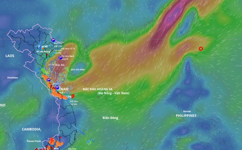
According to the National Center for Hydro-Meteorological Forecasting, the tropical depression has weakened into a low pressure area in the sea east of the North East Sea. At 1:00 a.m. on October 24, the center of the low pressure area was at about 17.4 degrees north latitude; 117.5 degrees east longitude. The strongest wind in the center of the low pressure area drops below level 6 (under 39km/h).
It is forecasted that in the next 12 hours, the low pressure area will continue to move mainly southwest, weakening and gradually dissipating.
However, due to the influence of the weakening of the low pressure circulation from the tropical depression combined with the strengthening of cold air, the situation of strong winds at sea will continue to be complicated.
Bach Long Vi station has strong northeast winds of level 6-7, gusting to level 9; Con Co station has strong winds of level 6, gusting to level 8.
Day and night on October 24, the North East Sea area (including Hoang Sa special zone) has strong northeast winds of level 6-7, gusting to level 8-9, rough seas, waves 3-5 m high.
The sea area from South Quang Tri to Quang Ngai will have strong northeast winds of level 6, gusting to level 8, rough seas, waves of 2.5-4.5 m high.
The Gulf of Tonkin has strong northeast winds of level 5, sometimes level 6, gusting to level 7-8, rough seas, waves 2-3.5 m high.
The sea area from South Quang Tri to Ca Mau, from Ca Mau to An Giang, the Gulf of Thailand, the North and Central East Sea (including Hoang Sa special zone) and the South East Sea (including Truong Sa special zone) on the day and night of October 24 is forecast to have scattered showers and thunderstorms; thunderstorms are likely to cause tornadoes, strong gusts of wind of level 6-7 and waves over 2 m high.
Day and night on October 25, the sea area north of the North East Sea will have strong northeast winds of level 6, sometimes level 7, gusting to level 8-9, rough seas, waves 3.0-5.0 m high.
The sea area from South Quang Tri to Quang Ngai has strong northeast winds of level 6, gusting to level 7-8, rough seas, waves 2.5-4.5 m high. The Gulf of Tonkin has strong northeast winds of level 5 during the day, sometimes level 6; gradually increasing to level 6 at night, gusting to level 7-8, rough seas, waves 2-4 m high.
The warning level of natural disaster risk at sea is level 2. All ships operating in the above areas are at high risk of being affected by strong winds and large waves.