
Hanoi City on the 13th. 9 sunny days with the highest temperature around 30 - 33 degrees C.
The Northern Hydrometeorological Station said that Hanoi weather is about to turn rainy due to the influence of the intertropical convergence zone connected to the tropical depression, which is likely to weaken into a low pressure area with a tendency to gradually raise its axis to the North combined with the southwest edge of the weakened continental high pressure.
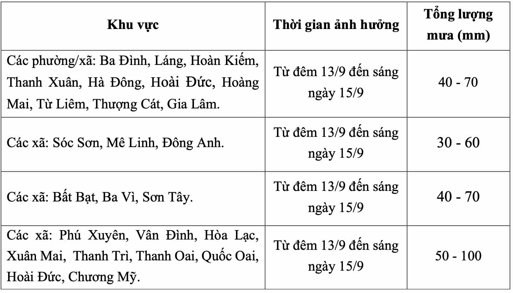
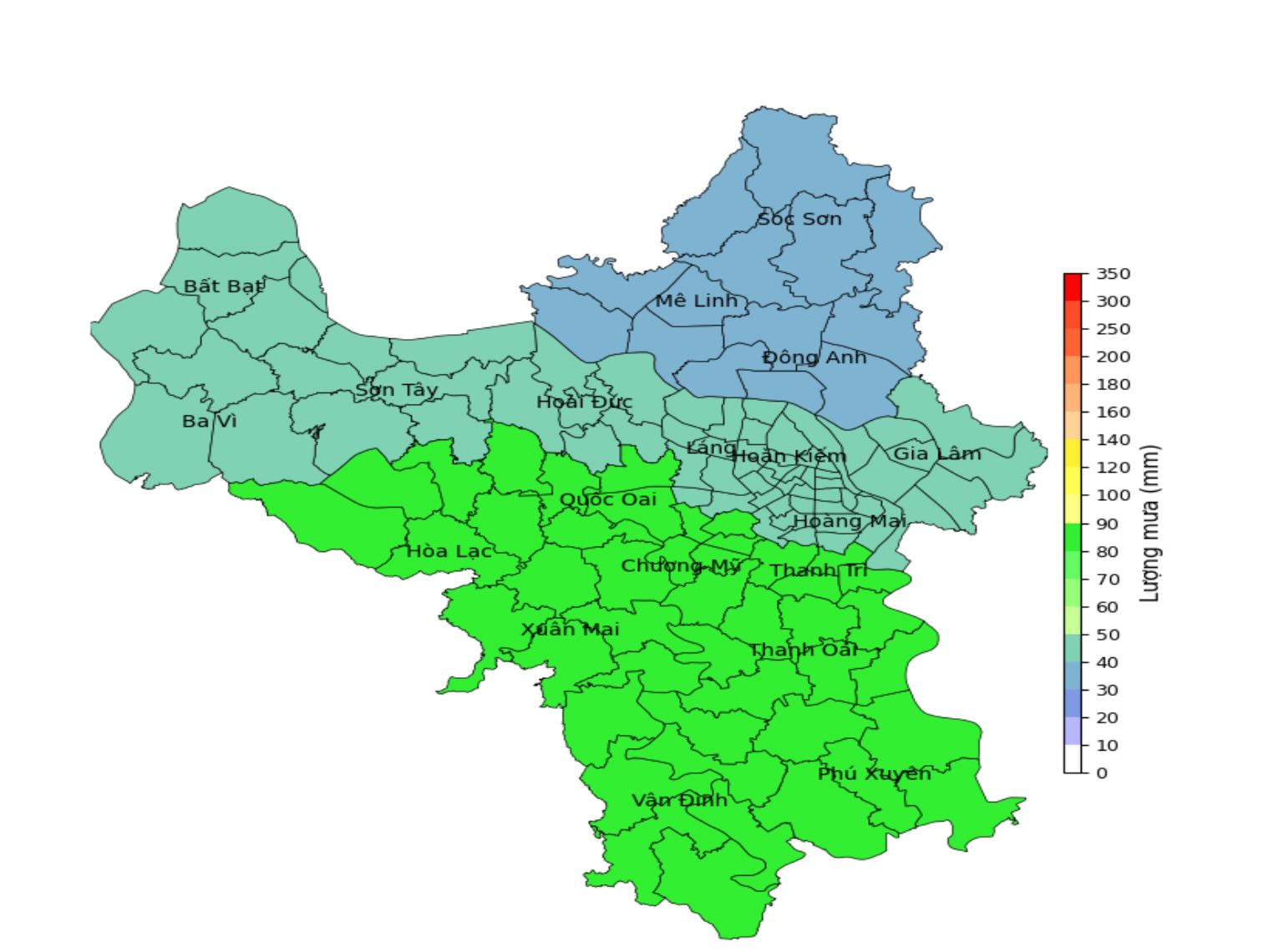
From tonight (September 13) to the morning of September 15, Hanoi city will have moderate rain, heavy rain and thunderstorms. In thunderstorms, there is a possibility of tornadoes, lightning and strong gusts of wind. Common rainfall is from 40 - 100mm, in some places over 100mm.
Wards/communes including Ba Dinh, Lang, Hoan Kiem, Thanh Xuan, Ha Dong, Hoai Duc, Hoang Mai, Tu Liem, Thuong Cat, Gia Lam have rainfall of about 40 - 70mm.
Soc Son, Me Linh, and Dong Anh communes have rainfall from 30 - 60mm.
Bat Bat, Ba Vi, Son Tay communes with rainfall from 40 - 70mm.
Phu Xuyen, Van Dinh, Hoa Lac, Xuan Mai, Thanh Tri, Thanh Oai, Quoc Oai, Hoai Duc, and Chuong My communes have rainfall from 50 - 100mm.
On the day and night of September 15, Hanoi city will have moderate rain, heavy rain and thunderstorms. Common rainfall is from 30 - 70mm, in some places even heavier.
The Northern Regional Meteorological Station warns that the level of natural disaster risk due to heavy rain is level 1. In thunderstorms, there may be tornadoes, lightning and strong gusts of wind that cause trees to fall, houses, traffic works and infrastructure to be damaged.
Heavy rain in a short period of time overloads the urban drainage system, causing flooding in residential areas, urban areas and low-lying areas, traffic jams due to road flooding and reduced visibility when driving, causing slipperiness and traffic accidents.


