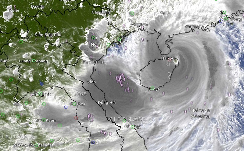
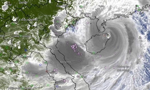
Storm No. 3 still maintains the intensity of a super typhoon after entering Hainan Island (China). Mr. Mai Van Khiem, Director of the National Center for Hydro-Meteorological Forecasting, General Department of Hydro-Meteorology, provided new analysis of this storm.
Never before has a storm entered the East Sea and then strengthened into a super typhoon.
- How do you rate this storm, will it set a record, sir?
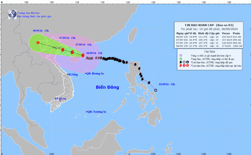
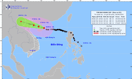
- Currently, storm number 3 is still at super storm level (level 16, gusting above level 17).
Previous super typhoons mainly formed in the Northwest Pacific Ocean, then entered the East Sea and often lost intensity. Rarely did a storm form a super typhoon right in the East Sea.
According to statistics, no storm has entered the East Sea and strengthened into a super typhoon (level 16). Previously, there were only 2 storms from the Northwest Pacific Ocean into the East Sea that reached super typhoon level but did not affect our mainland.
The first is storm Rai - storm No. 9 on December 2021, reaching level 16 in the East Sea, heading towards the Central region, then curving up, then gradually dissipating in the North East Sea and not affecting our country.
Storm Saola - storm number 3 in late August, early September 2023 reached level 16 in the East Sea, entered southern China and gradually dissipated without affecting our country.
Storm No. 3 also strengthened very quickly, from the time it entered the East Sea (September 2) at level 8, to more than 2 days later, the storm strengthened to level 8, reaching super typhoon level on September 5. This is also relatively rare for storms in the East Sea.
Maintaining level 16 intensity for more than a day is also quite long for a storm in the East Sea.
What do you think are the most worrying points about this storm?
According to the current forecast, there are the following main impacts that we need to pay attention to. Firstly, regarding strong winds, storm No. 3 can cause strong winds of level 16, gusting to level 17 in the North East Sea; level 13-14, gusting to level 17 in the North Gulf of Tonkin; level 11-12, gusting to level 14 in the coastal waters of Quang Ninh, Hai Phong, Thai Binh.
Second is about big waves and storm surges: In the East Sea, waves can be 10-12m high, in coastal areas along the coast of Quang Ninh - Thanh Hoa from 2-5m.
Third, about heavy rain, storm No. 3 can cause a heavy rain in the Northern and North Central provinces, focusing on the Northern region and Thanh Hoa with common rainfall from 100-350mm, in some places over 500mm.

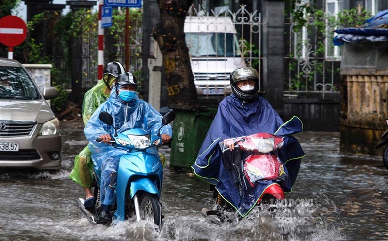
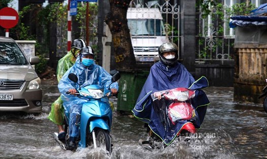
From tonight to tomorrow, the North will be strongly affected by the storm.
With such developments and impacts, what do you recommend people do and pay attention to?
- At this time, when the storm has not yet arrived, everyone needs to strictly follow the instructions of local authorities, reinforce houses, factories, equipment, trees, anchor boats in safe places; evacuate people from guard houses and aquaculture farms.
Note that before the storm comes, there will still be danger from thunderstorms before the storm, during the storm it can cause strong gusts of wind like the wind in a strong storm.
People in the coastal provinces of Quang Ninh, Hai Phong, Thai Binh, Nam Dinh, Ninh Binh, which are directly affected by storm No. 3, should absolutely not go out during heavy rain and strong winds when the storm's circulation directly affects them. It is forecasted that from tonight, the island districts, then the coastal areas of Quang Ninh - Thanh Hoa (forecasted from morning to evening tomorrow) will be affected.
For the mountainous provinces and cities in the Northern midlands and Thanh Hoa region, these are places facing the risk of flooding, flash floods, landslides, especially houses, constructions and organizations, immediately evacuate people and property when they are deemed unsafe; resolutely evacuate people to safe places.
After the storm passes, the risk of flash floods and landslides still exists in the following days, so extreme caution is needed.
Thank you very much!