Storm No. 3 Yagi is considered a very strong storm with a wide circulation. The area with strong winds above level 8 has a radius of about 250km, the area with strong winds above level 10 is about 150km, and the area with strong winds above level 12 is about 80km around the center of the storm.
International storm forecasting centers all agree that storm No. 3 will continue to maintain super storm level (level 16 or higher) until it reaches the eastern coastal area of Hainan Island.
The National Center for Hydro-Meteorological Forecasting has compiled statistics of previous storms that had similar paths to storm No. 3 Yagi.
Storm No. 7 in 2016 (Storm Sarika)
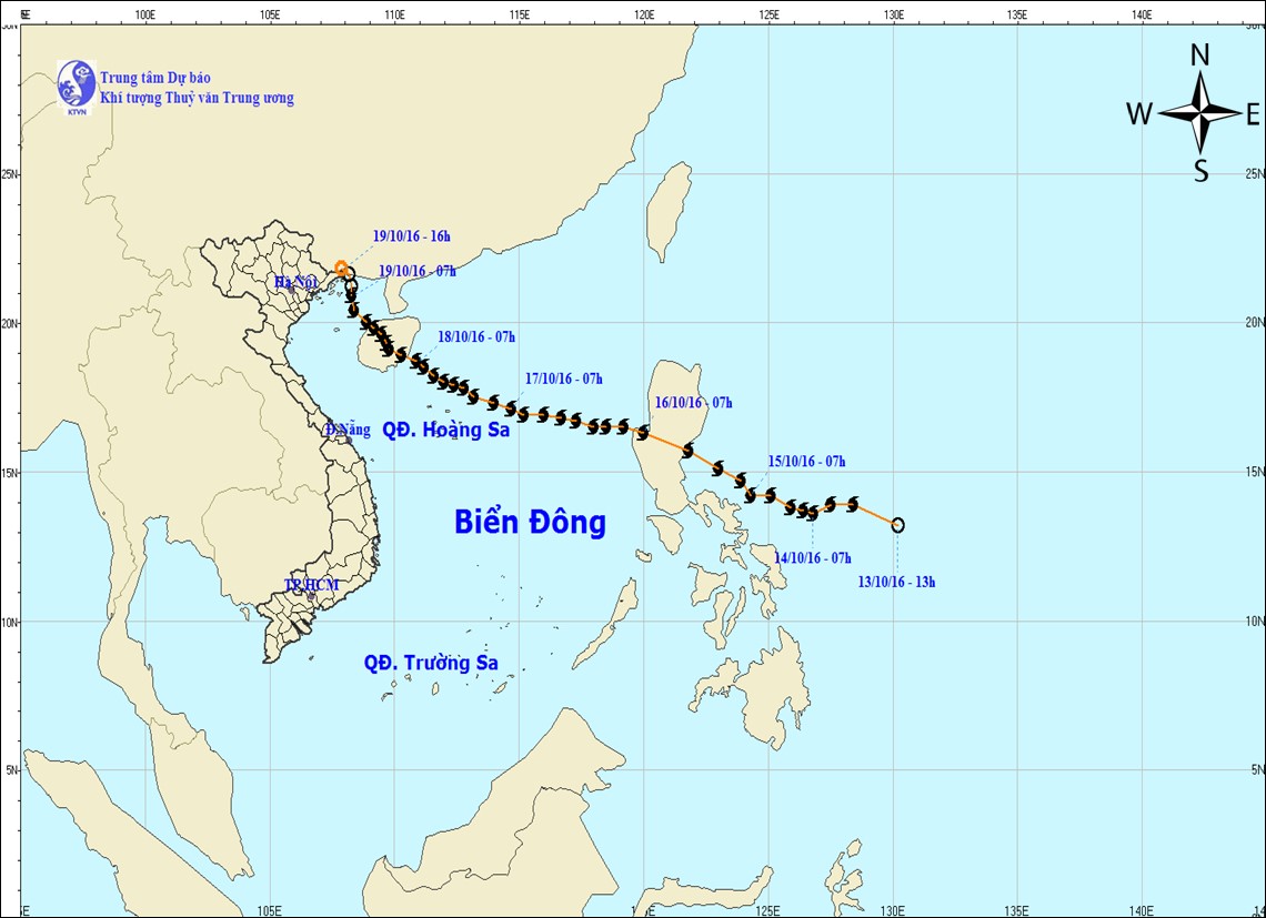
- Direction of movement: More northerly than storm number 3
- Intensity near Hainan Island (China): Level 14 (2 levels lower than storm No. 3).
- Intensity when entering the Gulf of Tonkin: Level 11-12.
- Strong winds on land: Coastal provinces from Quang Ninh to Nam Dinh have also observed strong winds of level 6-7, gusting to level 8.
- Total rainfall: Insignificant. The Northeastern provinces had rain from 7pm on October 18, 2016 to 1am on October 20, 2016, generally around 30 - 70mm, some places had very heavy rain over 100mm.
Storm No. 2 in 2014 (Storm Rammasun)
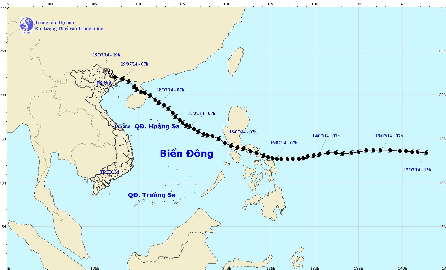
- Direction of movement: More northerly than storm number 3.
- Intensity near Hainan Island (China): Level 14-15 (1-2 levels lower than storm No. 3)
- Intensity when entering the Gulf of Tonkin: Level 14-15
- Strong winds on land: Strong winds level 8-9, gusting to level 10 in Quang Ninh province; in Lang Son and Bac Giang provinces, strong winds level 6-7, gusting to level 8; in Hai Phong, Bac Ninh and Hai Duong provinces, strong winds level 6-7.
- Total rainfall: From July 19 to 21, 2014, in the plains and midlands of the North, it is generally 40 - 70mm, in some places 80 - 120mm; in the mountainous provinces of the North, it is generally 100 - 300mm, in some places over 300mm.
Storm No. 3 in 2014 (Storm Kalmaegi)
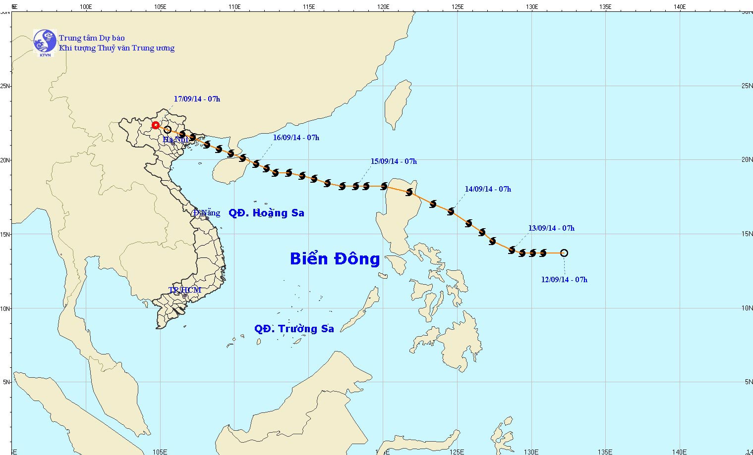
- Direction of movement: North of storm number 3
- Intensity near Hainan Island (China): level 13 (3 levels lower than storm number 3)
- Intensity when entering the Gulf of Tonkin: Level 12-13
- Strong winds on land: In Quang Ninh and Hai Phong, there are strong winds of level 8-9, gusting to level 10-11; in Cao Bang, Lang Son, Bac Ninh provinces and the Northern Delta, there are strong winds of level 6-7, gusting to level 8-9, with some places gusting to level 10.
- Total rainfall: From 13:00 September 16, 2014 - 13:00 September 18, 2014 in the northern mountainous provinces, it was generally 50-150mm, especially in Hoang Su Phi (Ha Giang): 204mm.


