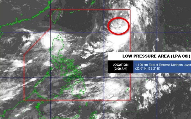
According to the National Center for Hydro-Meteorological Forecasting, currently, the tropical convergence zone has an axis at about 13 - 16 degrees north latitude connecting with the low pressure area in the central East Sea.
At 7:00 a.m. this morning, September 2, the low pressure area was located at about 13.5 - 14.5 degrees north latitude, 111.5 - 112.5 degrees east longitude. The sea area from Ca Mau to An Giang, the Gulf of Thailand, the central and southern East Sea (including the Truong Sa special zone) will have scattered showers and thunderstorms.
Day and night on September 2, the sea area from Quang Ngai to Ca Mau, Ca Mau to An Giang, the Gulf of Thailand, the central and southern East Sea (including the Truong Sa special zone) will have scattered showers and thunderstorms. During thunderstorms, there is a possibility of tornadoes, strong gusts of wind of level 6 - 7 and waves over 2m high.
In addition, the offshore waters from Khanh Hoa to Lam Dong and the South East Sea area (including Truong Sa special zone) will have strong southwest winds of level 5, sometimes level 6, gusting to level 7 - 8. Rough seas, waves 1.5 - 3m high. All ships operating in the above areas are at risk of being affected by tornadoes and strong gusts of wind