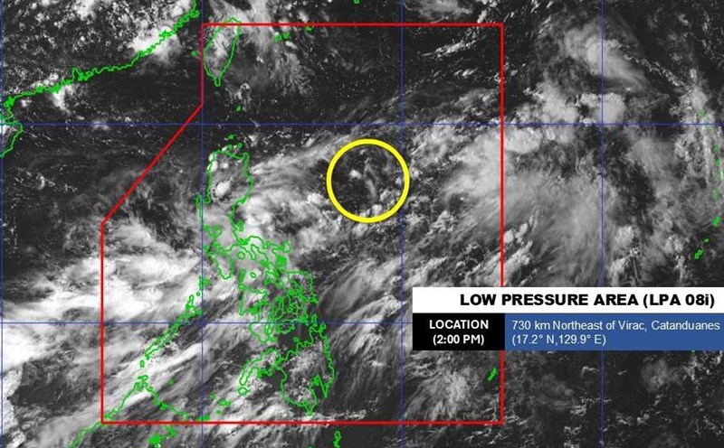
According to the Philippine Atmospheric, Geophysical and Astronomical Services Administration (PAGASA), at 3:00 a.m. this morning (September 3), the center of low pressure 08i was located about 1,190km northeast of Luzon Island, at 22.5 degrees North latitude, 133.2 degrees East longitude. This system currently maintains a strong wind circulation of 46-55 km/h, has a relatively clear tournament structure and is gradually reorganizing convective clouds.
Although still affected by the upper-level trough, HYSAT satellite data shows that the low pressure is qualified to be classified as a tropical depression today, before strengthening into a tropical storm Kiko.
The areas directly affected: Ilocos Region, Batanes, Babuyan, Apayao, Zambales, Bataan, Occidental Mindoro have moderate to heavy rain, some places have very heavy rain, high risk of flash floods and landslides.
Metro Manila, the rest of Central Luzon, CALABARZON, MIMAROPA, Bicol and Western Visayas: Cloudy, scattered showers, locally thunderstorms, easily causing urban flooding.
The rest of the Philippines: Cloudy, scattered showers and thunderstorms due to local convection effects.
The southwest monsoon continues to be active, causing Luzon and Visayas to record light to moderate winds, with rough seas from 0.6-1.5m.
According to the Joint Typhoon Warning Center (JTWC)'s storm forecast, low pressure 95W - corresponding to 08i - has almost only one direction of movement, which is north towards Okinawa Island (Japan). In the next 24-48 hours, this system could strengthen into a tropical storm when it crosses the extreme western Pacific Ocean.
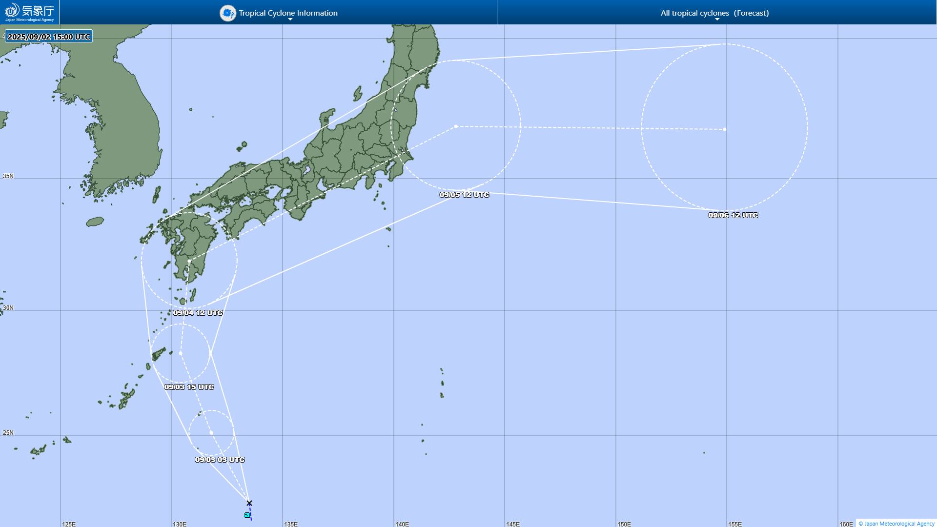
It is forecasted that by the end of September 4, the storm will approach Amami Oshima and is likely to make landfall on Kyushu Island (Japan) on September 5, before interacting with a low pressure strip and turning into an out tropical cyclone.
Storm forecasters say that even if the storm does not directly enter the Philippines, the "wind-pulling" effect will make the southwest monsoon more severe, pushing heavy rain to Luzon and the Visayas. This is the biggest concern, because in just a few days, the rainfall could reach the red warning level, causing widespread flash floods, landslides in mountainous areas and urban flooding.
PAGASA called on people in high-risk areas to closely monitor emergency weather forecasts.
Meanwhile, according to the Vietnam National Center for Hydro-Meteorological Forecasting, on September 3, the tropical convergence zone with an axis at about 13-16 degrees North latitude connected with the low pressure area in the Central East Sea, at 1:00 a.m. at about 14.5-15.5 degrees North latitude; 111.5-112.5 degrees East longitude.
Forecast for the day and night of September 3, the sea area from Khanh Hoa to Ca Mau, Ca Mau to An Giang, the Gulf of Thailand, the eastern sea area of the North East Sea, the Central and South East Sea (including the Truong Sa special zone) will have scattered thunderstorms.
Regarding today's Hanoi weather forecast: Lowest temperature 25-27 degrees Celsius, highest temperature 32-34 degrees Celsius. Cloudy, sunny during the day; showers and thunderstorms in some places in the evening and at night. Light wind. During thunderstorms, there is a possibility of tornadoes, lightning and strong gusts of wind.