The Philippine Atmospheric, Geophysical and Astronomical Services Administration (PAGASA) said it detected two low pressures on the afternoon of August 18, one of which was located inside the Philippine forecast area (PAR) near Batanes.
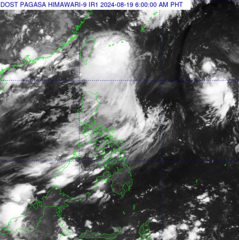
As of 5 a.m. on August 19, depression Dindo has strengthened into a tropical storm, currently with maximum winds of 65 km/h and gusts of up to 80 km/h. The storm's international name is Jongdari.
The location of the storm's center is at about 24.9 degrees north latitude; 126.1 degrees east longitude. At 4:00 a.m. on August 19, storm Jongdari (Dindo by local name) was at the northern boundary of PAR, 640 km northeast of Itbayat, Batanes. The storm is moving northeast at a speed of 10 km/h.
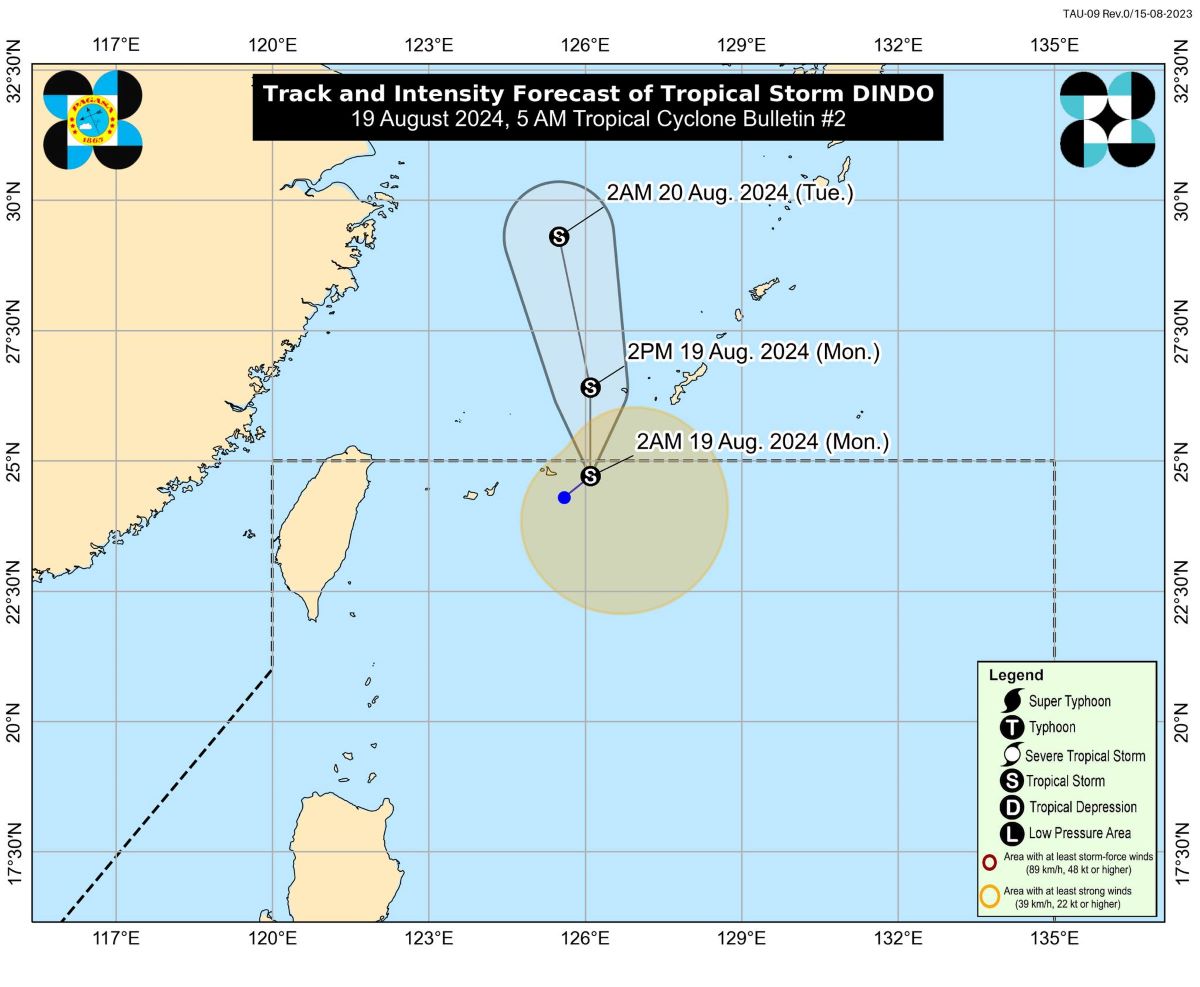
PAGASA forecasts that typhoon Jongdari is expected to leave PAR within the next 6 hours. Outside the PAR area, the storm will move across the East China Sea toward the Korean Peninsula or China's east coast.
The storm's intensity will be limited outside the PAR area, with weakening likely within the next 24 hours.
Previously, on the evening of August 18, weather forecaster Veronica Torres said that the low pressure inside PAR could strengthen into a storm within 24 hours. During that time, low pressure could also leave PAR, Torres added.
PAGASA is also monitoring a second low pressure that could enter PAR on August 19. This depression is currently located east of Northern Luzon outside PAR.
PAGASA said that the low pressure may enter PAR on August 19, leave PAR on August 20, then return to the Philippine monitoring area on August 22 and stay in the northern Philippine Sea until Sunday (August 25).
PAGASA also forecasts that a high pressure area will appear in the northern Philippine Sea from August 21-23.
Meanwhile, the southwest monsoon is expected to bring scattered rain and thunderstorms over Batanes and Babuyan islands.
People in affected areas are warned of the possibility of flash floods or landslides due to moderate to heavy rain.
Metro Manila and the rest of the country will be cloudy with showers or localized thunderstorms.
PAGASA warns that severe thunderstorms with moderate to heavy rain, strong winds and lightning are likely to occur in Central and Southern Luzon on August 19-20; in Visayas on August 19 and August 22; Mindanao throughout the week.
Philippine storm forecasters informed that 2-3 tropical storms are expected to form or enter the Philippine forecast area in August.
PAGASA also forecasts that there is a possibility of 13 to 16 storms entering the Philippine forecast area between now and the end of the year.
PAGASA's storm forecast says that the Philippines is likely to suffer more storms in the 2024 storm season than last year due to the possibility of the La Nina phenomenon returning.


