The latest storm and low pressure information on the afternoon of November 19 from the Philippine Atmospheric, Geophysical and Astronomical Services Administration (PAGASA) said that there are 2 low pressure areas expected to form from now until early December.
The first low pressure is forecast to form during the week of November 19 to November 25. This low pressure appears in the PAGASA TCAD forecast area, then enters the Philippine Forecast Area (PAR). This low pressure near the Philippines is forecasters say has the potential to strengthen into a storm or tropical depression at a low to moderate level.
Notably, this low pressure will continue to operate until the week of November 26 to December 2. Accordingly, during the forecast period, this low pressure will affect the Visayas - Southern Luzon region, Philippines and then enter the East Sea.
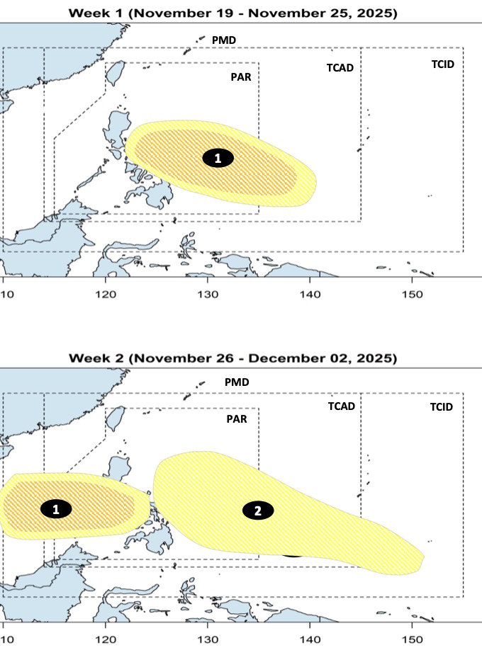
The forecast area of influence of this low pressure covers the entire area between the East Sea and approaches Vietnam. In terms of intensity, the new low pressure is expected to strengthen into a tropical depression or storm at a low to moderate level when operating in the East Sea.
After the first depression enters the South China Sea, another depression is expected to form near the Philippines, at the southeastern boundary of the PMD forecast area, then gradually move into the PAR. Compared to the first depression, this depression is less likely to strengthen into a storm or tropical depression.
PAGASA's typhoon forecasters said that while typhoons in November in the Philippines usually have 4 main direction of movement, typhoons in December have up to 5 direction of impact.
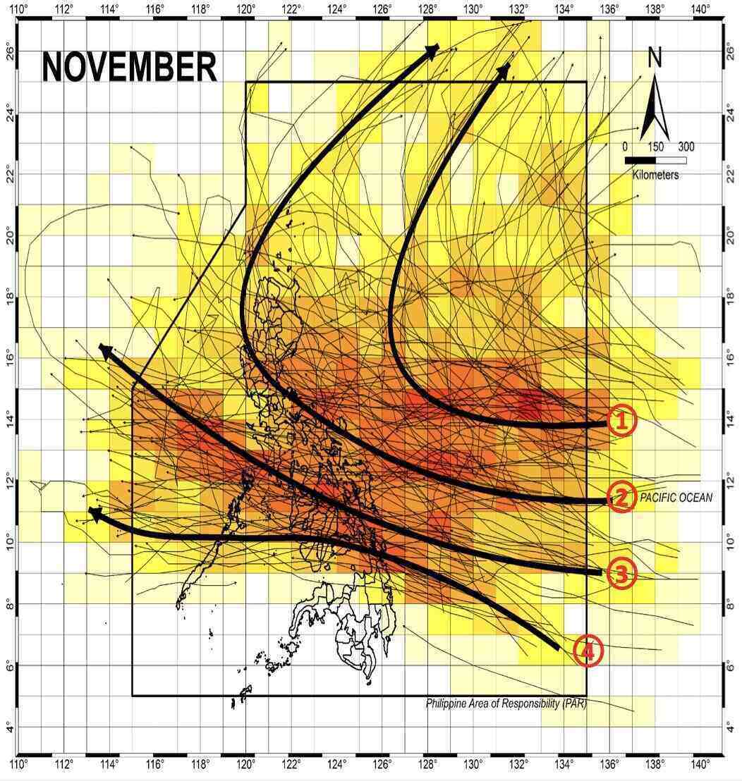
Accordingly, the November storm formed in the western Pacific, entering the PAR but not making landfall in the Philippines but loops right in the northeast part of the PAR towards Japan or South Korea;
The storm will make landfall in southern, northern or central Luzon, Philippines and then head towards Japan or South Korea;
The storm will make landfall in the central Philippines, enter the East Sea and head towards Vietnam;
The storm made landfall in the southern Visayas, Philippines, entered the East Sea and headed towards Thailand.
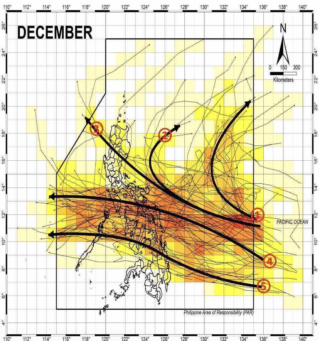
The December storm near the Philippines has 5 main moving directions, including: The storm formed in the western Pacific, entered PAR but did not make landfall in the Phillipines but changed direction right in the eastern part of PAR and straight towards Japan;
The storm formed in the western Pacific, entered PAR when it was about to make landfall in the Philippines and turned towards Japan;
The storm will make landfall in northern or central Luzon, enter the East Sea, and head towards Hong Kong (China);
The storm will make landfall in central Luzon - northern Visayas, enter the East Sea and head towards Vietnam;
The storm made landfall in the southern Visayas - northern Mindanao, Philippines, then entered the East Sea and headed towards Thailand.


