Latest typhoon and low pressure news in the afternoon of May 6 from the Philippine Atmospheric, Geophysical and Astronomical Services Administration (PAGASA) said that the low pressure located inside the Philippine Area of Responsibility (PAR) will cause rain in some places in Eastern Visayas and Caraga from the evening of May 6.
Cloudy skies, scattered showers and thunderstorms are forecast to occur in Eastern Samar, Southern Leyte, Dinagat Islands and Surigao del Norte.
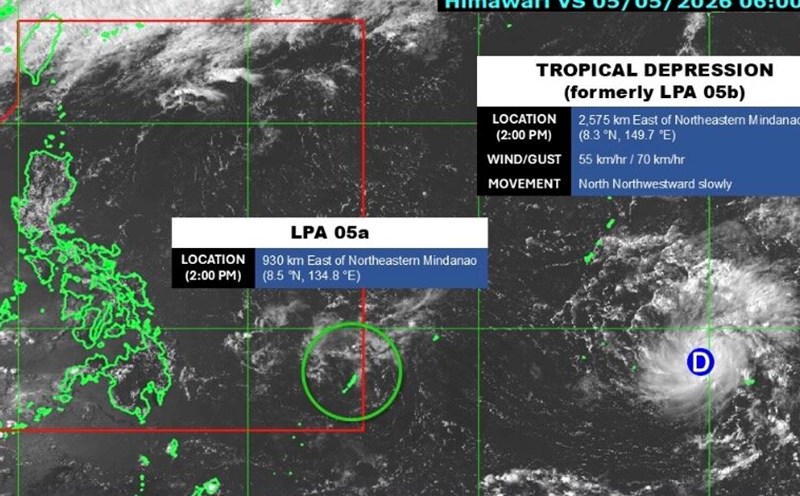
According to the latest data, this low pressure area is about 315km east of Hinatuan, Surigao del Sur.
This low pressure near the Philippines is unlikely to strengthen into a tropical storm, but is forecast to make landfall in the southern Philippines, causing rain before weakening and dissipating gradually.
Meanwhile, a tropical depression outside the forecast area of the Philippines still maintains its intensity, moving slowly westward.
This tropical depression is about 2,195km east of northeastern Mindanao, with maximum winds of 55 km/h and gusts up to 70 km/h.
It is forecast that this tropical depression may enter PAR from the evening of May 8 to the morning of May 9 and will be named Caloy locally.
During the time in the forecast area, this system is likely to weaken due to unfavorable conditions. However, we do not rule out the possibility that it may move closer to the east of the Philippines" - storm forecaster Chenel Dominguez stated in PAGASA's bulletin.
Because both the low pressure and tropical depression have not yet directly affected the mainland, hot and humid weather will continue in Metro Manila and other areas of the Philippines, under the influence of winter monsoons from the Pacific Ocean.