China is urgently responding to the winter storm, which is forecast to be the strongest since the beginning of the year.
According to the country's meteorological agency, a large-scale cold air mass coinciding with the 2026 cold spell will strongly affect the central and eastern regions of China from now until January 21, causing heavy snowfall, ice rain and dangerous freezing conditions in many provinces and cities.
Experts predict this will be the strongest and widest snow and ice wave since the beginning of winter. In particular, the southern regions of China are warned to experience deep and sudden temperature drops, while the central and eastern regions may face ice rain - a factor considered more dangerous than heavy snowfall.
Mr. Zhang Tao, Chief Forecaster of the National Meteorological Center of China, said that the weather dien bien this time is "extremely complicated", with great risks from ice rain.
Temperatures are forecast to decrease sharply on a large scale. Many southern areas may decrease by more than 12 degrees Celsius, with some places decreasing to 16 degrees Celsius. The Truong Giang delta is one of the areas most clearly affected because the weather was previously relatively warm, making the heat shock even more serious.
The cold air mass will gradually move from west to east, from north to south. By January 21, the temperature of freezing is expected to spread to both the southwestern and southern regions of China - where it is rare to face prolonged cold weather.
In Beijing, light snow continued to appear from the morning of January 18, after many districts of the capital welcomed the first snowfall of 2026 on the evening of January 17. The city's meteorological agency issued a yellow warning for slippery roads and prolonged low temperatures.
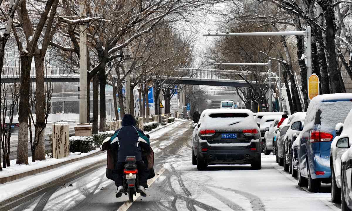
Not only Beijing, many other areas across the country are also entering the coldest period since the beginning of winter. China's Ministry of Emergency Management said this is the first large-scale cold air wave of the year, likely causing many places to record the lowest temperatures since the beginning of the season.
In Vietnam, according to the weather forecast of the National Center for Hydro-Meteorological Forecasting, from the evening and night of January 20, cold air will begin to affect the Northeast region; on January 21, it will strengthen strongly, affecting the Northwest, North Central and Central Central regions.
On land, northeast wind level 2-3, coastal areas level 3-4.
The North and North Central regions from January 21st will turn cold; especially the mountainous and midland areas of the North around January 22nd - 23rd are likely to experience severe cold and harmful cold.
Lowest common temperature: Northern region, Thanh Hoa, Nghe An 11-14 degrees C; Northern mountainous region 8-11 degrees C, high mountainous areas in some places below 6 degrees C.
Hanoi area: From the evening of January 20 to January 22, there will be scattered rain, from January 21, it will be cold; the lowest temperature is commonly 12-14 degrees C.


