The latest storm news from the Philippine Atmospheric, Geophysical and Astronomical Services Administration (PAGASA) said that at 10:00 AM on January 16, the center of Typhoon Ada was determined to be about 325km east of Guiuan town, Eastern Samar province, at 11.5 degrees north latitude and 128.7 degrees east longitude.
The strongest wind near the storm center is 65 km/h, gusting at 80 km/h, central pressure 998 hPa and is moving north at a speed of about 15 km/h.
Although only at the tropical storm level, Ada is assessed to have a wide scope of impact with a radius of about 400km from the center of the storm, posing significant danger to coastal areas and maritime activities.
In the next 24 hours, many coastal areas of the Philippines are forecast to have large waves and strong seas. Waves up to 4m high may appear along the northern and eastern coasts of Catanduanes and Northern Samar provinces; the east coast of Albay, Sorsogon and Eastern Samar; along with the coastal areas of Camarines Sur and Camarines Norte.
Authorities warned small boats, fishing boats and sea vehicles not to go out to sea in these dangerous weather conditions, and emphasized that heavy rain and strong winds may still occur outside the forecast storm center area.
Typhoon forecasts show that Ada (international name Nokaen) has a complex trajectory, will move mainly in a northwest direction from now until the end of January 17, before slowly changing direction to northwest and then northeast on January 18.
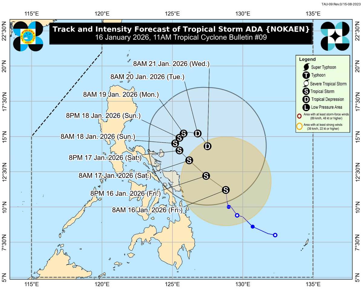
From the evening of January 20, the storm is forecast to move southeast as it continues to operate in the sea east of the Bicol area.
According to the current scenario, the storm's center may move close to Eastern Samar and Northern Samar on January 17, then approach Catanduanes from the evening of January 17 to the end of January 18.
However, PAGASA noted that just a small shift westward in orbit could cause the storm to make landfall directly in Eastern Visayas or the Bicol region.
A particularly dangerous thing is that the Philippine Institute of Volcanology and Sismology (Phivolcs) warns that heavy rain caused by Typhoon Ada may trigger dangerous lava flows around Mount Mayon, Albay province.
Expected rainfall of 100-200 mm may reactivate scattered volcanic materials on the mountainside, especially new sediments from the heat clouds during the ongoing eruption.
Reservoirs such as Mi-isi, Bonga, Basud, Buyuan and Padang are identified as high-risk areas. Phivolcs warn that hot lahars can cause serious burns or life-threatening if directly contacted, while causing flooding, burying and destroying downstream residential areas, even spreading to coastal areas.
On January 16, the Philippine Coast Guard said that more than 4,400 passengers were stranded at many ports across the country as Typhoon Ada affected maritime operations.
By dawn, there were 4,419 passengers, 1,828 cargo vehicles and 21 ships stalled, while 11 other ships had to find safe shelter.


