The latest storm news from the Philippine Atmospheric, Geophysical and Astronomical Services Administration (PAGASA) said that tropical depression Ada is expected to strengthen into Typhoon Ada on January 15.
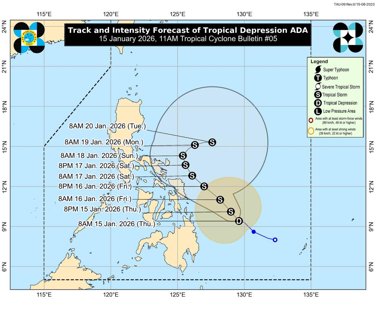
At 13:00 on the same day, the center of the low pressure was located at about 9.6 degrees north latitude, 129.3 degrees east longitude, in the Philippine Sea, about 420km east of Surigao city (Surigao del Norte province).
The strongest wind near the center of the tropical depression is 65 km/h, gusting at 75 km/h, the center pressure is about 1,000 hPa. The strong wind area of this system extends within a radius of about 400 km from the center.
The tropical depression is currently moving in a west-northwest direction at a speed of about 10 km/h and is forecast to continue to strengthen in the coming hours.
PAGASA has issued a level 1 tropical cyclone wind signal for many areas in Luzon, Visayas and Mindanao.
In which, the affected localities include Sorsogon, southeastern Albay, Catanduanes; the provinces of Samar, Eastern Samar, Northern Samar, part of Leyte, Biliran and Southern Leyte; along with the Dinagat, Surigao del Norte and Surigao del Sur archipelagos.
Strong winds in these areas could reach 39-61 km/h in the next 36 hours, posing a low to moderate risk to people's lives and property.
In addition to strong winds, heavy rain is identified as the most notable threat accompanied by the Ada tropical depression. From now until noon on January 16, common rainfall of 50-100mm is forecast in Northern Samar, Eastern Samar, Samar, Biliran, Leyte, Southern Leyte, Dinagat Islands, Surigao del Norte, Agusan del Norte and Surigao del Sur.
In the period from noon on January 16 to noon on January 17, rain may increase to 100-200mm in Catanduanes, Northern Samar and Eastern Samar; many other areas in Bicol and Visayas recorded rain of 50-100mm.
By the period from noon on January 17 to noon on January 18, Catanduanes, Camarines Sur and Albay continue to face very heavy rain, while Sorsogon, Northern Samar and Camarines Norte have moderate to heavy rain.
Forecasts show that actual rainfall may be higher in mountainous areas and high terrain areas, especially in the context that many places have had rain before, increasing the risk of flash floods and landslides.
At sea, the influence of Ada combined with the northeast monsoon caused large waves and strong sea waves to appear in many coastal areas of the Philippines. Waves up to 4m high are forecast in the northern and eastern waters of Catanduanes, Northern Samar, Siargao and the eastern coastal areas of Albay, Sorsogon, Eastern Samar, Dinagat Islands and Surigao del Sur.
In terms of trend, Ada is forecast to continue moving in a northwest to northwest direction from now until January 18, then is likely to shift direction to northeast.
This system is likely to strengthen into a tropical storm on January 15 - the first storm in 2026 in the Northwest Pacific region - and may go close to or directly affect Eastern Samar, Northern Samar and the eastern Catanduanes region in the coming days.


