An international research team led by Cornell University (USA) has just released the first data to decoding the "abnormal" behavior of the 2011 earthquake off the northeast coast of Japan - an event that lifted the seabed, caused a Tsunami that devastated coastal communities and led to a disaster at the Fukushima Daiichi nuclear power plant.
According to research published in the journal Science, in the Japan drainage - the deep ocean boundary where a tectonic plate crawles down to another plate - the fracture narrows into a thin layer rich in clay, hidden right at the bottom of the sea.
It was this "weak" material layer that allowed the 2011 super earthquake to spread and break down the ditches, creating a shallow slide of 50-70m, moving large areas of the seabed.
This work helps explain why the 2011 earthquake was so different from many previous forecast models, said Patrick Fulton, co-author of the study and associate professor of the Department of Earth Sciences and Atmospherics at Cornell Technical School. When we clearly see the structure of the fault, we can better understand where the slide will be concentrated and the potential for natural disasters in each subduction zone.
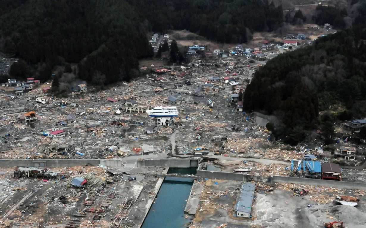
Normally, in subduction luge earthquakes, the fracture begins at a large depth and the slide decreases as it spreads to the seabed. But in 2011, the opposite happened: The slide increased sharply as it approached the surface - a surprising result, causing geophysicists to search for a solution for more than a decade.
The turning point came from the International Ocean Drilling Program (IODP) Expedition 405, also known as JTRACK, co-chaired by Mr. Fulton. In 2024, the deepwater research ship drilled through the broken area, entering the sediment of the Pacific Ocean. The total length of the drilling pipe is 7,906m below sea level - the record for the deepest scientific ocean drilling ever recognized by Guinness.
This record reflects not only the ship's technical capabilities, but also the close coordination between the Japan Japan Ocean - Earth Science - Technology Agency, industrial partners and international scientific teams. Fulton spent nearly two months on the ship tracking each stage.
The geological structure in the Japan throat is almost determined to form a fracture, Fulton said. It becomes an extremely weak, extremely concentrated surface, causing fractures that easily spread to the bottom of the sea.
Because this clay layer stretches hundreds of kilometers along the Japan throat, the area is more likely to experience shallow earthquakes than previously known, meaning a higher risk of Tsunami.


