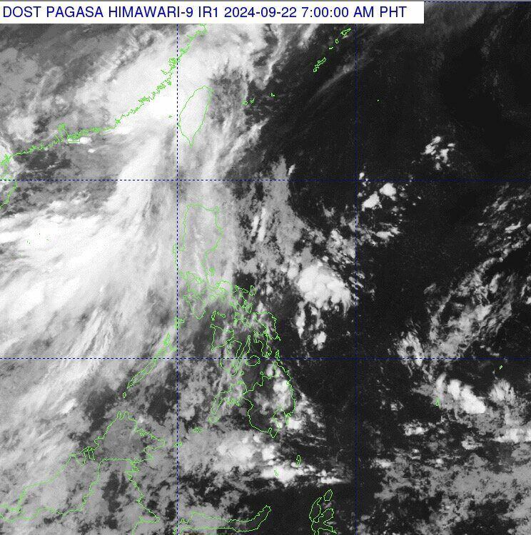
PAGASA's storm and low pressure forecast for the morning of September 22 said that the tropical depression near the Philippines, Igme, is about 535km north-northwest of Itbayat, Batanes, Philippines.
Tropical Depression Igme is currently outside the Philippines forecast area with sustained winds of about 55 km/h near its center and gusts of up to 70 km/h. The depression near the Philippines is currently moving west at 15 km/h.
PAGASA’s latest weather forecast bulletin states that the southwest monsoon or habagat is affecting Northern Luzon on September 22 and will bring rain in some areas.
Cloudy skies with scattered rains and thunderstorms due to the southwest monsoon were recorded in Ilocos, Batanes and Babuyan Islands. Some areas experienced moderate to heavy rains that may lead to flash floods or landslides.
According to the latest storm information from the Joint Typhoon Warning Center (JTWC) of the US Navy, Tropical Depression 17W (Filipino name: Igme) is located 74km northwest of Taipei, Taiwan (China). This tropical depression has been moving west at a speed of 17km/h for the past 6 hours.
Tropical Depression 17W is forecast to move west-southwest across the Taiwan Strait and towards the Chinese coast with landfall expected in about the next 12 hours.
Over the next 12 hours, environmental conditions in the strait are expected to remain favorable, allowing this tropical depression to intensify to about 65 km/h. After 12 hours, Tropical Depression 17W is expected to continue moving west-southwest over land over the next 24 hours. After 24 hours, the tropical depression system is forecast to move northwest.
The latest forecast of the Joint Typhoon Warning Center emphasizes that this tropical depression is expected to dissipate over land in about 36 hours. Many forecast models are showing a scenario where this tropical depression dissipates over mainland China.
According to the latest storm and low pressure information from Taiwan News, the Taiwan Weather Agency (CWA) issued a heavy rain advisory for Tainan, Kaohsiung and Pingtung County at 6:05 p.m. on September 21.
According to the CWA forecast, due to the influence of the tropical low pressure system, Taiwan (China) is likely to be affected by heavy rain in a very short period of time. Extremely heavy rain is "24-hour cumulative rainfall exceeding 200mm" while heavy rain is "24-hour cumulative rainfall exceeding 80mm".
Also affected by the tropical depression, localized heavy rain is expected in northern Hsinchu, Nantou, Taichung, Chiayi and mountainous areas of Hualien. The weather bureau also warned residents of the risk of lightning strikes and strong gusts of wind. Low-lying areas should be on guard against flooding and mountainous areas should be cautious of landslides.


