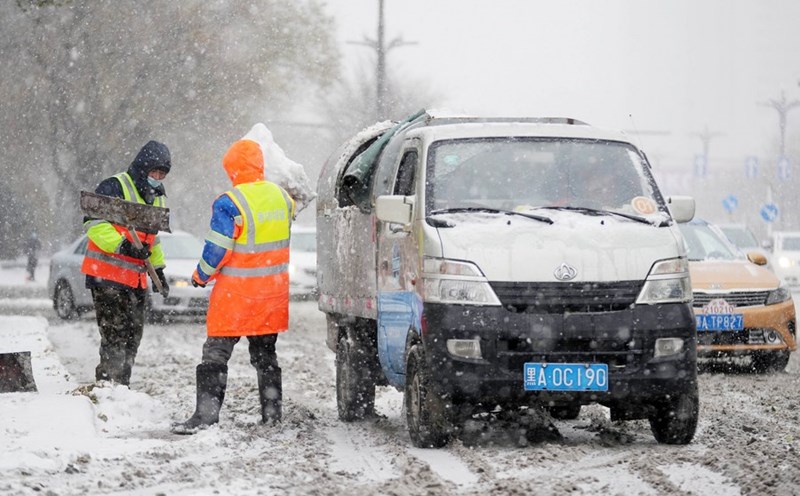
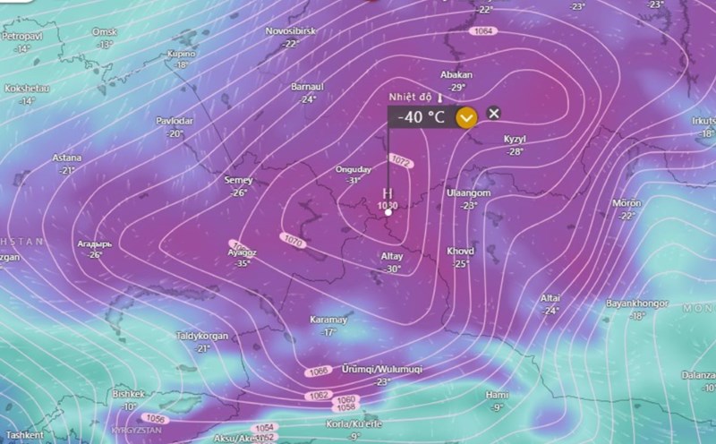
On January 25, the National Meteorological Center of China issued a yellow alert, the third severe warning level in the four-level warning system, for cold air and snowstorms across China, a few days before the Lunar New Year holiday.
The cold spell is expected to cause temperatures to drop sharply by 8 degrees Celsius to 14 degrees Celsius across large areas of the country and unusually low temperatures are likely to move south as far as northern Yunnan province on New Year's Eve, January 28, 2025.
Meanwhile, heavy snowfall is forecast in some northwestern regions of China and some parts of Hubei province, while some areas in Shandong Province and Ha Nam Province will see snowstorms with a depth of up to 2.2 cm. The total snow accumulation in some areas is expected to reach 3-8 cm, posing a risk to traffic and infrastructure.
Zhang Xiaoling, an official at the Meteorological Center, said that during the Lunar New Year holiday from January 28 to February 4, the northwestern and northern regions of the country are expected to have below-average temperatures and in some northern regions of China, temperatures will drop below minus 16 degrees Celsius on New Year's Eve.
snow is forecast in northeastern China on January 28-29. Widespread rain and snow will affect some northwestern and southern regions from January 31 to February 2.
Sunny and cloudy weather will appear in most of Central and South China on New Year's Eve and New Year's Day, but cold air will sweep across the eastern and southern regions from January 1 to February 3.
In February, the center forecasts colder-than-normal temperatures in parts of northwestern and southwestern China and Xinjiang Autonomous Region, while the Northeast and North regions will be warmer than average.
As the Lunar New Year holiday approaches, the government is urging people to prepare for severe cold, heavy snowfall and traffic disruption. Enhanced safety measures are being recommended for transportation, heating and outdoor activities to ensure a safe and warm Lunar New Year.
Meanwhile, according to the weather forecast of the Vietnam National Center for Hydro-Meteorological Forecasting, during the day and night of January 26, cold air will affect the Northeast region, then the North Central region, the Northwest region, the Central Central region and some places in the South Central region. The northeast wind inland will strengthen to level 3, coastal areas level 3-4, some places have gusts of level 6.
In the North and North Central regions, the weather will be very cold, with severe cold in mountainous areas and high mountainous areas, with the possibility of frost and frost; in the Central Central region from the night of January 26, the weather will turn cold.
The lowest temperature in this cold air mass in the North and North Central regions is generally from 9-12 degrees, in the mountainous areas of the North 6-8 degrees, in high mountainous areas below 3 degrees; in the area from Quang Binh to Hue, it is generally 14-17 degrees; in the area from Da Nang to Quang Ngai, it is generally 16-19 degrees.
There will be occasional showers and thunderstorms in the Hanoi area. Severe cold. The lowest temperature in this cold air mass is generally 9-12 degrees.
The North and North Central regions from the night of January 26-29 will be very cold, the mountainous areas of the North will be very cold, and the high mountains will likely have frost and frost.


