The emergence of La Nina typically brings wetter and cooler conditions to Southeast Asia and Australia, while El Nino typically brings drier and warmer conditions to the region.
La Nina and El Nino appear alternately after several years. These two phenomena are two phases of the global climate cycle El Nino - Southern Oscillation (ENSO). ENSO is concerned with changes in winds and sea surface temperatures in the tropical Pacific Ocean, the world's largest ocean basin.
During the La Nina phenomenon, winds blowing from east to west over the tropical Pacific Ocean will be stronger. These winds are called trade winds. Many warmer waters are concentrated in the western Pacific Ocean, including Southeast Asia. This often leads to heavier rainfall in Singapore because the wind carries moisture and rainfall to the area.
The Singapore Meteorological Agency (MSS) under the National Environment Agency of this country informed on February 22 that the La Nina phenomenon is considered to have formed based on a number of indicators such as sea surface temperature, trade winds and clouds in the tropical Pacific. The current La Nina cycle is expected to last until April or May, after which a neutral ENSO state is expected to appear.
The Singapore Meteorological Agency points out that during and immediately after La Nina, the highest temperature and average daily temperature tend to be lower, but high temperatures can still occur. For example, in the most recent La Nina event lasting until early 2023, the temperature peaked at 37 degrees Celsius on May 13 in Singapore, a level not seen since 1983, the highest level since last year.
Dr. Koh Tieh Yong - from the World Climate Research Program - said that the current La Nina is weak, meaning that the weather impacts in other areas can easily overwhelm the impact of this phenomenon.
"The local weather could operate within normal range of range of range - wetter or drier, cooler or warmer - as if La Nina had not happened," said Koh Tieh Yong.
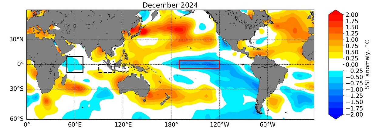
globally, the La Nina phenomenon appeared in December 2024, which is a relatively late start. The MSS explains that the reason for the delay in La Nina's emergence may be due to unfavorable trading winds and the slow cooling of the upper-level shallow water layer in the eastern Pacific, near South America.
Therefore, the La Nina phenomenon is expected to only last for a short time if no random weather phenomenon occurs in April or May, making La Nina stronger, added Dr. Koh Tieh Yong.
The most recent La Nina period from 2020 to early 2023 was particularly long. In 2022, under the influence of La Nina, Singapore recorded the driest October in more than 40 years, with rainfall of up to 412 mm. However, the annual temperature in 2022 remains at the 10th highest since temperature changes began in 1929.
Also in the La Nina bulletin, the Singapore Meteorological Agency added: "There is a small chance that the La Nina phenomenon could persist or re-develop in the second half of 2025".


